Pawtucket in Providence County, Rhode Island — The American Northeast (New England)
Waterpower
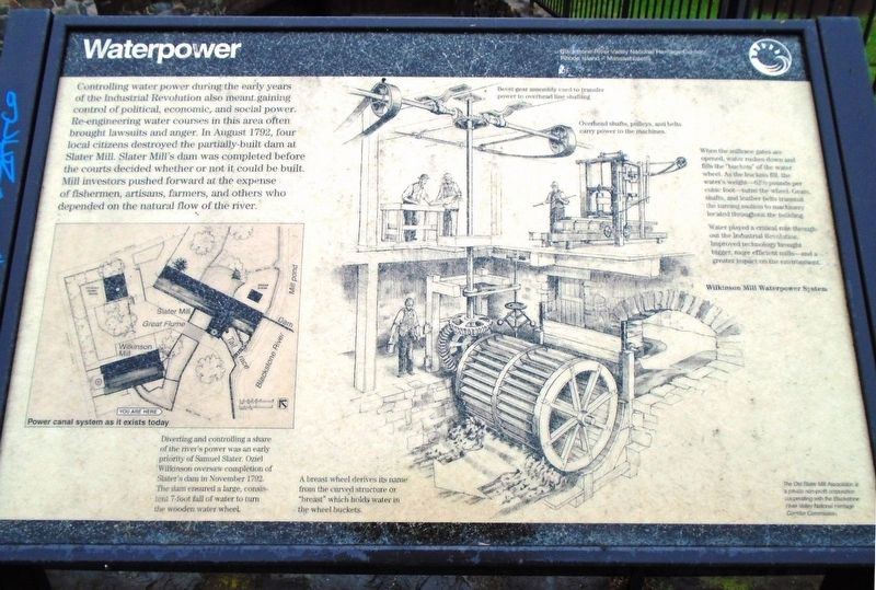
Controlling water power during the early years of the Industrial Revolution also meant gaining control of political, economic, and social power. Re-engineering water courses in this area often brought lawsuits and anger. In August 1792, four local citizens destroyed the partially-built dam at Slater Mill. Slater Mill's dam was completed before the courts decided whether or not it could be built. Mill investors pushed forward at the expense of fishermen, artisans, farmers, and others who depended on the natural flow of the river.
[Illustration captions and subtext, from left to right, read]
• Power canal system as it exists today
Diverting and controlling a share of the river's power was an early priority of Samuel Slater. Oziel Wilkinson oversaw completion of Slater's dam in November 1792. The dam ensured a large, consistent 7-foot fall of water to turn the wooden water wheel.
• Wilkinson Mill Waterpower System
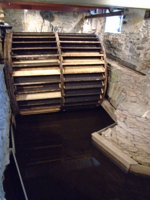
A breast wheel derives its name from the curved structure or "breast" which holds water in the wheel buckets.
Bevel gear assembly used to transfer power to overhead line shafting.
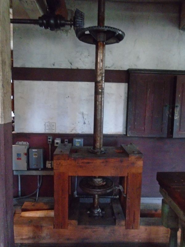
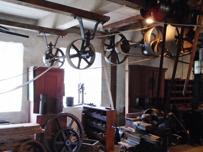
Overhead shafts, pulleys, and belts carry power to the machines.
When the millrace gates are opened, water rushes down and fills the "buckets" of the water wheel. As the buckets fill, the water's weight—62˝ pounds per cubic foot—turns the wheel. Gears, shafts, and leather belts transmit the turning motion to machinery located throughout the building.
Water played a critical role throughout the Industrial Revolution. Improved technology brought bigger, more efficient mills—and a greater impact on the environment.
Erected by Blackstone River Valley National Heritage Corridor and Old Slater Mill Association.
Topics. This historical marker is listed in these topic lists: Industry & Commerce • Waterways & Vessels. A significant historical month for this entry is August 1792.
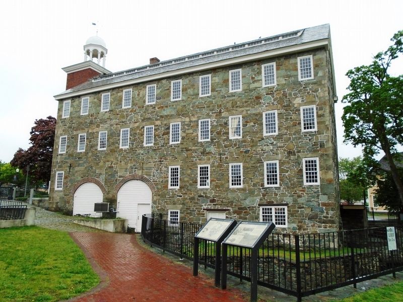
Location. This marker has been replaced by another marker nearby. It was located near 41° 52.643′ N, 71° 22.972′ W. Marker was in Pawtucket, Rhode Island, in Providence County. Marker could be reached from Roosevelt Avenue, 0.1 miles north of Main Street (Rhode Island Route 15), on the right when traveling north. Marker is on the Slater Mill Historic Site grounds, along the raceway just south of the Wilkinson Mill. Touch for map. Marker was at or near this postal address: 67 Roosevelt Avenue, Pawtucket RI 02860, United States of America. Touch for directions.
Other nearby markers. At least 8 other markers are within walking distance of this location. Birthplace of American Manufacturing (here, next to this marker); Water Works (a few steps from this marker); Wilkinson Mill
(a few steps from this marker); A Family Business (a few steps from this marker); Harnessing the Power of the Blackstone River (within shouting distance of this marker); Milling Machines (within shouting distance of this marker); a different marker also named The Wilkinson Mill (within shouting distance of this marker); The Old Slater Mill (within shouting distance of this marker). Touch for a list and map of all markers in Pawtucket.
Related marker. Click here for another marker that is related to this marker. This marker has been replaced by the linked marker.
Also see . . .
1. Blackstone River Valley National Heritage Corridor. (Submitted on June 5, 2018, by William Fischer, Jr. of Scranton, Pennsylvania.)
2. Watermill at Wikipedia. (Submitted on June 5, 2018, by William Fischer, Jr. of Scranton, Pennsylvania.)
3. Samuel Slater Bio. (Submitted on June 5, 2018, by William Fischer, Jr. of Scranton, Pennsylvania.)
Credits. This page was last revised on May 8, 2023. It was originally submitted on June 5, 2018, by William Fischer, Jr. of Scranton, Pennsylvania. This page has been viewed 236 times since then and 16 times this year. Photos: 1, 2. submitted on June 5, 2018, by William Fischer, Jr. of Scranton, Pennsylvania. 3. submitted on June 4, 2018, by William Fischer, Jr. of Scranton, Pennsylvania. 4, 5, 6. submitted on June 5, 2018, by William Fischer, Jr. of Scranton, Pennsylvania.
