Near Gettysburg in Adams County, Pennsylvania — The American Northeast (Mid-Atlantic)
Maurin's Battery - Garnett's Battalion
Heth's Division - Hill's Corps
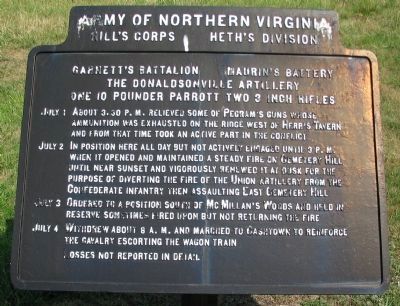
— Army of Northern Virginia —
Hill's Corps Heth's Division
Garnett's Battalion Maurin's Battery
The Donaldsville Artillery
One 10 pounder Parrott, Two 3 inch Rifles
July 1 About 3.30 p.m. relieved some of Pegram's guns whose ammunition was exhausted on the ridge west of Herr's Tavern and from that time to an active part in the conflict.
July 2 In position here all day but not actively engaged until 3 p.m. when it opened and maintained a steady fire on Cemetery Hill until near sunset and vigorously renewed it at dusk for the purpose of diverting the fire of Union artillery from the Confederate infantry then assaulting East Cemetery Hill.
July 3 Ordered to a position south of McMillan's Woods and held in reserve sometimes fired upon but not returning the fire.
July 4 Withdrew about 8 a.m. and marched to Cashtown to reinforce the cavalry escorting the wagon train.
Losses not reported in detail.
Erected 1910 by Gettysburg National Military Park Commission.
Topics. This historical marker is listed in this topic list: War, US Civil. A significant historical month for this entry is July 1828.
Location. 39° 49.565′ N, 77° 14.695′ W. Marker is near Gettysburg, Pennsylvania, in Adams County. Marker is on West Confederate Avenue, on the left when traveling south. Located opposite the Schultz Woods section of Seminary Ridge on Confederate Avenue in Gettysburg National Military Park. Touch for map. Marker is in this post office area: Gettysburg PA 17325, United States of America. Touch for directions.
Other nearby markers. At least 8 other markers are within walking distance of this marker. Griffin's Battery - Dance's Battalion (within shouting distance of this marker); Lewis's Battery - Garnett's Battalion (within shouting distance of this marker); Watson's Battery - Dance's Battalion (about 300 feet away, measured in a direct line); a different marker also named Watson's Battery - Dance's Battalion (about 400 feet away); Johnson's Virginia Battery - McIntosh's Battalion (about 400 feet away); Army of Northern Virginia (about 400 feet away); a different marker also named Army of Northern Virginia (about 400 feet away); a different marker also named Army of Northern Virginia (about 400 feet away). Touch for a list and map of all markers in Gettysburg.
Also see . . . The Donaldsonville Artillery. Page detailing the history of the battery. (Submitted on September 28, 2008, by Craig Swain of Leesburg, Virginia.)

Photographed By Craig Swain, August 16, 2008
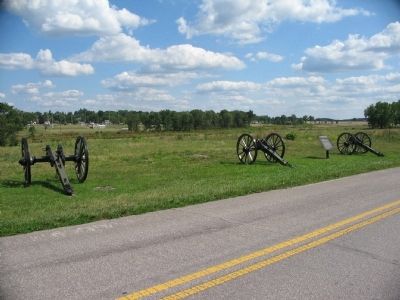
3. The Donaldsville Artillery's View of the Federal Lines
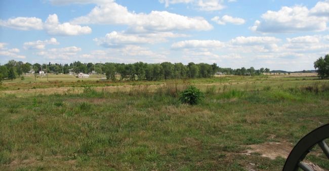
Looking past the carriages toward the east. Maurin's Louisiana men had a wide view of the Federal lines from this part of Seminary Ridge. While modern buildings and trees block the direct view of Cemetery Hill, the Round Tops to the south can be seen on the right.
Credits. This page was last revised on June 1, 2020. It was originally submitted on September 28, 2008, by Craig Swain of Leesburg, Virginia. This page has been viewed 913 times since then and 28 times this year. Photos: 1, 2, 3. submitted on September 28, 2008, by Craig Swain of Leesburg, Virginia.

