New Iberia in Iberia Parish, Louisiana — The American South (West South Central)
Lake Peigneur
Rip Van Winkle Gardens
— Atchafalaya Water Heritage Trail —
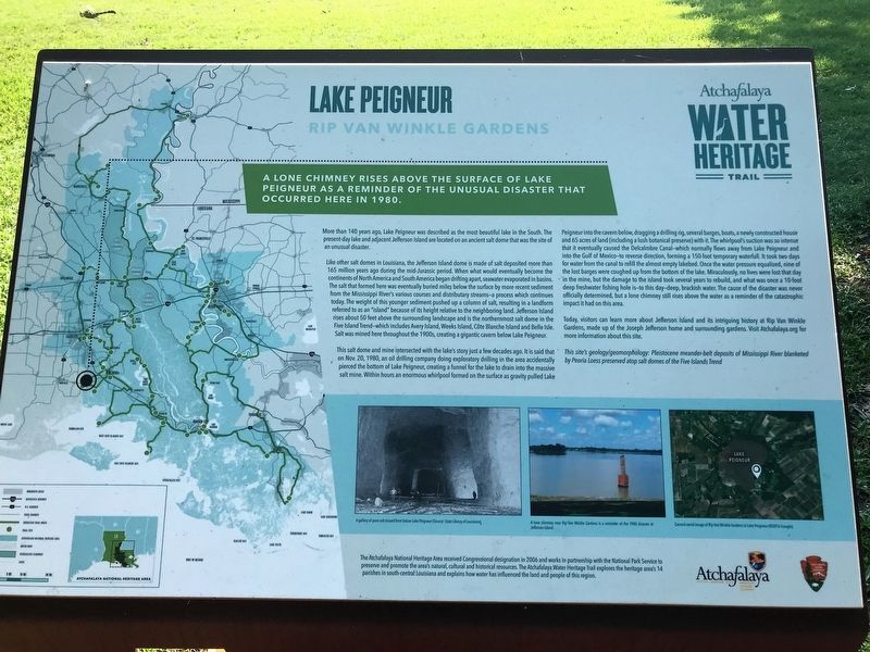
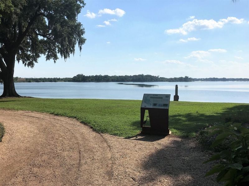
A lone chimney rises above the surface of Lake Peigneur as a reminder of the unusual disaster that occurred here in 1980.
More than 140 years ago, Lake Peigneur was described as the most beautiful lake in the South. The present-day lake and adjacent Jefferson Island are located on an ancient salt dome that was the site of an unusual disaster.
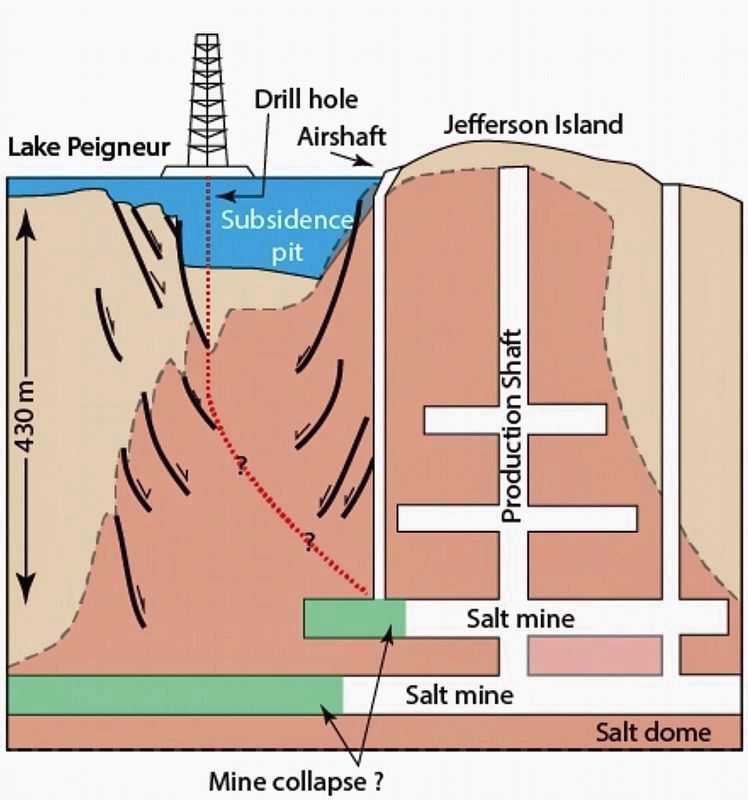
Like other salt domes in Louisiana, the Jefferson Island dome is made of salt deposited more than 165 million years ago during the mid-Jurassic period. When what would eventually become the continents of North America and South America began drifting apart, seawater evaporated in basins. The salt that formed here was eventually buried miles below the surface by more recent sediment from the Mississippi River’s various courses and distributary streams — a process which continues today. The weight of this younger sediment pushed up a column of salt, resulting in a landform referred to as an “island” because of its height relative to the neighboring land. Jefferson Island rises about 50 feet above the surrounding landscape and is the northernmost salt dome in the Five Island Trend—which includes Avery Island, Weeks Island, Côte Blanche Island and Belle Isle. Salt was mined here throughout the 1900s, creating a gigantic cavern below Lake Peigneur.
This salt dome and mine intersected with the lake’s story just a few decades ago. It is said that on Nov. 20, 1980, an oil drilling company doing exploratory drilling in the area accidentally pierced the bottom of Lake Peigneur, creating a funnel for the lake to drain into the massive salt mine. Within hours an enormous whirlpool formed on the surface as gravity pulled Lake Peigneur into the cavern below, dragging a drilling rig, several barges, boats, a newly constructed house and 65 acres of land (including a lush botanical preserve) with it. The whirlpool’s suction was so intense that it eventually caused the Delcalmbre Canal—which normally flows away from Lake Peigneur and into the Gulf of Mexico—to reverse direction, forming a 150-foot temporary waterfall. It took two days for water from the canal to refill the almost empty lakebed. Once the water pressure equalized, nine of the lost barges were coughed up from the bottom of the lake. Miraculously, no lives were lost that day in the mine, but the damage to the island took several years to rebuild, and what was once a 10-foot deep freshwater fishing hole is—to this day—deep, brackish water. The cause of the disaster was never officially determined, but a lone chimney still rises above the water as a reminder of the catastrophic impact it had on this area.
Today, visitors can learn more about Jefferson Island and its intriguing history at Rip Van Winkle Gardens, made up of the Joseph Jefferson home and surrounding gardens.
This site’s geology/geomorphology: Pleistocene meander-belt deposits of Mississippi River blanketed by Peoria Loess preserved atop salt domes of the Five Islands Trend
Erected by State of Louisiana and National Park Service.
Topics and series. This historical marker is listed in these topic lists: Disasters • Environment • Waterways & Vessels. In addition, it is included in the Atchafalaya Water Heritage Trail series list. A significant historical date for this entry is November 20, 1980.
Location. 29° 58.394′ N, 91° 58.529′ W. Marker is in New Iberia, Louisiana, in Iberia Parish. Marker can be reached from Jefferson Island Road. Touch for map. Marker is at or near this postal address: 10106 Jefferson Island Road, New Iberia LA 70560, United States of America. Touch for directions.
Other nearby markers. At least 8 other markers are within 5 miles of this marker, measured as the crow flies. Dedicated to the Memory of Joseph Jefferson (approx. 0.2 miles away); Jefferson Island (approx. 0.3 miles away); Bayou Carlin Cove (approx. 2.2 miles away); First Lt. Brandon R. Dronet (approx. 3.7 miles away); Private Farrell J. Vice (approx. 3.7 miles away); The 1964 Fall of the Erath Water Tower (approx. 3.7 miles away); The Erath Sugar Company (approx. 3.8 miles away); Acadian Prairie Settlement (approx. 4.7 miles away). Touch for a list and map of all markers in New Iberia.
More about this marker. Located within the Rip Van Winkle Gardens, so a fee will be charged for the garden tour, and access to the marker.
Credits. This page was last revised on April 7, 2024. It was originally submitted on June 15, 2018, by Cajun Scrambler of Assumption, Louisiana. This page has been viewed 1,753 times since then and 160 times this year. Photos: 1, 2. submitted on June 15, 2018. 3. submitted on March 4, 2024, by Craig Baker of Sylmar, California.


