Williamston in Ingham County, Michigan — The American Midwest (Great Lakes)
The Bridge
Linking a City
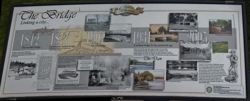
1842: The wooden bridge
Though no records exist of Williamston's first bridge, there must have been bridges to move supplies and traffic between the mills and farms on the north side.
One entering our Village from the north, will not fail to discover that the bridge across the Cedar River is about the worst and most dangerous structure of its kind in the state horses instinctively dread to cross it and the driver congratulates himself when safe over. The bridge proper is bad enough, but the embankment south of it is positively disgraceful and the town may consider itself fortunate in so far almost any sort of accident may occur any day, from the neglected and unsafe condition of that bridge. A good and substantial bridge is a pressing want: When will it be supplied. Next to a railroad, nothing adds more to the prosperity of a town that .good solid roads passable at all times, and in this matter is mainly business men are culpably negligent. The road entering our town from the North East and over which a large portion of the people of Locke have to travel to reach us, is often in a shameful condition, and this road is partially at least within the corporation.
Article referencing the wooden bridge, Williamston Enterprise - June 5,1873
1877: A publically funded bridge
This bridge was funded by the Village through the sale of $2500 in bonds.
1902: The iron bridge
By the later half of the 19th century, iron bridges were being factory produced by numerous companies. By 1900, iron bridges had become a common site throughout Michigan. Today, only a few remain.
"Pratt Truss" (called also the "Murphy-Whipple," or "Quadrangular" truss) - A single-intersection truss with vertical struts and diagonal ties.
"Single Intersection" - That style of truss in which the diagonals do not cross the posts.
1931: A modern bridge for the automobile age
With the coming of the automobile, traffic demanded a two lane bridge. A reinforced concrete bridge was dedicated in 1931, completed in 1932, served until 2005. This bridge was built under the "State Reward Act", financed in part by gasoline tax revenue. The "reward" was payment of half the cost through the State Highway Commission (the Village and County Road Commission paid the balance).
2005: The Mill Pond
On April 18, 1975, the City of Williamston received 4.89 inches of rain in seven hours. This resulted in the most devastating flood since 1904. The dam, built in 1840 and its mill pond, were lost. To restore natural fisheries, and other environmental concerns, the
state denied efforts to rebuild it. With a grant from the Natural Resources Trust Fund and funding from the sale of bonds by the Downtown Development Authority, an innovative alternative was realized in 1998. Costing less than a dam and fish ladder, the boulder impoundment raises the water level over one mile and provides whitewater recreation and natural wildlife habitat.
History Plaza funding by Williamston Sunrise Rotary
Design by: Earl Wolf
Thanks to: Charles Dietz Sr., Bernard Eckman, David H. Jones, Cloyce O’Dell & The Depot Museum
Special Thanks to Mitch Lutzke, Kenneth Zichi, Bev O'Malia & The Williamston Downtown Development Authority
Erected by Williamston Sunrise Rotary, The Depot Museum & The Williamston Downtown Development Authority.
Topics. This historical marker is listed in these topic lists: Bridges & Viaducts • Roads & Vehicles • Waterways & Vessels.
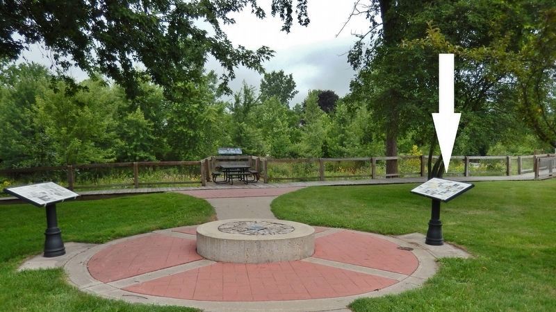
Location. 42° 41.411′ N, 84° 17.006′ W. Marker is in Williamston, Michigan, in Ingham County. Marker is at the intersection of North Putnam Street and High Street, on the left when traveling north on North Putnam Street. Marker is located along the pedestrian walkway, west of where High Street dead-ends into Putnam
Street. Touch for map. Marker is in this post office area: Williamston MI 48895, United States of America. Touch for directions.
Other nearby markers. At least 8 other markers are within walking distance of this marker. The Mill (here, next to this marker); McCormick Park (within shouting distance of this marker); Williamston Wall of Honor (about 400 feet away, measured in a direct line); Williamston Civil War Memorial (about 600 feet away); Williamston Area World War II Memorial (about 600 feet away); Downtown Historic District (about 700 feet away); Saint Mary Parish (about 700 feet away); McCormick Park Gazebo (about 700 feet away). Touch for a list and map of all markers in Williamston.
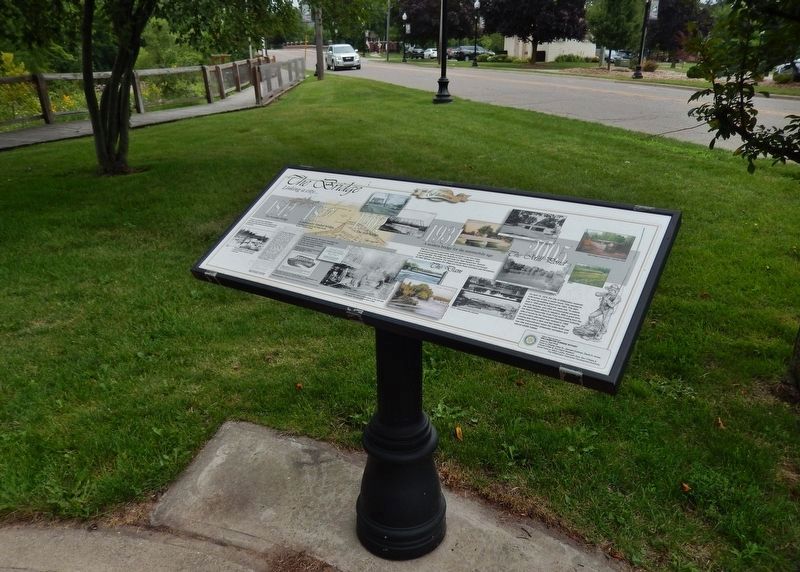
More about this marker. Marker is a large composite plaque, mounted horizontally, waist-high, on a decorative black metal post.
Credits. This page was last revised on December 8, 2020. It was originally submitted on June 17, 2018, by Cosmos Mariner of Cape Canaveral, Florida. This page has been viewed 209 times since then and 6 times this year. Photos: 1, 2, 3. submitted on June 17, 2018, by Cosmos Mariner of Cape Canaveral, Florida. • Andrew Ruppenstein was the editor who published this page.


