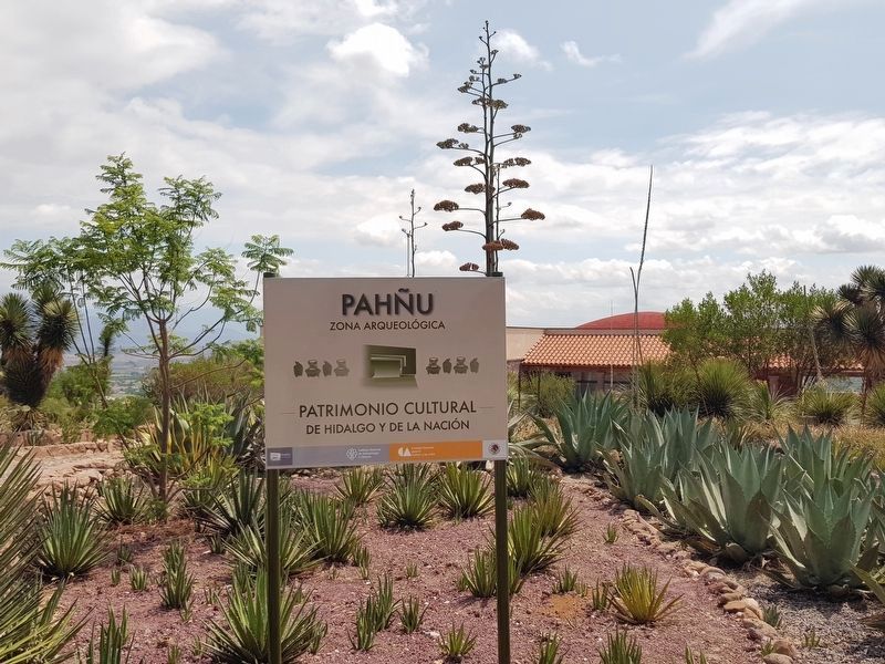
La Mesilla in Tecozautla, Hidalgo, Mexico — The Central Highlands (North America)
Pah˝u: The Luminous Path
Pah˝u: El Camino Luminoso
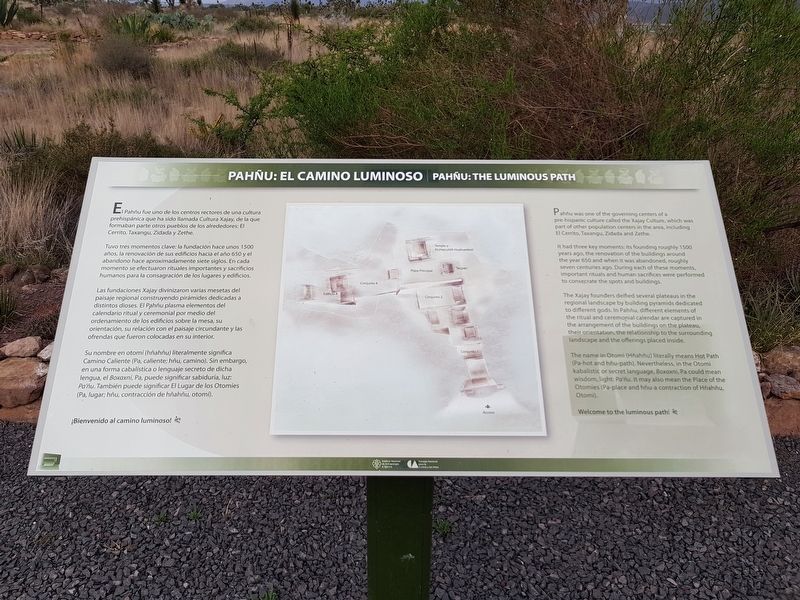
El Pah˝u fue uno de los centros rectores de una cultura prehispßnica que ha sido llamada Cultura Xajay, de la que formaban parte otros pueblos de los alrededores: El Cerrito, Taxangu, Zidada y Zethe.
Tuvo tres momentos clave: la fundaciˇn hace unos 1500 a˝os, la renovaciˇn de sus edificios hacia el a˝o 650 y el abandono hace aproximadamente siete siglos. En cada momento se efectuaron rituales importantes y sacrificios humanos para la consagraciˇn de los lugares y edificios.
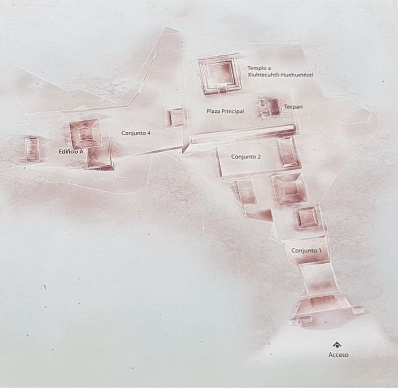
Las fundaciones Xajay divinizaron varias mesetas del paisaje regional construyendo pirßmides dedicadas a distintos dioses. El Pah˝u plasma elementos del calendario ritual y ceremonial por medio del ordenamiento de los edificios sobre la mesa, su orientaciˇn, su relaciˇn con el paisaje circundante y las ofrendas que fueron colocadas en su interior.
Su nombre en otomÝ (h˝ah˝u) literalmente significa Camino Caliente (Pa, caliente; h˝u, camino). Sin embargo, en una forma cabalÝstica o lenguaje secreto de dicha lengua, el Boxaxni, Pa, puede significar sabidurÝa, luz: Pa'˝u. TambiÚn puede significar El Lugar de los OtomÝes (Pa, lugar; h˝u, contracciˇn de h˝ahňu, otomÝ).
íBienvenido al camino luminoso!
Pah˝u: The Luminous Path
Pah˝u was one of the governing centers of a pre-hispanic culture called the Xajay Culture, which was part of other population centers in the area, including El Cerrito, Taxangu, Zidada and Zethe.
It had three key moments: its founding roughly 1500 years ago, the renovation of the buildings around the year 650 and when it was abandoned, roughly seven centuries ago. During each of these moments, important rituals and human sacrifices were performed to consecrate the spots and buildings.
The Xajay founders deified several plateaus in the regional landscape by building pyramids dedicated to different gods. In Pah˝u, different elements of the ritual and ceremonial calendar are captured in the arrangement of the buildings on the plateau, their orientation, the relationship to the surrounding landscape and the offerings placed inside.
The name in Otomi (H˝ah˝u) literally means Hot Path (Pa-hot and h˝u-path). Nevertheless, in the Otomi kabalistic or secret language, Boxaxni, Pa could mean wisdom, light: Pa'˝u. It may also mean the Place of the Otomies (Pa-place and h˝u-a contraction of H˝ah˝u, Otomi).
Welcome to the luminous path!
Erected by
Consejo Nacional para la Cultura y las Artes (CONACULTA) y el Instituto Nacional de AnthropologÝa e Historia (INAH).
Topics. This historical marker is listed in these topic lists: Anthropology & Archaeology • Man-Made Features • Native Americans. A significant historical year for this entry is 1500.
Location. 20° 30.204′ N, 99° 41.041′ W. Marker is in La Mesilla, Hidalgo, in Tecozautla. Marker can be reached from Entrada del Sitio Arqueolˇgico de Pah˝u, on the right when traveling north. Touch for map. Marker is in this post office area: La Mesilla HGO 42460, Mexico. Touch for directions.
Other nearby markers. At least 8 other markers are within walking distance of this marker. The Quincunx and the Ritual Paths (within shouting distance of this marker); Sacred plants and animals (about 90 meters away, measured in a direct line); Message in the Soil: Geoglyph (about 150 meters away); A Sacred Triangle and the Temple of the Sun (about 180 meters away); Messages in the Rocks: Petroglyphs (about 180 meters away); Circular Altar or Wheel of Sacrifice (Temalßcatl) (about 210 meters away); The Calendar on the Landscape (about 210 meters away); The Plaza and the Xiuhtecuhtli Temple (about 240 meters away). Touch for a list and map of all markers in La Mesilla.
Credits. This page was last revised on June 23, 2018. It was originally submitted on June 23, 2018, by J. Makali Bruton of Accra, Ghana. This page has been viewed 170 times since then and 26 times this year. Photos: 1, 2, 3, 4, 5. submitted on June 23, 2018, by J. Makali Bruton of Accra, Ghana.
