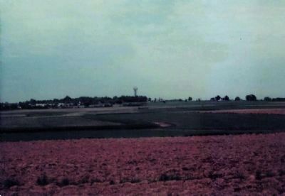
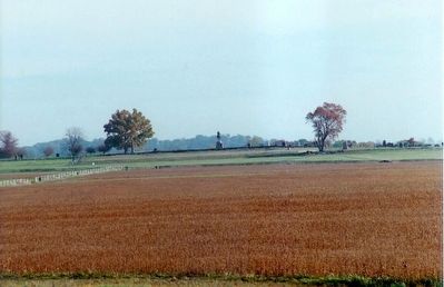
Cumberland Township near Gettysburg in Adams County, Pennsylvania — The American Northeast (Mid-Atlantic)
Pickett's Charge
July 3, 1863 - Third Day
Pvt. Randolph Shotwell, C.S.A.
8th Virginia Infantry
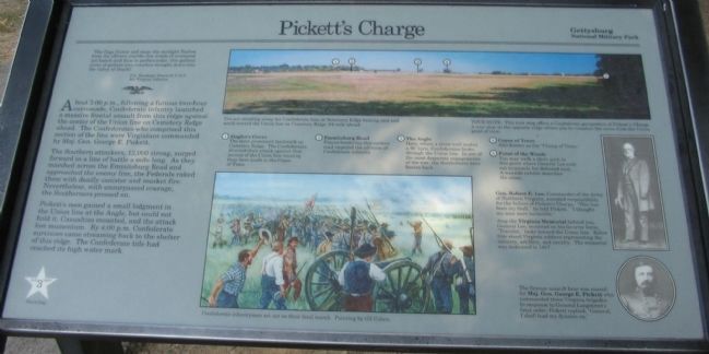
About 3:00 p.m., following a furious two-hour cannonade, Confederate infantry launched a massive frontal assault from this ridge against the center of the Union line on Cemetery Ridge ahead. The Confederates who comprised this section of the line were Virginians commanded by Maj. Gen. George E. Pickett.
The Southern attackers, 12,000 strong, surged forward in a line of battle a mile long. As they marched across the Emmitsburg Road and approached the enemy line, the Federals raked them with deadly canister and musket fire, Nevertheless, with unsurpassed courage, the Southerners pressed on.
Pickett's men gained a small lodgment in the Union line at the Angle, but could not hold it. Casualties mounted, and the attack lost momentum. By 4:00 p.m. Confederate survivors came streaming back to the shelter of this ridge. The Confederate tide had reached its high water mark.
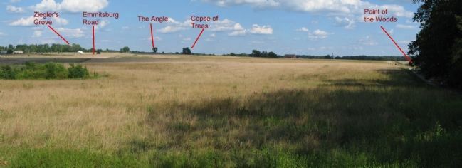
(Numbered References to the panoramic photo of the field):
1. Ziegler's Grove
The most prominent landmark on Cemetery Ridge. The Confederates directed their attack against that section of the Union line running from here south to the Copse of Trees.
2. Emmitsburg Road
Fences bordering this sunken road impeded the advance of Confederate infantry
3. The Angle
Here, where a stone wall makes a 90° turn, Confederates broke through the Union line. In one of the most desperate engagements of the war, the Southerners were beaten back.
4. Copse of Trees
Also known as the "Clump of Trees."
5. Point of the Woods
You may walk a short path to this point where General Lee rode out to console his defeated men. A wayside exhibit describes the scene.
Erected by Gettysburg National Miltary Park.
Topics. This historical marker is listed in this topic list: War, US Civil.
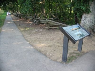
Location. This marker has been replaced by another marker nearby. It was located near 39° 48.834′ N, 77° 15.015′ W. Marker was near Gettysburg, Pennsylvania, in Adams County. It was in Cumberland Township. Marker was on West Confederate Avenue, on the left when traveling south. Located in the parking lot for the Virginia State Memorial (Driving Tour Stop 5) on Seminary Ridge in Gettysburg National Military Park. A walking trail to overlook the field of Pickett's Charge starts at the marker. Touch for map. Marker was in this post office area: Gettysburg PA 17325, United States of America. Touch for directions.
Other nearby markers. At least 8 other markers are within walking distance of this location. The Storm of Battle (here, next to this marker); Virginia Memorial (within shouting distance of this marker); Wright's Brigade (within shouting distance of this marker); Army of Northern Virginia (within shouting distance of this marker); Ward's Battery - Poague's Battalion (within shouting distance of this marker); Posey's Brigade (within shouting distance of this marker); Brooke's Battery - Poague's Battalion (within shouting distance of this marker); Garnett's Brigade (about 300 feet away, measured in a direct line). Touch for a list and map of all markers in Gettysburg.
More about this marker. In the upper center is a panoramic photo keyed to the points indicated in the text. You are standing along the Confederate line on Seminary Ridge looking east and south toward the Union line on Cemetery Ridge 3/4 mile ahead.
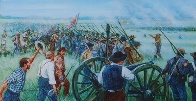
In the lower center is a painting by Gil Cohen depicting Confederate infantrymen set out on their fatal march.
On the right is a portrait of Gen. Robert E. Lee, Commander of the Army of Northern Virginia who accepted responsibility for the failure of Pickett's Charge. "This has been my fault," he told Pickett. "I thought my men were invincible."
Atop the Virginia Memorial behind you, General Lee, mounted on his favorite horse, "Traveler," looks toward the Union line. Below him stand Virginia soldiers representing the infantry, artillery, and cavalry. The memorial was dedicated in 1917.
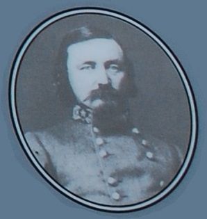
Below that portrait is one of General Pickett. The famous assault here was named for Maj. Gen. George E. Pickett who commanded three Virginia brigades. In response to General Longstreet's fatal order, Pickett replied, "General, I shall lead my division on."
This marker was replaced by a new one named "The Storm of Battle" (see nearby markers).
Related markers. Click here for a list of markers that are related to this marker. Gettysburg Markers and Monuments near Spangler's Woods (Virginia Monument).
Also see . . . Pickett's Charge Battlefield Walk. Gettysburg Daily article covering a guided tour by one of Gettysburg's Ranger-Historians. (Submitted on December 2, 2008, by Craig Swain of Leesburg, Virginia.)
Photographed By Craig Swain
5. Pickett's Charge Panoramic View
In addition to the points indicated in the marker's text, additional key points often referenced in accounts of the charge are the Brian Farm (white buildings near Ziegler's Grove) and the Codori Farm (red barn seen just right of center).
Credits. This page was last revised on February 7, 2023. It was originally submitted on September 29, 2008, by Craig Swain of Leesburg, Virginia. This page has been viewed 3,693 times since then and 54 times this year. Photos: 1. submitted on September 29, 2008, by Craig Swain of Leesburg, Virginia. 2, 3. submitted on August 28, 2015, by Brandon Fletcher of Chattanooga, Tennessee. 4, 5. submitted on September 29, 2008, by Craig Swain of Leesburg, Virginia. 6, 7. submitted on December 30, 2008, by Mike Stroud of Bluffton, South Carolina.
