Tecozautla, Hidalgo, Mexico — The Central Highlands (North America)
Tecozautla
Tecozautla
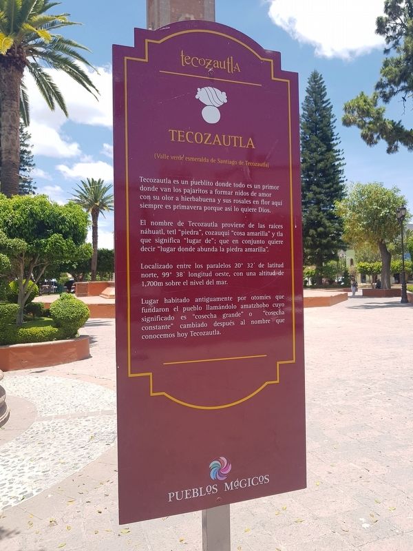
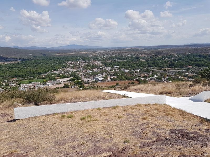
(Valle verde esmeralda de Santiago de Tecozautla)
Tecozautla es un pueblito donde todo es un primor
donde van los pajaritos a formar nidos de amor
con su olor a hierbabuena y sus rosales en flor aquí
siempre es primavera porque así lo quiere Dios.
El nombre de Tecozautla proviene de las raíces náhuatl, tetl "piedra", cozauqui "cosa amarilla" y tla que significa "lugar de"; que en conjunto quiere decir "lugar donde abunda la piedra amarilla".
Localizado entre los paralelos 20° 32' de latitud norte, 99° 38’ longitud oeste, con una altitud de 1,700m sobre el nivel del mar.
Lugar habitado antiguamente por otomies que fundaron el pueblo llamándolo amatzhobo cuyo significado es "cosecha grande" o "cosecha constante" cambiado después al nombre que conocemos hoy Tecozautla.
Tecozautla
(Emerald green valley of Santiago de Tecozautla)
Tecozautla is a small town where everything is a delight
and where the little birds go to form nests of love
with a smell of mint and its rose bushes in bloom here
its always spring because that’s how God wants it.
(A portion of the poem "Canto a Tecozautla")
The name of Tecozautla comes from the Nahuatl root words: tetl or "stone", cozauqui meaning "yellow thing" and tla that means "place of", which together means "place where yellow stone abounds".
Located between the parallels of 20° 32' north latitude and 99° 38' west longitude, with an altitude of 1,700 m above sea level.
This place was formerly inhabited by Otomies that founded the town and called it Amatzhobo, whose meaning is "great harvest" or "constant harvest". The name was changed later to what we now know as Tecozautla.
Topics. This historical marker is listed in these topic lists: Native Americans • Settlements & Settlers.
Location. 20° 32.05′ N, 99° 38.085′ W. Marker is in Tecozautla, Hidalgo. Marker is on Calle Plaza Constitución just south of Camino Real a Guadalupe, on the left when traveling south. Touch for map. Marker is in this post office area: Tecozautla HGO 42440, Mexico. Touch for directions.
Other nearby markers. At least 8 other markers are within 6 kilometers of this marker, measured as the crow flies. Chapel of the Lord of Expiration (about 90 meters away, measured in a direct line); Benito Juárez (about 120 meters away); The Irrigation System of Tecozautla (approx. 0.6 kilometers away); The Aqueduct of the Arches (approx.
1.1 kilometers away); Messages in the Rocks: Petroglyphs (approx. 6.1 kilometers away); Tecpan: The Place of Duality (approx. 6.1 kilometers away); Tecpan: “The Government House” (approx. 6.1 kilometers away); The Calendar on the Landscape (approx. 6.1 kilometers away). Touch for a list and map of all markers in Tecozautla.
Regarding Tecozautla. "When the Toltec empire disintegrated, a large number of migrants arrived who settled in this municipality and, fearing attacks by other tribes, built a wall that measured between five and six meters high with an approximate length of 4788 meters, most likely between the years 730 and 740 AD.
The construction of this wall helped to protect the town, especially when the Chichimecas attacked the Toltecs that inhabited this region. After the Spanish Conquest, in 1551 the Spaniards came to take over lands. One of the first Spaniards to arrive was Nicolás Montaño, Cacique de Jilotepec.
In order to evangelize the Indians here, the first Franciscan missionary Fray Juan de Sanabria arrived in 1535. He founded the first convent and worked with other friars to evangelize and create reconciliation
with the Chichimecas who lived in the southern part of the population. The wall dividing the two groups was destroyed in order to show this determination." Translated from Wikipedia.
Photographed By J. Makali Bruton, June 9, 2018
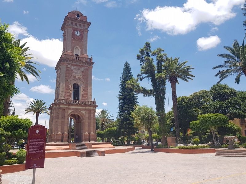
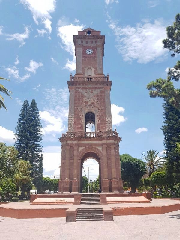
4. The Tecozautla Clock Tower
Construction on this clock tower began in 1904 in preparation for the celebration of 100 years of independence from Spain in 1910. Unfortunately, with the outbreak of the Mexican Revolution it was not completely finished until 1921.
Credits. This page was last revised on July 9, 2018. It was originally submitted on June 25, 2018, by J. Makali Bruton of Accra, Ghana. This page has been viewed 207 times since then and 20 times this year. Photos: 1, 2. submitted on June 25, 2018, by J. Makali Bruton of Accra, Ghana. 3. submitted on July 9, 2018, by J. Makali Bruton of Accra, Ghana. 4, 5. submitted on June 25, 2018, by J. Makali Bruton of Accra, Ghana.
