Griswoldville in Twiggs County, Georgia — The American South (South Atlantic)
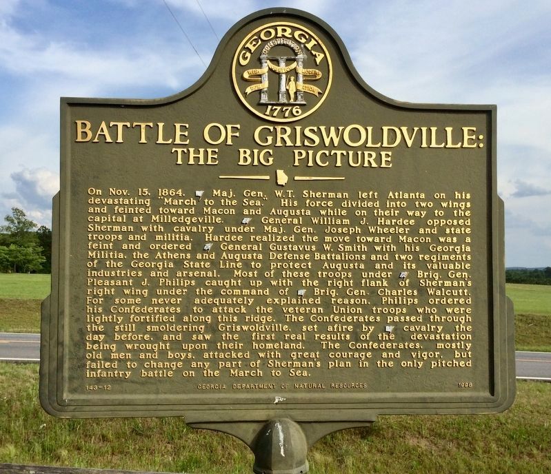
Battle of Griswoldville:
The Big Picture
On Nov. 15, 1864, [US) Maj. Gen. W.T. Sherman left Atlanta on his devastating “March to the Sea.” His force divided into two wings and feinted toward Macon and Augusta while on their way to the capital at Milledgeville. [CS] General William J. Hardee opposed Sherman with cavalry under Maj. Gen. Joseph Wheeler and state troops and militia. Hardee realized the move toward Macon was a feint and ordered [CS] General Gustavus W. Smith with his Georgia Militia, the Athens and Augusta Defense Battalions and two regiments of the Georgia State Line to protect Augusta and its valuable industries and arsenal. Most of these troops under [CS] Brig. Gen. Pleasant J. Philips caught up with the right flank of Sherman's right wing under the command of [US] Brig. Gen. Charles Walcutt. For some never adequately explained reason, Philips order his Confederates to attack the veteran Union troops who were lightly fortified along this ridge. The Confederates passed through the still smoldering Griswoldville, set afire by [US] cavalry the day before, and saw the first real results of the devastation being wrought upon their homeland. The Confederates, mostly old men and boys, attacked with great courage and vigor, but failed to change any part of Sherman’s plan in the only pitched infantry battle on the March to Sea.
Erected 1998 by Georgia Department of Natural Resources. (Marker Number 143-12.)
Topics and series. This historical marker is listed in this topic list: War, US Civil. In addition, it is included in the Georgia Historical Society, and the Sherman’s March to the Sea series lists. A significant historical month for this entry is October 1884.
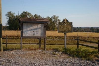
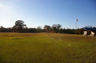
Location. 32° 52.155′ N, 83° 27.6′ W. Marker is in Griswoldville, Georgia, in Twiggs County. Marker is on Baker Road, 0.6 miles east of Old Griswoldville Road, on the left when traveling east. Touch for map. Marker is in this post office area: Macon GA 31217, United States of America. Touch for directions.
Other nearby markers. At least 8 other markers are within 2 miles of this marker, measured as the crow flies. Battle of Griswoldville (within shouting distance of this marker); Target Griswoldville (within shouting distance of this marker); The Cavalry Skirmish (approx. 0.6 miles away); Battle of Griswoldville The Deployment and Assaults (approx. ¾ mile away); a different marker also named Battle of Griswoldville (approx. 1.7 miles away); Battle of Griswoldville The Advance from East Macon (approx. 1.7 miles away); Confederate Pistol Factory (approx. 1.7 miles away); Griswoldville (approx. 1.7 miles away). Touch for a list and map of all markers in Griswoldville.
Credits. This page was last revised on November 24, 2019. It was originally submitted on September 29, 2008, by David Seibert of Sandy Springs, Georgia. This page has been viewed 2,290 times since then and 15 times this year. Photos: 1. submitted on November 22, 2019, by Mark Hilton of Montgomery, Alabama. 2. submitted on September 29, 2008, by David Seibert of Sandy Springs, Georgia. 3, 4. submitted on November 23, 2009, by David Seibert of Sandy Springs, Georgia. • Craig Swain was the editor who published this page.


