Riggins in Idaho County, Idaho — The American West (Mountains)
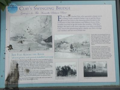
Clay's Swinging Bridge
Getting to the Flat Across the Salmon River
— Salmon River Heritage Waking Tour —

Photographed By Barry Swackhamer, May 4, 2018
1. Clay's Swinging Bridge Marker
Captions: (upper left) View of early Riggins looking north. Notice the swinging cable bridge at the lower right.; (center bottom) 1942 - Riggins football team. Left-Right: Bud Clark, Frankie Heath,George Alkire, Jack Williams, Larry Parks, Don Wilson, Dan Wilson and a very serious Ace Barton.; (bottom right) In 1910, the Riggins boat ferry was moved from Goff to a new location at what is now the Riggins City Park
Used cable was purchased from an old mine tramway in Warren, and Clay dragged it to the river with horses. The cable was loaded on a raft and floated to Riggins, and the cable bridge across the Salmon River was built just north of Berger Street.
Clay eventually constructed a shearing plant and lambing sheds on the east side of the river after the bridge was completed in 1912. The Forest Service also helped maintain the bridge over the years. In 1956, high water undermined the piers and a floating tree caught the sagging bridge and took it out.
The Flat Across the River
Livestock operation, rodeo grounds, football field and airstrip
From 1912 to 1956, the large flat across the river was accessible by Clay’s cable bridge and the property had various and unique uses in addition to his livestock operation. In the late 1930s, Milt Carnefix briefly tried his luck with a sawmill operation and parts of his abandoned steam machinery are still visible. The Barham family lived there, farming a portion of the flat for several years with remnants of their residence still standing. In the 1940s, it served as the first rodeo grounds.
In 1942, Frank Heath courageously braved the swinging bridge in his 1932 Model B touring car. Using the car to pull a springtooth harrow and with his team members’ help, Frank cleared a football field. That fall, the first of many Riggins High School football games was played there.
In 1951, the State Aeronautical Board leased the site and excavated an emergency airstrip. It was abandoned in 1971.
Erected by City of Riggins.
Topics. This historical marker is listed in these topic lists: Bridges & Viaducts • Industry & Commerce.
Location. 45° 25.254′ N, 116° 18.93′ W. Marker is in Riggins, Idaho, in Idaho County. Marker is on Main Street (U.S. 95) near Salmon Road, on the right when traveling north. Touch for map. Marker is at or near this postal address: 300 Main Street, Riggins ID 83549, United States of America. Touch for directions.
Other nearby markers. At least 8 other markers are within walking distance of this marker. Riggins' Early Hotels (within shouting distance of this marker); The Forest Service (within shouting distance of this marker); Gouge-Eye Legend (about 300 feet away, measured in a direct line); Early Businesses (about 300 feet away); Riggins in the 1940s (about 300 feet away); You’ve Got Mail (about 400 feet away); The Evolution of a River Terrace (about 500 feet away); Memorable Homes (about 600 feet away). Touch for a list and map of all markers in Riggins.
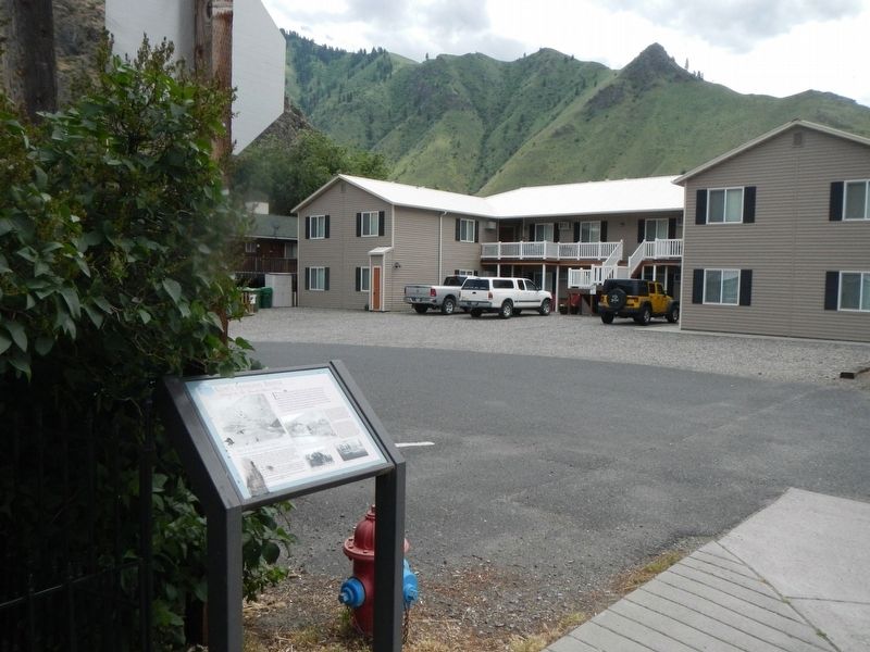
More about this marker. Next to Big Rock Condominiums.
Credits. This page was last revised on June 27, 2018. It was originally submitted on June 27, 2018, by Barry Swackhamer of Brentwood, California. This page has been viewed 230 times since then and 25 times this year. Photos: 1, 2. submitted on June 27, 2018, by Barry Swackhamer of Brentwood, California.
