Port Tobacco in Charles County, Maryland — The American Northeast (Mid-Atlantic)
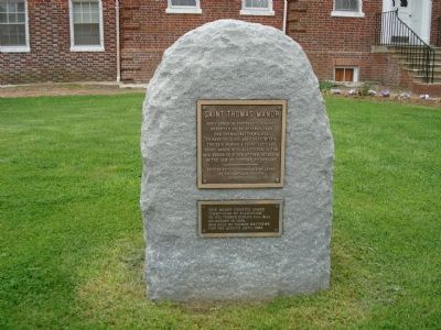
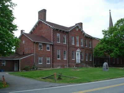
Saint Thomas Manor
(smaller brass tablet) This manor granted under “conditions of plantation” to (Fr.) Thomas Copley, Esq. (S.J.) on August 15, 1649, was held by Thomas Matthews for the Jesuits until 1662.
Erected 1963 by Lords of the Maryland Manors.
Topics. This historical marker is listed in this topic list: Colonial Era. A significant historical date for this entry is October 25, 1649.
Location. 38° 27.942′ N, 77° 1.401′ W. Marker is in Port Tobacco, Maryland, in Charles County. Marker is on Chapel Point Road, 4 miles south of Port Tobacco Road (Maryland Route 6), on the right when traveling east. Touch for map. Marker is at or near this postal address: 8855 Chapel Point Road, Port Tobacco MD 20677, United States of America. Touch for directions.
Other nearby markers. At least 8 other markers are within 2 miles of this marker, measured as the crow flies. Rise from the Ashes (within shouting distance of this marker); The Tension of Liberty (within shouting distance of this marker); Saint Ignatius' Church (within shouting distance of this marker); Ways to Explore Southern Maryland’s Scenic and Historic Routes (within shouting distance of this marker); St. Ignatius Catholic Church (about 300 feet away, measured in a direct line); Chapel Point Park (approx. 0.2 miles away); Mulberry Grove (approx. 1.8 miles away); John Hanson (approx. 1.8 miles away). Touch for a list and map of all markers in Port Tobacco.
Also see . . .
1. Saint Ignatius Church and Saint Thomas Manor. (Submitted on June 18, 2007, by Roger Dean Meyer of Yankton, South Dakota.)
2. St. Thomas Manor, Maryland's National Register Properties. (Submitted on January 25, 2019.)
Credits. This page was last revised on January 30, 2019. It was originally submitted on June 18, 2007, by Roger Dean Meyer of Yankton, South Dakota. This page has been viewed 2,622 times since then and 33 times this year. Photos: 1, 2. submitted on June 18, 2007, by Roger Dean Meyer of Yankton, South Dakota. • J. J. Prats was the editor who published this page.

