Near West Point in Calaveras County, California — The American West (Pacific Coastal)
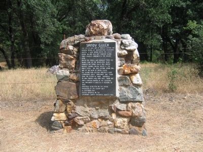
Sandy Gulch
Water for mining was brought from the Middle Fork of the Mokelumne River. Through the Sandy Gulch and Kadish Ditches. Quartz mining began in the early fifties. The first custom stamp mill was at the head of Sandy Gulch.
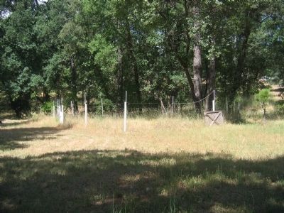
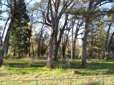
The school and elections precincts were established early. Hangman’s Tree stood near the center of town. Numerous Mi-Wuk Indians lived here then. There are many pioneers buried in the cemetery. This monument is erected in memory of them.
Erected 1941 by The Native Daughters of the Golden West 14 September 1941. Rededicated by Calaveras County Historical Society 1993. (Marker Number 253.)
Topics and series. This historical marker is listed in these topic lists: Cemeteries & Burial Sites • Industry & Commerce • Native Americans • Settlements & Settlers • Women. In addition, it is included in the California Historical Landmarks, and the Native Sons/Daughters of the Golden West series lists. A significant historical year for this entry is 1849.
Location. 38° 22.811′ N, 120° 31.938′ W. Marker is near West Point, California, in Calaveras County. Marker is on State Highway 26, on the left when traveling east. Touch for map. Marker is in this post office area: West Point CA 95255, United States of America. Touch for directions.
Other nearby markers. At least 8 other markers are within 7 miles of this marker, measured as the crow flies. West Point (approx. 1.2 miles away); Keepers of the Land! (approx. 1½ miles away); HOSTAGE: A most painful experience of human suffering (approx. 1.6 miles away); Rail Road Flat (approx. 2.8 miles away); Chaw Sé Roundhouse (approx. 6.7 miles away); Chaw'se (approx. 6.7 miles away); Petroglyphs (Rock Carvings) (approx. 6.7 miles away); Hun'ge (approx. 6.7 miles away). Touch for a list and map of all markers in West Point.
More about this marker. This site has been designated as California Registered Historical Landmark No.253
Additional keywords. Gold Rush
Credits. This page was last revised on November 3, 2019. It was originally submitted on October 1, 2008, by Syd Whittle of Mesa, Arizona. This page has been viewed 2,271 times since then and 24 times this year. Photos: 1, 2, 3. submitted on October 1, 2008, by Syd Whittle of Mesa, Arizona. 4. submitted on November 30, 2008, by Jennifer Howse of West Point, California.


