Santiago de Querétaro in Querétaro, Mexico — The Central Highlands (North America)
Hill of the Bells
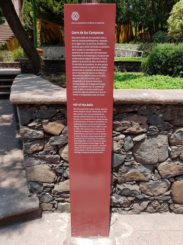
Cerro de las Campanas
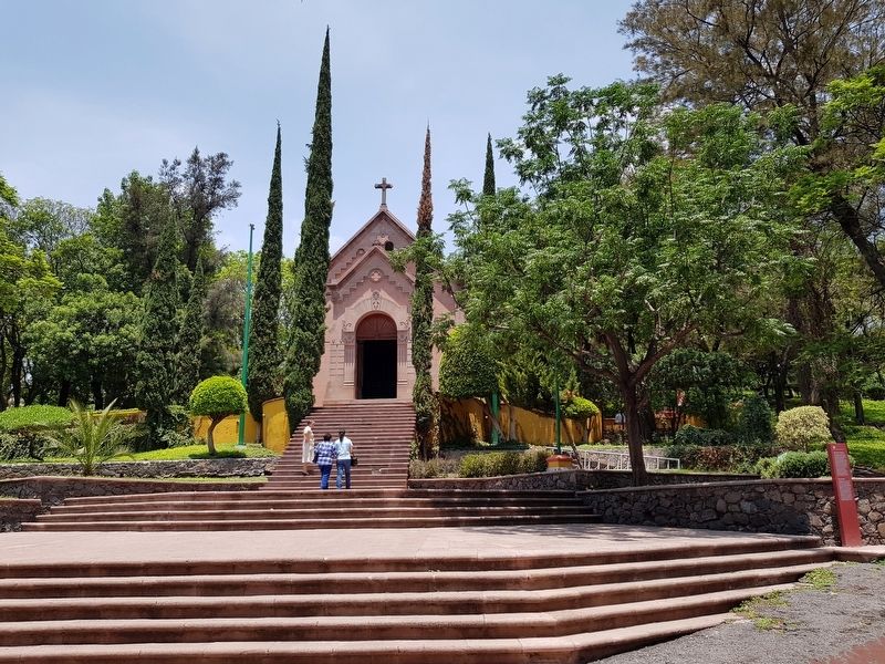
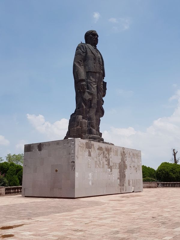
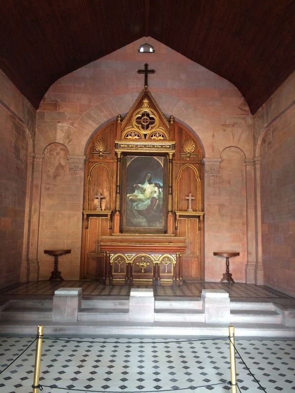
Este cerro solía ser un marcador solar y sitio de rituales prehispánicos. Después, en el siglo XVIII, la zona fue dividida en terrenos para varias haciendas al poniente de la ciudad. Es recordado por ser escenario de la ejecución del emperador Maximiliano de Habsburgo y los generales conservadores Miguel Miramón y Tomás Mejía el 19 de junio de 1867, marcando el fin del Sitio de Querétaro. En este parque nacional destacan la capilla de La Piedad (construida en memoria de Maximiliano por la Casa Real de Austria en 1901), el Monumento a Benito Juárez en la cima del cerro (obra del escultor Juan Olaguibel) y un espacion interactivo llamado Museo de la Magia del Pasado. Según la tradición oral, el nombre del cerro se debe al sonido metálico que producían algunas piedras de la zona al chocar o ser golpeadas unas con otra.
Hill of the Bells
This hill used to be a solar marker and site of Pre-Hispanic rituals. Afterwards, in the 18th century, the area was divided into land for several haciendas in the west of the city. It is remembered for being the site of the execution of Maximilian of Habsburg and the conservative generals Miguel Miramón and Tomás Mejía on June 19, 1867. This national park features the chapel of La Piedad (built in memory of Maximilian by the Royal House of Austria in 1901), the Benito Juárez Monument on the top of the hill (work by the sculptor Juan Olaguibel), and an interactive space called the Museum of the Magic of the Past. According to oral tradition, the hill is named for the metallic sound that some of the stones in the area produced when striking or being struck by each other.
Erected 2018 by Municipalidad de Querétaro.
Topics. This historical marker is listed in this topic list: Wars, Non-US. A significant historical date for this entry is June 19, 1867.
Location. 20° 35.602′ N, 100° 24.563′ W. Marker is in Santiago de Querétaro, Querétaro. Marker can be reached from Calle Cerro de las Campanas just west of Calle Justo Sierra, on the left when traveling north. The marker is on the right some few steps after entering Cerro de las Campanas Park, to the right of the Chapel of La Piedad. Touch for map. Marker is in this post office area: Santiago de Querétaro QUE 76010, Mexico. Touch for directions.
Other nearby markers. At least 8 other markers are within walking distance of this marker. The Chapel of La Piedad (a few steps from this marker); a different marker also named Hill of the Bells (within shouting distance of this marker); General Mariano Escobedo
(about 90 meters away, measured in a direct line); Founding of the Autonomous University of Querétaro (about 210 meters away); Site of the Surrender of Maximilian (approx. 0.3 kilometers away); The Children Heroes of the Battle of Chapultepec (approx. half a kilometer away); The Parish of Cristo Rey (approx. 0.7 kilometers away); Félix Nabor Osores de Sotomayor García (approx. 0.8 kilometers away). Touch for a list and map of all markers in Santiago de Querétaro.
Photographed By J. Makali Bruton, June 17, 2018
5. An additional Hill of the Bells Marker
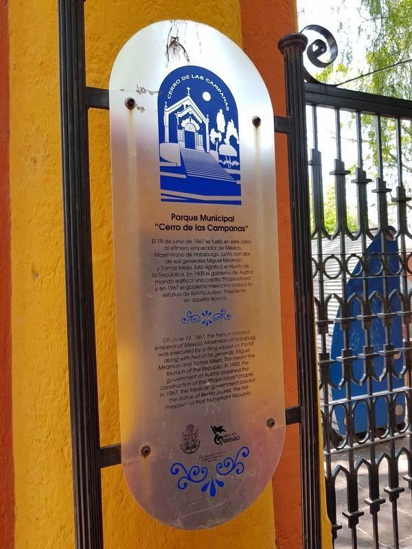
This additional, older marker is just to the left of the entrance to the Hill of the Bells park. It is hidden by the ticket booth and is hard to see. It reads:
Parque Municipal “Cerro de las Campanas”
El 19 de junio de 1867 se fusiló en este cerro al efímero emperador de México, Maximiliano de Habsburgo, junto con dos de sus generales Miguel Miramón y Tomás Mejía. Esto significó el triunfo de la República. En 1900 el gobierno de Austrio mandó edificar una capilla "Propiciatoria" y en 1967 el gobierno mexicano colocó la estatua de Benito Juárez, Presidente en aquella época.
English:
Municipal Park “Hill of the Bells”
On June 19, 1867, the French-installed emperor of Mexico, Maximilian of Habsburg, was executed by a firing squad on this hill along with two of his generals, Miguel Miramon and Tomas Mejia. This meant the triumph of the Republic. In 1900, the government of Austria ordained the construction of the Propiciatory" chapel. In 1967, the Mexican government placed the statue of Benito Juarez the first President of that triumphant Republic.
El 19 de junio de 1867 se fusiló en este cerro al efímero emperador de México, Maximiliano de Habsburgo, junto con dos de sus generales Miguel Miramón y Tomás Mejía. Esto significó el triunfo de la República. En 1900 el gobierno de Austrio mandó edificar una capilla "Propiciatoria" y en 1967 el gobierno mexicano colocó la estatua de Benito Juárez, Presidente en aquella época.
Municipal Park “Hill of the Bells”
On June 19, 1867, the French-installed emperor of Mexico, Maximilian of Habsburg, was executed by a firing squad on this hill along with two of his generals, Miguel Miramon and Tomas Mejia. This meant the triumph of the Republic. In 1900, the government of Austria ordained the construction of the Propiciatory" chapel. In 1967, the Mexican government placed the statue of Benito Juarez the first President of that triumphant Republic.
Credits. This page was last revised on June 10, 2020. It was originally submitted on July 9, 2018, by J. Makali Bruton of Accra, Ghana. This page has been viewed 143 times since then and 16 times this year. Photos: 1, 2, 3. submitted on July 9, 2018, by J. Makali Bruton of Accra, Ghana. 4, 5. submitted on July 10, 2018, by J. Makali Bruton of Accra, Ghana.
