Montrose in Montrose County, Colorado — The American Mountains (Southwest)
Preserving Our Heritage
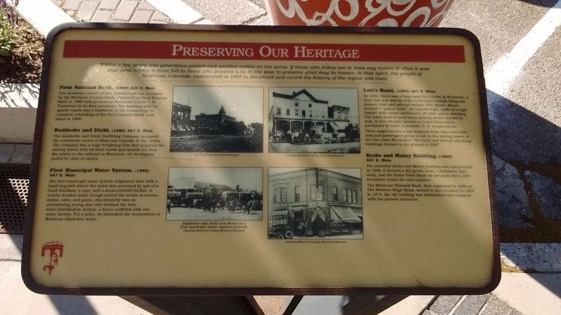
Within a few years, one generation passes and another comes on the scene. If those who follow are to have any notion of what it was that went before, it must fall to those who possess a tie to the past to preserve what may be known. In that spirit, the people of Montrose, Colorado, endeavored in 1997 to document and record the history of the region and town.
First National Bank (1889)
400 E. Main
The southeast corner of this intersection was occupied by the Montrose County Bank, chartered as First National Bank in 1889 with prominent Montrose citizen I.B. Townsend as its first president. The building with its spired cupola was a landmark in the community. A complete rebuilding of the First National Bank took place in 1968.
Buddecke and Diehl (1882)
347 E. Main
The Buddecke and Diehl Outfitting Company occupied the northwest corner of Main and Cascade in the 1880s. The company was a huge freighting firm that supplied the mining towns with all their needs and hauled ore from the mines to the railroad in Montrose, all via wagons pulled by oxen or mules.
First Municipal Water System (1882)
347 E. Main
The first municipal water system originated here with a hand-dug well where the water was accessed by use of a hand-windlass, a rope, and a moss-covered bucket. A nearby wooden water trough served the needs of horses, mules, oxen, and goats. Jim Donnelly was an enterprising young man who devised the first water-distribution system, a burro outfitted with two water barrels. For a price, he furnished the housewives of Montrose alkali-free water.
Lott's Hotel (1883)
401 E. Main
By 1883, there was a huge need for a hotel in Montrose, a need that was met by town co-founder Joseph Selig and pioneer road and railroad builder Otto Mears. Mears erected a "palace hotel" two stories high, made of rough lumber with rooms partitioned off with canvas sheeting. The lower level housed every gaming device known to man. It later became known as Lott's Hotel when purchased by town co-founder O.D. Loutsenhizer.
Three stagecoaches a day departed from this hotel with mail and passengers going south to the mining towns of the San Juan Mountains. The hotel and several adjoining buildings burned to the ground in 1897.
Krebs and Mabry Building (1898)
401 E. Main
The beautiful Krebs and Mabry Building was constructed in 1898. It housed a dry goods store, a millinery (hat) shop, and the Home State Bank on the main floor, with furnished rooms for rent upstairs.
The Montrose National Bank, first organized in 1898 as The Western Slope Bank, move to this location in 1922. In 1974, the old building was demolished and replaced with the present structure.
Topics and series. This historical marker is listed in these topic lists: Architecture • Notable Buildings. In addition, it is included in the Colorado - Montrose - Preserving Our Heritage series list.
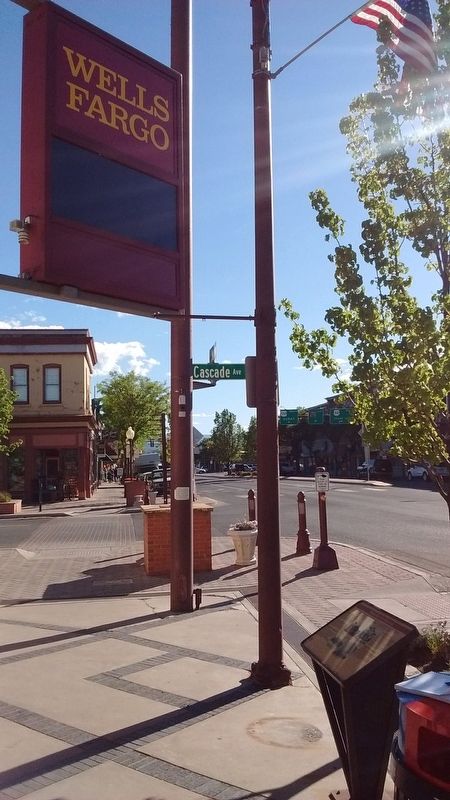
Location. 38° 28.783′ N, 107° 52.569′ W. Marker is in Montrose, Colorado, in Montrose County. Marker is on East Main Street, on the right when traveling north. Touch for map. Marker is in this post office area: Montrose CO 81401, United States of America. Touch for directions.
Other nearby markers. At least 8 other markers are within walking distance of this marker. A different marker also named Preserving Our Heritage (within shouting distance of this marker); What's in a Name? (within shouting distance of this marker); The Winds of Change (about 300 feet away, measured in a direct line); a different marker also named Preserving Our Heritage (about 300 feet away); a different marker also named Preserving Our Heritage (about 300 feet away); a different marker also named Preserving Our Heritage (about 400 feet away); a different marker also named Preserving Our Heritage (about 400 feet away); The Gunnison Tunnel (about 600 feet away). Touch for a list and map of all markers in Montrose.
Credits. This page was last revised on July 17, 2018. It was originally submitted on July 14, 2018, by Tom Bosse of Jefferson City, Tennessee. This page has been viewed 155 times since then and 12 times this year. Photos: 1, 2. submitted on July 14, 2018, by Tom Bosse of Jefferson City, Tennessee. • Syd Whittle was the editor who published this page.
Editor’s want-list for this marker. Photos of existing buildings mentioned in marker text. • Can you help?

