Roseville in Macomb County, Michigan — The American Midwest (Great Lakes)
A Plank Road History
Gratiot Avenue and "The Junction"
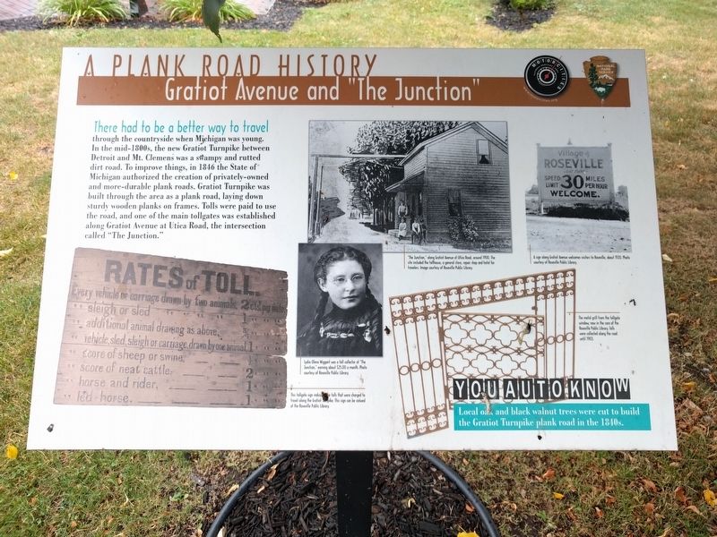
There had to be a better way to travel
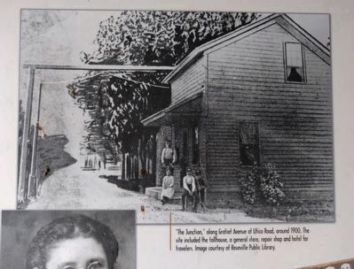
through the countryside when Michigan was young. In the mid-1800s, the new Gratiot Turnpike between Detroit and Mt. Clemens was a swampy and rutted dirt road. To improve things, in 1846 the State of Michigan authorized the creation of privately-owned and more-durable plank roads. Gratiot Turnpike was built through the area as a plank road, laying down sturdy wooden planks on frames. Tolls were paid to use the road, and one of the main tollgates was established along Gratiot Avenue at Utica Road, the intersection called "The Junction."
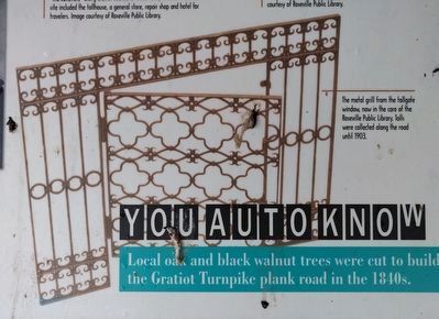
You Auto Know
Local oak and black walnut trees were cut to build the Gratiot Turnpike plank road in the 1840s.
Erected 2014 by MotorCities National Heritage Area, National Park Service.
Topics and series. This historical marker is listed in this topic list: Roads & Vehicles. In addition, it is included in the MotorCities National Heritage Area series list. A significant historical year for this entry is 1846.
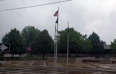
Location. 42° 30.968′ N, 82° 55.612′ W. Marker is in Roseville, Michigan, in Macomb County. Marker is at the intersection of VFW Memorial Drive and PFC Wetzel Drive, on the right when traveling east on VFW Memorial Drive. Marker is in front of Roseville City Hall. Touch for map. Marker is at or near this postal address: 29777 Gratiot Avenue, Roseville MI 48066, United States of America. Touch for directions.
Other nearby markers. At least 8 other markers are within 2 miles of this marker, measured as the crow flies. Rapid Railway Company (here, next to this marker); Packard Field in Roseville (here, next to this marker); Watching the Big Show (a few steps from this marker); Frenchy's Auto Parts (a few steps from this marker); Erin United Presbyterian Church (approx. ¼ mile away); Sacred Heart Church (approx. 0.9 miles away); The Baumgartner House 1875 (approx. 1.1 miles away); Baumgartner House (approx. 1.1 miles away). Touch for a list and map of all markers in Roseville.
Photographed By Joel Seewald, July 21, 2018
2. Left Images
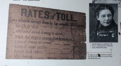
Left: This tollgate sign indicates the tolls that were charged to travel along the Gratiot Turnpike. This sign can be viewed at the Roseville Public Library. Right: Lydia Olena Wiggant was a toll collector at "The Junction," earning about $25.00 a month. Photo courtesy of Roseville Public Library.
Credits. This page was last revised on July 24, 2018. It was originally submitted on July 21, 2018, by Joel Seewald of Madison Heights, Michigan. This page has been viewed 993 times since then and 130 times this year. Photos: 1, 2, 3, 4, 5, 6. submitted on July 21, 2018, by Joel Seewald of Madison Heights, Michigan.
