Ilwaco in Pacific County, Washington — The American West (Northwest)
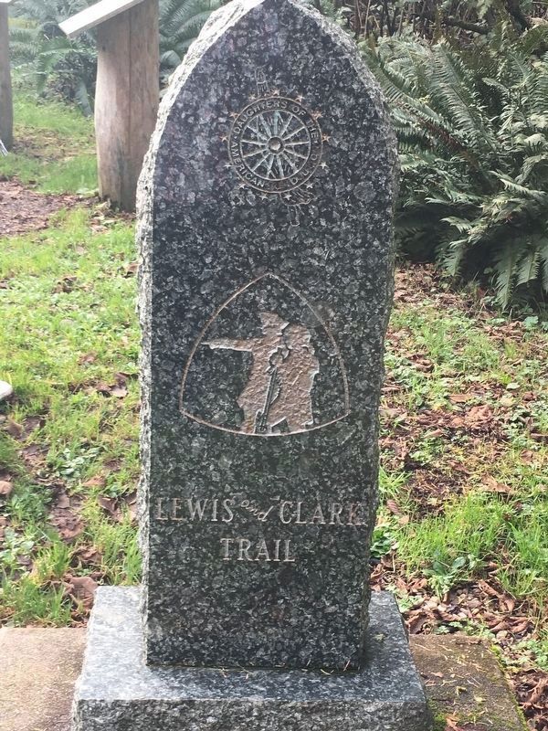
Lewis and Clark Trail
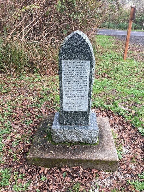
William Clark recorded in his
journal that on this date:
"I set out with 10 men and my man York to the ocian by land.... (later in the day) … I found Capt. Lewis name on a tree. I also engraved my name.... I crossed the neck of the land low and 1/2 of a mile wide to the main ocian. At the foot of a high open hill.... I ascended this hill which is covered with high corse grass. Descended to the N. of it and camped.”
The site of this marker is probably within a few hundred feet of campsite.
Erected 2000 by Washington State Society Daughters of the American Revolution.
Topics and series. This historical marker is listed in this topic list: Exploration. In addition, it is included in the Daughters of the American Revolution, and the Lewis & Clark Expedition series lists. A significant historical date for this entry is November 18, 1805.
Location. 46° 16.669′ N, 124° 3.222′ W. Marker is in Ilwaco, Washington, in Pacific County. Marker can be reached from Cape D Road when traveling south. Marker is located south of the parking lot at McKenzie Head in Cape Disappointment (formerly Ft Canby) State Park. Touch for map. Marker is in this post office area: Ilwaco WA 98624, United States of America. Touch for directions.
Other nearby markers. At least 8 other markers are within 7 miles of this marker, measured as the crow flies. Keeping Pace with Technology (within shouting distance of this marker); Fort Canby (within shouting distance of this marker); Cape Disappointment Lighthouse (approx. 0.2 miles away); Life of a Lighthouse Keeper (approx. 1.8 miles away); Clamshell Railroad Driving Tour (approx. 2.2 miles away); An Evolving Playground (approx. 2.3 miles away); A Disastrous Year (approx. 2.3 miles away); Battery Pratt (approx. 6.4 miles away in Oregon). Touch for a list and map of all markers in Ilwaco.
More about this marker. Nearby, along the trail, are found 8 interpretive panels.
Clark's Camp Nov 18, 1805 On the beach, north side of McKenzie Head. The campsite was a log-strewn beach, as evidenced by photographs taken in 1890, prior to construction of the North Jetty after which the resultant accretion and forestation obliterated the site. The area of McKenzie Head is now the location of a monument marker placed by the Daughters of the American Revolution (DAR) on November 1, 2000. The granite marker commemorates the only known campsite of Lewis and Clark on the Washington Coast. -- Pacific County Friends of Lewis & Clark Website, 2002
Regarding Lewis and Clark Trail. It is the most western campsite of the Lewis & Clark Expedition. This marker is the fourth in a series.
Excerpt from Lewis & Clark Trail Heritage Foundation WA Chapter Newsletter, January 2001 edition:
submitted by Leota “Lee” King: On October 21, 2000,
the fourth special marker on the Lewis and Clark trail in Washington was dedicated… Expecting rain, the City of Long Beach loaned a tent for the ceremonies, and Park Manager Larry Chapman and his staff borrowed chairs from a local church and helped in many other ways. About 60 or 70 people attended… This is the final marker in this project. The Daughters of the American Revolution are honored to have been able to place these markers along the trail made by those special people—Lewis and Clark, Sacagawea and little Pomp, York and the other hunters, boatment, soldiers and (let’s not forget) Seaman.
Credits. This page was last revised on July 25, 2018. It was originally submitted on July 25, 2018, by Shirley A Stirling of Lacey, Washington. This page has been viewed 233 times since then and 24 times this year. Photos: 1, 2. submitted on July 25, 2018, by Shirley A Stirling of Lacey, Washington. • Syd Whittle was the editor who published this page.
Editor’s want-list for this marker. Entering of the interpretive markers along the trail. • Can you help?

