Pluma in Lawrence County, South Dakota — The American Midwest (Upper Plains)
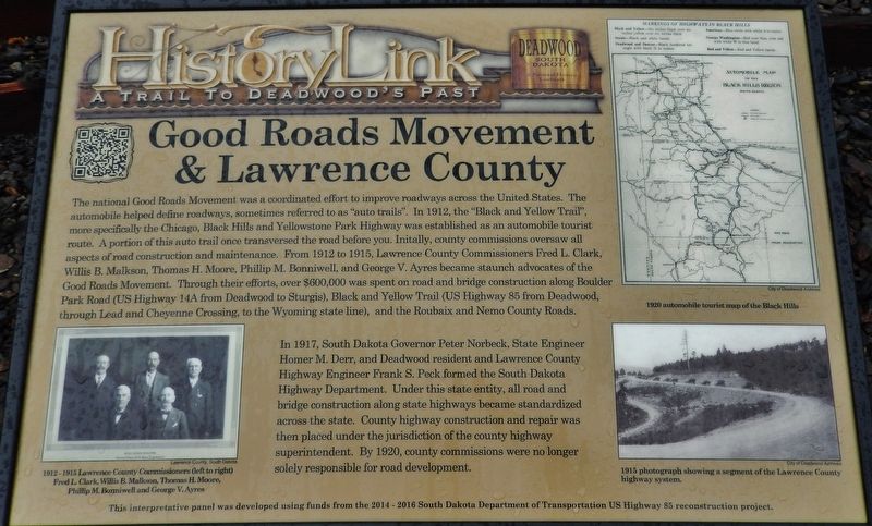
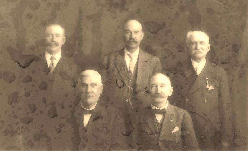
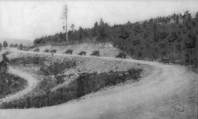
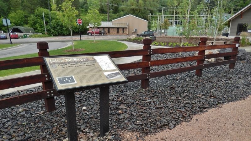
Good Roads Movement & Lawrence County
In 1917, South Dakota Governor Peter Norbeck, State Engineer Homer M. Derr, and Deadwood resident and Lawrence County Highway Engineer Frank S. Peck formed the South Dakota Highway Department. Under this state entity, all road and bridge construction along state highways became standardized across the state. County highway construction and repair was then placed under the jurisdiction of the county highway superintendent. By 1920, county commissions were no longer solely responsible for road development.
Erected by The Deadwood Historic Preservation Commission.
Topics. This historical marker is listed in these topic lists: Man-Made Features • Roads & Vehicles.
Location. 44° 21.578′ N, 103° 44.322′ W. Marker is in Pluma, South Dakota, in Lawrence County. Marker is on CanAm Highway (U.S. 85) north of U.S. 385, on the left when traveling north. Marker is located beside the Mickelson Trail, on the west side of the highway, near the Pluma, South Dakota Visitor Center, overlooking the parking lot. Touch for map. Marker is in this post office area: Deadwood SD 57732, United States of America. Touch for directions.
Other nearby markers. At least 8 other markers are within walking distance of this marker. Pluma: Right Place, Right Time (a few steps from this marker); Flooding & The Railroads (a few steps from this marker); George S. Mickelson Trail (within shouting distance of this marker); Pluma's Power Plants (within shouting distance of this marker); Cheyenne & Deadwood Stage Route (within shouting distance of this marker); Rev. L.R.S. Ferguson Ski & Sled Area (approx. 0.8 miles away); Cleveland (approx. 0.8 miles away); Partners in Land Preservation (approx. 0.8 miles away). Touch for a list and map of all markers in Pluma.
More about this marker. Marker is a large composite plaque, mounted horizontally on two waist-high posts.
Also see . . .
1. U.S. 14 Chicago, Illinois, to Yellowstone National Park. In 1925, at the request of the State highway agencies, the Secretary of Agriculture appointed the Joint Board on Interstate Highways to develop a plan for marking the Nation's interstate highways. The Joint Board, which included 21 State highway officials and three officials of the U.S. Bureau of Public Roads, met with State road officials around the country, developed standardized signs, including the original U.S. shield, identified the Nation's main interstate roads, and conceived a system for numbering them. The Joint Board completed its report on the new marking system in October 1925. Within the proposed grid of U.S. routes, the report identified U.S. 14. The original description of the route read: From Winona, Minnesota, to New Ulm, Brookings, South
Dakota, Huron, Pierre, Midland.
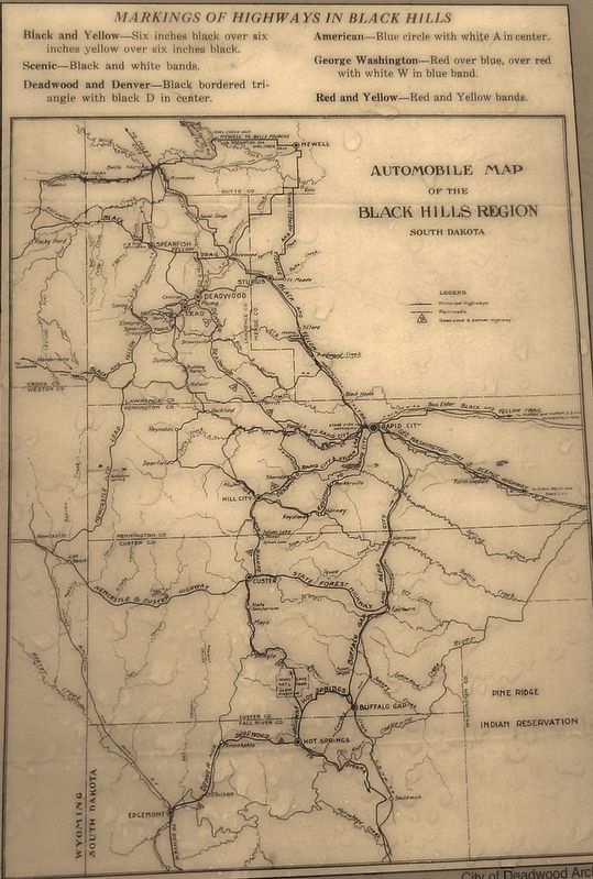
Much of proposed U.S. 14 (Winona to Pierre) was also known as the Black and Yellow Trail, a named trail from Chicago, Illinois, to Yellowstone National Park. (Submitted on August 5, 2018, by Cosmos Mariner of Cape Canaveral, Florida.)
2. Peter Norbeck (1870-1936). Peter Norbeck was governor and U.S. senator from South Dakota and a pivotal figure in South Dakota politics in the early twentieth century. After attending the University of South Dakota, Norbeck invented an improved method of drilling wells to extract water from aquifers. He and his partner, Oscar Nicholson, established a well-drilling business in Redfield, South Dakota. The business prospered in the drought-stricken Great Plains, and Norbeck became wealthy. Inspired by the progressive Republicanism of Theodore Roosevelt, Norbeck entered politics. He was elected to the South Dakota Senate in 1908 and served three two-year terms. He was elected lieutenant governor in 1914 and governor in 1916 and 1918. (Submitted on August 5, 2018, by Cosmos Mariner of Cape Canaveral, Florida.)
Credits. This page was last revised on August 6, 2018. It was originally submitted on August 4, 2018, by Cosmos Mariner of Cape Canaveral, Florida. This page has been viewed 239 times since then and 26 times this year. Photos: 1. submitted on August 4, 2018, by Cosmos Mariner of Cape Canaveral, Florida. 2, 3, 4, 5. submitted on August 5, 2018, by Cosmos Mariner of Cape Canaveral, Florida. • Bill Pfingsten was the editor who published this page.
