Kooskia in Idaho County, Idaho — The American West (Mountains)
History of a Frontier Community

Photographed By Barry Swackhamer, May 5, 2018
1. History of a Frontier Community Marker
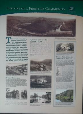
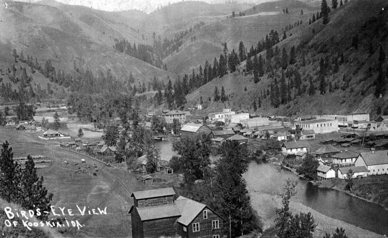
Captions: (top) This early 1900s view shows the town separated by Mount Stuart. The area to the right of the photo shows the confluence of the Clearwater River's South Fork and Middle Fork as well as the depot and train tracks. The green star indicates where you are standing today.; (middle left) A packstring winding down Main Street was a common spectacle in the early 1900s.; (bottom left) James Stuart is shown above left with his trusted horse Chechopath, and above right posing with his wife in these turn-of-the-century photos.; (center row, top to bottom) Early 1900s Kooskia flour mill was built on the west bank of the South Fork Clearwater River near the base of Mount Stuart. There was a tram from the mill to the Camas Prairie gran fields from 1909 to 1939. The tramway carried 30 buckets on two cables running the entire length of the 1.25 miles.; January 3, 1913 Within a four-hour period and pushed by a brisk wind, fire raged through Kooskia's business district. It was thought the fires started in the pool hall and engulfed the town's other wooden structures Very few buildings survived the fire.; May 22, 1948 Kooskia was flooded when the South Fork Clearwater River overflowed its banks. A week later, the Middle Fork swept over its banks. Soon thereafter, levies were built to secure protection from high water.; (side bar on right) Bitterroot Forest Reserve employees pose in front of the Kooskia headquarters in May 1907. Today the building, at the northwest corner of Front Street and A Avenue is a residence.
As a flurry of land claims were filed within the reservation boundaries, 104 acres at the confluence of the Middle Fork and South Forks of the Clearwater River were set aside for the townsite. Soon after, in 1897, the town of Stuart was surveyed. Its namesake, James Stuart, was a prominent Nez Perce Indian who was an accomplished surveyor, furniture store merchant, Forest Service ranger, and a member of the town's first Board of Trustees.
In 1900, a railroad line was laid through the town. The depot was called Kooskia as the name of Stuart was already in use on the rail line. The town officially changed its name to Kooskia in April 1902.
Over time, the name of Koos-koos-kee was thought to be a Nez Perce word meaning clear water. However, P.B. Whitman, an interpreter and teacher for the Office of Indian Affairs Nez Perce Agency in the 1870s, noted some confusion when the Nez Perce tried to explain to Lewis and Clark that there were two large streams running through their country. The smaller of the two streams was the one they saw, and the other larger one was called the Snake. The Nez Perce repeated the words Koots-koots-kee and pointed to the smaller visible stream meaning "this is the smaller" from which Lewis and Clark inferred that this was its Indian name.
Kaih-kaih-koosh is the correct Nez Perce word describing clear water.
(side-bar on right:)
Kooskia has been a "Forest Service community" since the early Bitterroot Forest Reserve was designated in 1897. At some point, many residents and their relatives have worked for the Forest Service in the rugged demanding landscape between here and the Montana border.
Probably the most notable figure in the area's fledging Forest Service was the accomplished Frank Fenn whose varies career included naval cadet, farmer, teacher, county deputy, legislator, attorney, infantry volunteer, and forest supervisor. In addition to active service during the 1877 Nez Perce conflict, Fenn served in the Idaho First Volunteer Infantry during the Spanish-American War in the Philippines. He returned to Idaho after attaining the rank of major, began a career in the forest reserve system, and soon became the Idaho superintendent.
In 1907, when forest reserves became national forests, Major Fenn served as Clearwater National Forest's first supervisor. His distinguished career spanned over 20 years and several landmarks bear his name. He died in 1927 and was buried in Kooskia's Pine Grove Cemetery.
Erected by City of Kooskia.
Topics. This historical marker is listed in this topic list: Settlements & Settlers.
Location. 46° 8.352′ N, 115° 58.716′ W. Marker is in Kooskia, Idaho, in Idaho County. Marker is at the intersection of Main Street and First Street, on the left when traveling north on Main Street. Touch for map. Marker is at or near this postal address: 15 Main Street, Kooskia ID 83539, United States of America. Touch for directions.
Other nearby markers. At least 8 other markers are within 6 miles of this marker, measured as the crow flies. Kooskia Crossing Kiosk (approx. 0.6 miles away); Looking Glass (approx. 1.2 miles away); Nez Perce War (approx. 4.4 miles away); Trails at Heart of the Monster (approx. 5.1 miles away); Nez Perce National Historical Park (approx. 5.1 miles away); Long Camp (approx. 5.9 miles away); Asa Smith Mission (approx. 5.9 miles away); Lewis and Clark Route (approx. 6 miles away). Touch for a list and map of all markers in Kooskia.
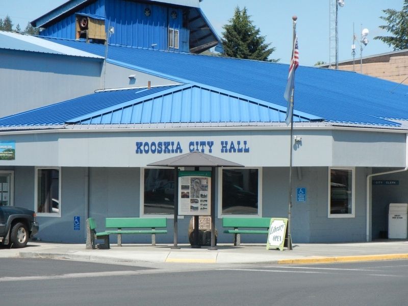
More about this marker. This marker is located in front of Kooskia City Hall.
Also see . . . A Brief History of Kooskia, Idaho -- City of Kooskia. Kooskia (pronounced Koos-kee) lies on an elevated plain at the confluence of the Middle Fork of the Clearwater River, as it fows from the east, and the South Fork of the Clearwater as they merge to form the main Clearwater River. The forks of the rivers and the city wrap around a hogback extension of Mount Stewart. (Submitted on August 8, 2018, by Barry Swackhamer of Brentwood, California.)
Credits. This page was last revised on August 8, 2018. It was originally submitted on August 8, 2018, by Barry Swackhamer of Brentwood, California. This page has been viewed 289 times since then and 31 times this year. Photos: 1, 2, 3. submitted on August 8, 2018, by Barry Swackhamer of Brentwood, California.

