St. Simons Island in Glynn County, Georgia — The American South (South Atlantic)
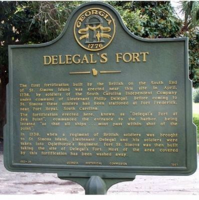
Delegal's Fort
The first fortification built by the British on the South End of St. Simons Island was erected near this site in April, 1736, by soldiers of the South Carolina Independent Company under the command of Lieutenant Philip Delegal. Before coming to St. Simons these soldiers had been stationed at Fort Frederica near Port Royal, South Carolina.
The fortification erected here, known as "Delegal's Fort at Sea Point", commanded the entrance to the harbor, being located "so that all ships... must pass within shot of the point".
In 1738, when a regiment of British soldiers was brought to St. Simons Island, Lieutenant Delegal and his soldiers were taken into Oglethorpe`s Regiment. Fort St. Simons was then built taking the site of Delegal's Fort. Most of the area covered by the fortification has been washed away.
Erected 1961 by Georgia Historical Commission. (Marker Number 063-39.)
Topics and series. This historical marker is listed in these topic lists: Forts and Castles • Military • War, US Revolutionary. In addition, it is included in the Georgia Historical Society series list. A significant historical month for this entry is April 1736.
Location. 31° 8.13′ N, 81° 23.283′ W. Marker is on St. Simons Island, Georgia, in Glynn County. Marker is at the intersection of Ocean Blvd and 8th St, on the right when traveling north on Ocean Blvd. Touch for map. Marker is in this post office area: Saint Simons Island GA 31522, United States of America. Touch for directions.
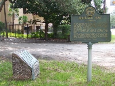
Other nearby markers. At least 8 other markers are within walking distance of this marker. Fort Saint Simons (here, next to this marker); Old Spanish Garden (about 700 feet away, measured in a direct line); Welcome to St. Simons Light! (approx. 0.3 miles away); Couper's Point (approx. 0.3 miles away); Fort St. Simons (approx. 0.3 miles away); Keepers of the Light (approx. 0.3 miles away); a different marker also named Fort St. Simons (approx. 0.3 miles away); Historic St. Simons Lighthouse (approx. 0.3 miles away). Touch for a list and map of all markers in St. Simons Island.
Credits. This page was last revised on November 23, 2020. It was originally submitted on October 6, 2008, by Mike Stroud of Bluffton, South Carolina. This page has been viewed 1,838 times since then and 71 times this year. Photos: 1, 2. submitted on October 6, 2008, by Mike Stroud of Bluffton, South Carolina. • Bill Pfingsten was the editor who published this page.

