Laurinburg in Scotland County, North Carolina — The American South (South Atlantic)
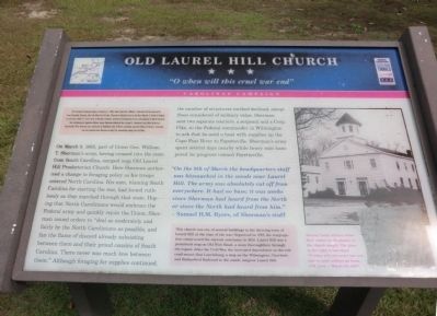
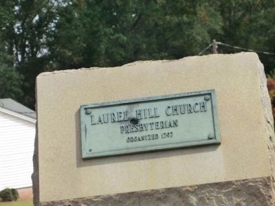
Old Laurel Hill Church
"O when will this cruel war end"
— Carolina Campaign —
The Carolina Campaign began on February 1, 1865, when Union Gen. William T. Sherman led his army north from Savannah, Georgia, after the March to the Sea. Sherman’s objective was to join with Gen. Ulysses S. Grant in Virginia to crush Robert E. Lee’s Army of Northern Virginia. Scattered Confederate forces consolidated in North Carolina, the Confederacy’s logistical lifeline, where Sherman defeated Gen. Joseph E. Johnston’s last-ditch attack at Bentonville. After Sherman was reinforced at Goldsboro late in March, Johnston saw the futility of further resistance and surrendered near Durham on April 26, essentially ending the Civil War.
(main text)
On March 8, 1865, part of Union Gen. William T. Sherman’s army, having crossed into the state from South Carolina, camped near Old Laurel Hill Presbyterian Church. Here Sherman authorized a change in foraging policy as his troops entered North Carolina. His men, blaming South Carolina for starting the war, had looted ruthlessly as they marched through the state. Hoping that North Carolinians would embrace the Federal army and quickly rejoin the Union, Sherman issued orders to “deal as moderately and fairly by the North Carolinians as possible, and fan the flame of discord already subsisting between them and their proud cousins of South Carolina. There never was much love between them.” Although foraging for supplies continued, the number of structures torched declined, except those considered of military value. Sherman sent two separate couriers, a sergeant and a Corp. Pike, to the Federal commander in Wilmington to ask that he send a boat with supplies up the Cape Fear River to Fayetteville. Sherman’s army spent several days nearby while heavy rain hampered its progress toward Fayetteville.
“On the 8th of March the headquarters staff was bivouacked in the woods near Laurel Hill. The army was absolutely cut off from everywhere. It had no base; it was weeks since Sherman had heard from the North or since the North had heard from him.” –Samuel H.M. Byers, of Sherman’s staff
(sidebar)
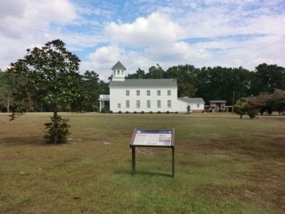
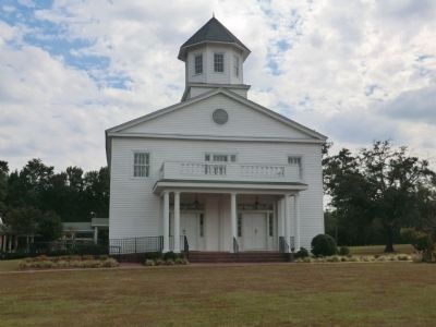
This church was one of several buildings in the thriving town of Laurel Hill at the time of the war. Organized in 1797, the congregation constructed the current sanctuary in 1856. Laurel Hill was a prominent stop on Old Wire Road, a main thoroughfare through the region. After the Civil War, the increased dependence on the railroad meant that Laurinburg, a stop on the Wilmington, Charlotte and Rutherford Railroad to the south, outgrew Laurel Hill.
(caption)
(right) Several Union soldiers wrote their names in the plaster of the church steeple. The piece to the right is inscribed; “O when will this cruel war end and we poor soldiers go home. J.M. Leca … March 9th 1865”
Erected by North Carolina Civil War Trails. (Marker Number 310.)
Topics and series. This historical marker is listed in these topic lists: Churches & Religion • War, US Civil. In addition, it is included in the American Presbyterian and Reformed Historic Sites, and the North Carolina Civil War Trails series lists. A significant historical month for this entry is February 1796.
Location. 34° 49.914′ N, 79° 27.936′ W. Marker is in Laurinburg, North Carolina, in Scotland County. Marker is at the intersection of McFarland Road and Laurel Hill Church Road, on the right when traveling west on McFarland Road. Touch for map. Marker is at or near this postal address: 15301 McFarland Road, Laurinburg NC 28352, United States of America. Touch for directions.
Other nearby markers. At least 8 other markers are within 4 miles of this marker, measured as the crow flies. Sherman's March (approx. 0.7 miles away); Laurinburg Institute (approx. 3.4 miles away); Original Richmond Cotton Mill (approx. 3.7 miles away); Murdoch Morrison Gun Factory (approx. 3.7 miles away); Murdoch Morrison (approx. 3.7 miles away); Our Confederate Heroes (approx. 3.9 miles away); Quackenbush (approx. 3.9 miles away); Scotland County Veterans Memorial (approx. 3.9 miles away). Touch for a list and map of all markers in Laurinburg.
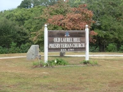
Regarding Old Laurel Hill Church. Laurel Hill Presbyterian Church was listed in the National Register of Historic Places in 1983. This church is also one of 445 American Presbyterian and Reformed Historical Sites registered between 1973 and 2003 by the Presbyterian Historical Society (PHS), headquartered in Philadelphia. Approved sites received a metal plaque featuring John Calvin’s seal and the site’s registry number (PHS marker location unknown).
The following text is taken from the Presbyterian Historical Society website:
Organized in 1797, Laurel Hill Presbyterian Church is the oldest Presbyterian congregation in Scotland County. The congregation has been the "mother church" of at least eight other congregations in the region. The present building, the third structure on land donated by Hon. Duncan McFarland, was erected in 1856 by local craftsmen. The dome that once graced the cupola has been replaced by the present octagonal spire, pews removed by Federal troops were restored, and the slave gallery was demolished. The church is now the oldest church building still in use in Scotland County and remains an important example of American vernacular Greek Revival church architecture. It was listed on the National Register of Historic Places in 1983.
Credits. This page was last revised on September 7, 2018. It was originally submitted on November 21, 2013, by Don Morfe of Baltimore, Maryland. This page has been viewed 940 times since then and 50 times this year. Last updated on August 18, 2018, by Douglass Halvorsen of Klamath Falls, Oregon. Photos: 1, 2, 3, 4, 5. submitted on November 21, 2013, by Don Morfe of Baltimore, Maryland. • Bill Pfingsten was the editor who published this page.
