Near Affton in St. Louis County, Missouri — The American Midwest (Upper Plains)
Working Plantation / ~150 Years Ago - Emancipation
Working Plantation (left panel)
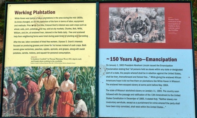
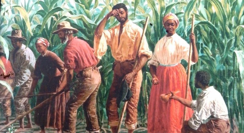
White Haven was typical of slave plantations in the area during the mid-1800s. As times changed, so did the operation of the farm in terms of labor, equipment and methods. Prior to the Civil War, Colonel Dent's interest was cash crops such as wheat, oats, corn, potatoes, and hay, sold at city markets. Charles, Bob, Willis, William, and Jim, all enslaved men, labored in the fields daily. Free and enslaved help from neighboring farms were hired during peak times of planting and harvesting.
After the war, labor consisted of hired free workers. Ulysses S. Grant's interests focused on producing grasses and clover for his horses instead of cash crops. Both owners grew nectarines, peaches, apples, apricots, and grapes, along with sweet potatoes, carrots, melons, and squash for personal consumption.
150 Years Ago - Emancipation (right panel)
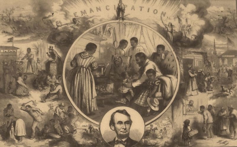
On January 1, 1863 President Abraham Lincoln issued the Emancipation Proclamation stating that “all persons held as slaves within any state or designated part of a state, the people whereof shall be in rebellion against the United States, shall be then, thenceforward and forever free…” While giving the enslaved African Americans hope it did not free them on plantations like White Haven in Missouri. The enslaved here escaped slavery at some point before May 1864.
The state of Missouri abolished slavery on January 11, 1865. The country soon followed with the passage and ratification of the 13th Amendment to the United States Constitution in December of 1865. It stated that, “Neither slavery nor involuntary servitude, except as a punishment for crime whereof the party shall have been duly convicted, shall exist within the United States...”
Erected by Ulysses S. Grant National Historic Site.
Topics and series. This historical marker is listed in these topic lists: African Americans • War, US Civil. In addition, it is included in the Former U.S. Presidents: #18 Ulysses S. Grant series list. A significant historical date for this entry is January 1, 1863.
Location. 38° 33.099′ N, 90° 21.124′ W. Marker is near Affton, Missouri, in St. Louis County. Marker can be reached from Grant Road, 0.3 miles north of Gravois Road (U.S. 30), on the right when traveling north. Marker is located on the grounds of the Ulysses S. Grant National Historic Site, along the walking path, and overlooking the woods on the west side of the complex. Touch for map. Marker is at or near this postal address: 7400 Grant Road, Saint Louis MO 63123, United States of America. Touch for directions.
Other nearby markers. At least 8 other markers are within walking distance of this marker. Changes at White Haven / ~150 Years Ago - Grants Horses (within shouting distance
of this marker); Grant's Departure / ~150 Years Ago (within shouting distance of this marker); A Slave Plantation (within shouting distance of this marker); Green Haven? (within shouting distance of this marker); White Haven's Outbuildings (within shouting distance of this marker); Early Owners of the Farm (within shouting distance of this marker); New Buildings for White Haven (within shouting distance of this marker); Slaves Only (within shouting distance of this marker). Touch for a list and map of all markers in Affton.
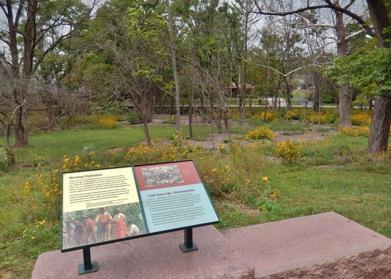
More about this marker. Marker is a large composite plaque, mounted horizontally, at waist-level, on short posts, atop a stone pedestal.
Also see . . . Emancipation Proclamation. Before the start of the American Civil War, many people and leaders of the North had been primarily concerned merely with stopping the extension of slavery into western territories that would eventually achieve statehood within the Union. With the secession of the Southern states and the consequent start of the
Civil War, however, the continued tolerance of Southern slavery by Northerners seemed no longer to serve any constructive political purpose. Emancipation thus quickly changed from a distant possibility to an imminent and feasible eventuality. Lincoln had declared that he meant to save the Union as best he could—by preserving slavery, by destroying it, or by destroying part and preserving part. Just after the Battle of Antietam (September 17, 1862) he issued his proclamation calling on the revolted states to return to their allegiance before the next year, otherwise their slaves would be declared free men. No state returned, and the threatened declaration was issued on January 1, 1863. (Submitted on August 26, 2018, by Cosmos Mariner of Cape Canaveral, Florida.)
Credits. This page was last revised on April 24, 2020. It was originally submitted on August 24, 2018, by Cosmos Mariner of Cape Canaveral, Florida. This page has been viewed 248 times since then and 13 times this year. Photos: 1, 2, 3, 4. submitted on August 26, 2018, by Cosmos Mariner of Cape Canaveral, Florida. • Bill Pfingsten was the editor who published this page.


