Providence Township near New Providence in Lancaster County, Pennsylvania — The American Northeast (Mid-Atlantic)
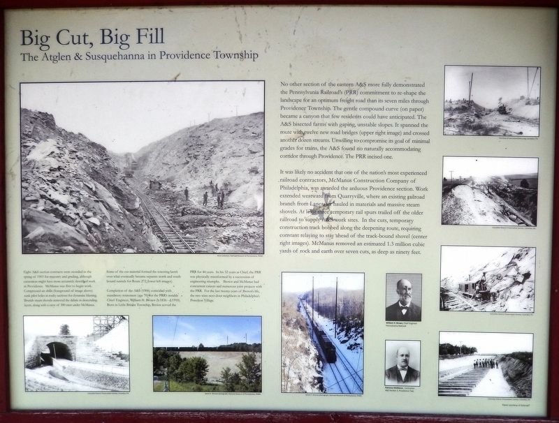
Big Cut, Big Fill
The Atglen & Susquehanna in Providence Township
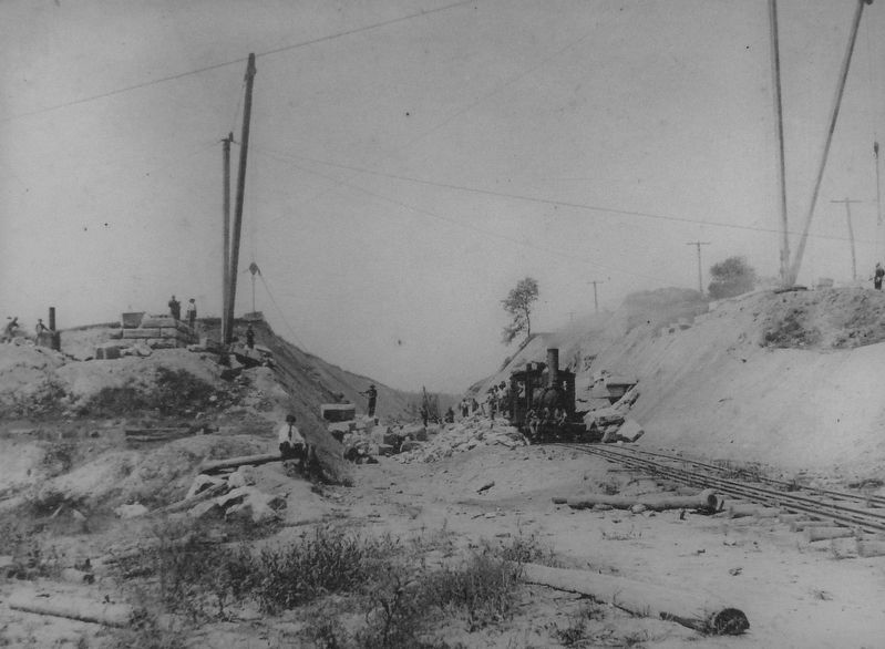
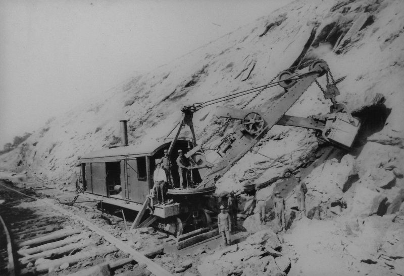
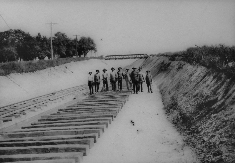
It was likely no accident that one of the nation's most experienced railroad contractors, McManus Construction Company of Philadelphia, was awarded the arduous Providence section. Work extended westward from Quarryville, where an existing railroad branch from Lancaster hauled in materials and massive steam shovels. At least three temporary rail spurs trailed off the older railroad to supply A&S work sites. In the cuts, temporary construction track bobbed along the deepening route, requiring constant relaying to stay ahead of the track-bound shovel (center right images). McManus removed an estimated 1.3 million cubic yards of rock and earth over seven cuts, as deep as ninety feet.
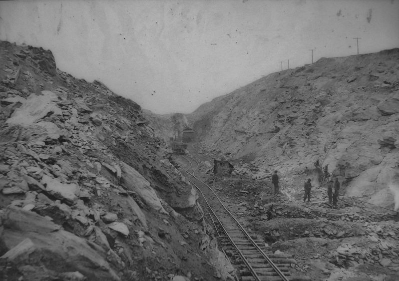
Eight A&S section contracts were awarded in the spring of 1903 for masonry and grading, although excavation might have more accurately described work in Providence. McManus was first to begin work. Compressed air drills (foreground of image above) sunk pilot holes in rocky sections for dynamite blasting. Brutish steam shovels removed the debris in descending layers, along with a crew of 300 men under McManus.
Some of the cut material formed the towering berm over what eventually became separate north and south bound tunnels for Route 272 (lower left images).
Completion of the A&S (1906) coincided with mandatory retirement (age 70) for the PRR's notable Chief Engineer, William H. Brown (b.1836 - d.1910). Born in Little Britain Township, Brown served the PRR for 44 years. In his 32 years as Chief, the PRR was physically transformed by a succession of engineering triumphs. Brown and McManus had concurrent careers and numerous joint projects with the PRR. For the last twenty years of Brown's life, the two were next-door neighbors in Philadelphia's Powelton Village.
Erected by Amtrak.
Topics and series. This historical marker is listed in these topic lists: Industry & Commerce • Railroads & Streetcars. In addition, it is included in the Pennsylvania Railroad (PRR) series list. A significant historical year for this entry is 1903.
Location.
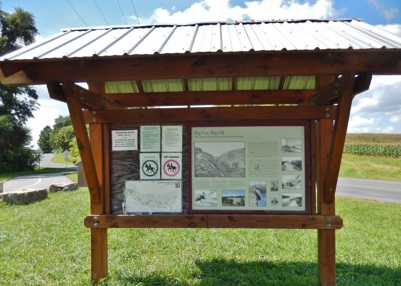
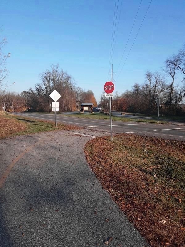
39° 53.928′ N, 76° 11.136′ W. Marker is near New Providence, Pennsylvania, in Lancaster County. It is in Providence Township. Marker is on Fairview Road, 0.3 miles west of Beaver Valley Pike (U.S. 222), on the left when traveling west. Marker is located within the trailhead kiosk, at the west end of the New Providence parking lot for access to the Enola Low Grade Trail. If traveling west on Fairview Road, the kiosk is reached before the trail itself. Touch for map. Marker is in this post office area: New Providence PA 17560, United States of America. Touch for directions.
Other nearby markers. At least 8 other markers are within 6 miles of this marker, measured as the crow flies. Quarryville (approx. 0.7 miles away); The Atglen & Susquehanna Low Grade (approx. 4.2 miles away); A Job on the A & S (approx. 4.2 miles away); Refton (approx. 4.7 miles away); Drumore Township Illustrious Americans (approx. 4.7 miles away); Lime Valley Bridge (1871) (approx. 5 miles away); Drumore Township Service Rolls (approx. 5.4 miles away); Jackson's Mill Bridge (1878) (approx. 5.6 miles away).
More about this marker. This is a large, "billboard-style" marker, mounted on the east-facing side of the trailhead kiosk for the Enola Low Grade Rail Trail.
Related markers. Click here for a list of markers that are related to this marker. The Atglen & Susquehanna Low Grade
Also see . . . The Engineer And the Contractor. BY 1903 William H. Brown, the man who earned the nickname the stone man for his preference of masonry bridge construction was winding down a rewarding 44-year career with the Pennsylvania Railroad, 32 of which he served as Chief Engineer. Brown's tenure was part of an era that was arguably one of the most transformative times for the PRR's infrastructure and right of way. His role in the construction of the Low Grade, especially the Atglen & Susquehanna segment would be his last major project before reaching the mandatory retirement age of 70. Brown had come full circle in life having been born and raised in the same rolling countryside of Southern Lancaster County where he'd close out an impressive career. (Submitted on September 1, 2018, by Cosmos Mariner of Cape Canaveral, Florida.)
Credits. This page was last revised on February 7, 2023. It was originally submitted on August 30, 2018. This page has been viewed 291 times since then and 26 times this year. Last updated on November 25, 2020. Photos: 1, 2, 3, 4, 5, 6. submitted on September 1, 2018, by Cosmos Mariner of Cape Canaveral, Florida. 7, 8. submitted on November 15, 2020, by Carl Gordon Moore Jr. of North East, Maryland. • J. Makali Bruton was the editor who published this page.
