Manhattan in Riley County, Kansas — The American Midwest (Upper Plains)
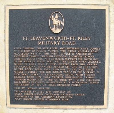
Ft. Leavenworth - Ft. Riley Military Road
Inscription.
After crossing the Blue River and entering Riley County at the foot of Poyntz Avenue, "The Great Military Road" proceeded west to this point, where it angled off southwest passing through Theodore Roosevelt School grounds, Longs Park, and squeezed between the south end of the ridge in Sunset Park and the Kansas River channel, where Ft. Riley Blvd. is now located. From this marker, two additional branches angled off, one to the north to the Rocky Ford area, and one to the northwest where it joined "The Old Indian Trail" in the vicinity of Cico Park. Albert D. Richardson, along with Horace Greeley, both New York Tribune journalists, passing through Manhattan in 1859 on their way to the Colorado gold fields, described Manhattan as "a flourishing Yankee settlement of two or three hundred people."
Text by Morris Werner
Erected 2009 by Polly Ogden Chapter D.A.R., Travis Matteson Family, Commerce Bank, and Bayer Construction Co.
Topics and series. This historical marker is listed in these topic lists: Forts and Castles • Roads & Vehicles. In addition, it is included in the Daughters of the American Revolution series list. A significant historical year for this entry is 1859.
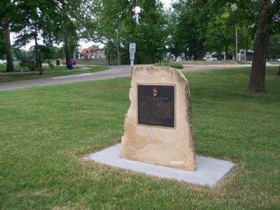
Location. 39° 10.779′ N, 96° 34.487′ W. Marker is in Manhattan, Kansas
Other nearby markers. At least 8 other markers are within walking distance of this marker. Civil War Memorial (about 600 feet away, measured in a direct line); Spanish American War Veterans Memorial (about 600 feet away); Harahey (about 700 feet away); Dobřichovice, Czech Republic • Manhattan, Kansas (approx. 0.2 miles away); Carnegie Library (approx. 0.6 miles away); Riley County Courthouse (approx. 0.6 miles away); Amanda Arnold Arch (approx. 0.6 miles away); World War II Memorial (approx. 0.6 miles away). Touch for a list and map of all markers in Manhattan.
Related markers. Click here for a list of markers that are related to this marker. Fort Leavenworth - Fort Riley Military Road
Also see . . . History of Frontier Trails in Kansas. Legends of America website entry (Submitted on February 14, 2015, by William Fischer, Jr. of Scranton, Pennsylvania.)
Credits. This page was last revised on February 1, 2022. It was originally submitted on February 14, 2015, by William Fischer, Jr. of Scranton, Pennsylvania. This page has been viewed 645 times since then and 14 times this year. Last updated on September 4, 2018, by Cosmos Mariner of Cape Canaveral, Florida. Photos: 1, 2. submitted on February 14, 2015, by William Fischer, Jr. of Scranton, Pennsylvania. • Andrew Ruppenstein was the editor who published this page.

