Near Saltese in Mineral County, Montana — The American West (Mountains)
A wonderful Piece of Engineering: The Mullan Road
Inscription.
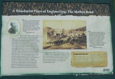
"Our work ... from the 16th of August to the 4th of December, 1859 consisted of cutting through this densely timbered section of one hundred miles, building small bridge were required, and grading thousands of places.... the work was heavy, and ... justice cannot be done to the industry and fortitude of the men while mastering this wilderness sections." -- John Mullan, 1863
In July 1859, Lieutenant John Mullan and 230 workers, soldiers, and teamsters began construction on a 624-mile wagon road from Walla Walla, Washington through the Rocky Mountains to Fort Benton, the head of steamboat navigation on the upper Missouri River in Montana. The topography between Lake Coeur d'Alene and the Missoula Valley was a tangle of towering mountains, serpentine rivers, steep rugged hillsides, low swampy areas, deep ravines, and fallen timbers. Mullan's men constructed 47 bridges across the St. Regis-DeBorgia River between base St. Regis Pass and its confluence with the Clark Fork 28 miles east of here. The road, although primitive, was a triumph of engineering and a tribute to Mullan's engineering ability and his optimism about the future of the Pacific Northwest and Montana. Originally intended as a military road, it was only used in that capacity once, instead parts of it became important emigrant and freight roads in western and central Montana. Unfortunately, the Mullan Road west of Missoula was not heavily used by pioneers because of the difficult terrain. Indeed, within a couple of years after its completion, most of the bridges had washed out and timber and landslides had blocked portions of the road. By the 1870s, the Mullan Road through this area was little more than a pack trail. The road still exists in places through here, high on mountainsides overlooking Interstate 90.
"We started out as early as possible, as we fully realized that for many miles the road ahead of us was mountainous and rough beyond anything yet traversed. The scenery was the wildest ever gaze upon, and grand, if as feeble a world as that can be used to properly express anything in this amazing range of mountains. Up, up, still up we went winding over a trail made barely passable ... wrenching and jolting the wagons terribly, and causing the poor mules infinite misery." -- Randall Hewett, 1862
(sidebar)
A Plague Spot of Vice: Taft
In 1908, the Chicago, Milwaukee, St. Paul & Pacific (Milwaukee Road) Railroad completed its west coast extension along the Clark Fork to Seattle. The railroad camp of Taft was located near here. Founded in 1907, it became the center of operations for the construction of the railroad's 8,750-foot tunnel through the Bitterroot Divide at
St. Paul's Pass. For a little over a year 2,000 men worked day and night boring the tunnel through the mountains. Taft was a wide open town with 27 saloons, gambling halls, and brothels ready to separate the men from their hard-earned pay. In 1909, the Chicago Tribune called Taft the "wickedest city in America." The tunnel completed, the men moved on, leaving the town all but deserted. Most of the town was destroyed in the 1910 forest fire and the rest buried beneath I-90 in 1962.
Erected by Montana Department of Transportation.
Topics. This historical marker is listed in these topic lists: Roads & Vehicles • Settlements & Settlers. A significant historical month for this entry is July 1859.
Location. 47° 25.17′ N, 115° 37.722′ W. Marker is near Saltese, Montana, in Mineral County. Marker is on Interstate 90 at milepost 4, on the right when traveling east. Touch for map. Marker is in this post office area: Saltese MT 59867, United States of America. Touch for directions.
Other nearby markers. At least 8 other markers are within 2 miles of this marker, measured as the crow flies. A Lost World (a few steps from this marker); Join the Voyage of Discovery (within shouting distance of this marker); Substation 13 (approx. 1.6 miles away); Life Along the Line (approx. 1.6 miles away); Pluck and Good Fortune (approx. 1.6 miles away); A Battle That Could Not Be Won (approx. 1.6 miles away); When the Mountains Roared (approx. 1.6 miles away); An Unlikely Safe Haven (approx. 1.6 miles away). Touch for a list and map of all markers in Saltese.
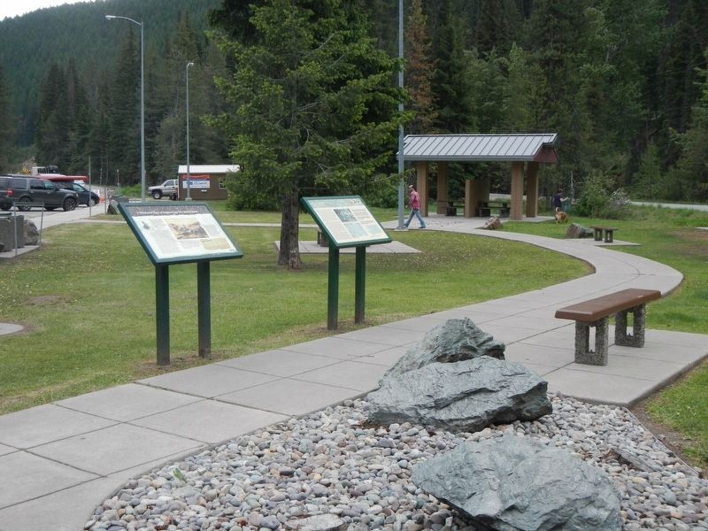
More about this marker. This marker is located at the Dena Mora Rest Area Eastbound.
Credits. This page was last revised on September 6, 2018. It was originally submitted on September 6, 2018, by Barry Swackhamer of Brentwood, California. This page has been viewed 255 times since then and 16 times this year. Photos: 1, 2. submitted on September 6, 2018, by Barry Swackhamer of Brentwood, California.

