Greenough in Missoula County, Montana — The American West (Mountains)
A Vast Network of Indigenous Trails.
Inscription.
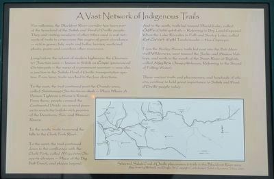
For millennia, the Blackfoot River corridor has been part of the homeland of the Salish and Pend d'Oreille people. They and visiting members of other tribes used a vast network of trails to criss-cross this region of great abundance -- rich in game, fish, roots and bulbs, berries, medicinal plants, paint, and countless other resources.
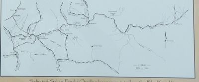
Long before the advent of modern highways, the Clearwater Junction area -- known in Salish as Čćnpá (pronounced Ch-tsin-pah -- the name of a prominent warrior) -- was also a junction in the Salish-Pend d'Oreille transportation system, From here, trails reached to the four directions.
To the east, the trail continued past the Ovando area, called Sntntnmsqá (Sin-tin-tin-im-skah -- Place Where A Person Tightens a Horse's Reins). From here, people crossed the Continental Divide via several passes to reach the buffalo-rich prairies of the Dearborn, Sun, and Missouri Rivers.
To the south trails traversed the hills to the Clark Fork River.
To the west, the trail continued down the confluence with the Clark Fork, called N?aycčstm (Jn-aye-ts-ch-sten -- Place of the Big Bull Trout), and places beyond.
And to the north, trails lead toward Placid Lake, called Čtáll?e (Chithl-qul-il-eh -- Referring to Dry Land Exposed when the Lake Recedes in Fall) and Seeley Lake, called Ept Ćixwćwt (Epthl Tsiwh-tsuwht -- Has Ospresy).
From the Seeley-Swan, trails led east to the Bob Marshall Wilderness, west toward the Jocko and Mission Valleys, and north to the mouth of the Swan River at Bigfork, called Nqeytkwm ( Jn-qeythl-kwum, Referring to the Sound of Falling Water).
These ancient trails and placenames and hundreds of others, continue to hold great importance to the Salish and Pend d'Oreille people today.
Erected by Montana Department of Transportation.
Topics. This historical marker is listed in this topic list: Native Americans.
Location. 47° 0.126′ N, 113° 22.164′ W. Marker is in Greenough, Montana, in Missoula County. Marker is at the intersection of State Highway 200 at milepost 31 and State Highway 83, on the right when traveling east on State Highway 200. Touch for map. Marker is at or near this postal address: 44601 Montana Highway 200, Bonner MT 59823, United States of America. Touch for directions.
Other nearby markers. At least 8 other markers are within 12 miles of this marker, measured as the crow flies. Big Blackfoot Milling Company (here, next to this marker); Souvenirs of the Ice Age (within shouting distance of this marker); Big Blackfoot Railroad (approx. half a mile away); The Blackfoot River Corridor (approx. 3.2 miles away); Seaman
(approx. 7½ miles away); Ghost Town Byway (approx. 9.1 miles away); Historic Logging Shaped These Woods (approx. 9.9 miles away); Sand Park Cemetery (approx. 11.7 miles away). Touch for a list and map of all markers in Greenough.
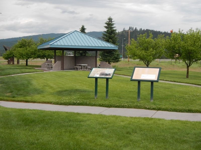
More about this marker. This marker is located at the Clearwater Rest Area.
Credits. This page was last revised on September 9, 2018. It was originally submitted on September 9, 2018, by Barry Swackhamer of Brentwood, California. This page has been viewed 250 times since then and 14 times this year. Photos: 1, 2, 3. submitted on September 9, 2018, by Barry Swackhamer of Brentwood, California.


