Near Lolo in Missoula County, Montana — The American West (Mountains)
Fort Fizzle
Photographed By Barry Swackhamer, May 10, 2018
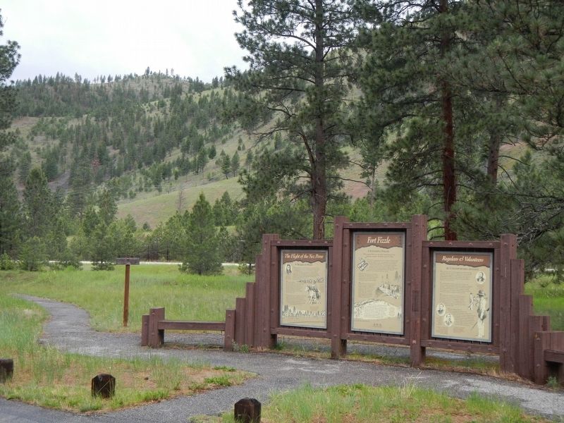
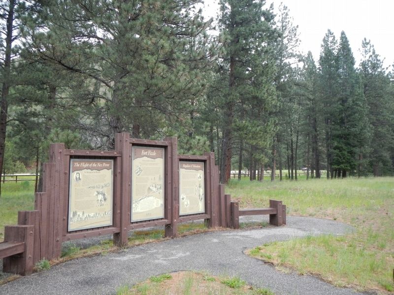
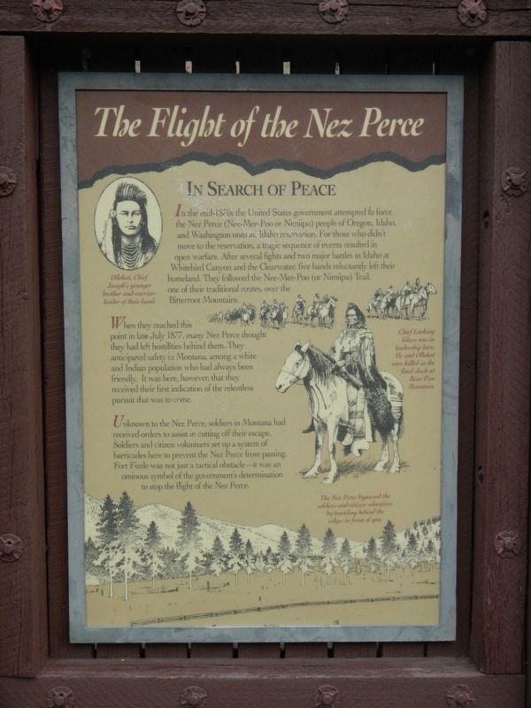
1. The Flight of the Nez Perce panel
Captions: (upper left) Ollokot, Chief Joseph's younger brother and warrior-leader of their band.; (center right) Chief Looking Glass was in leadership here, He and Ollokot were killed in the final dash at Bear Paw Mountain.; (bottom right) The Nez Perce bypassed the soldiers and citizen volunteers by traveling behind the ridge in front of you.
In Search of Peace
In the mid-1870s the United States government attempted to force the Nez Perce (Nee-Mee-Poo or Nimiipu) people of Oregon, Idaho, and Washington onto an Idaho reservation. For those who didn’t move to the reservation, a tragic sequence of events resulted in open warfare. After several fights and two major battles in Idaho at Whitebird Canyon and the Clearwater, five bands reluctantly left their homeland. They followed the Nee-Mee-Poo (or Nimiipu) Trail, one of their traditional routes, over the Bitterroot Mountains.
When they reached this point in late July 1877, many Nez Perce thought they had left hostilities behind them. They anticipated safety in Montana, among a white and Indian population who had always been friendly. It was here, however, that they received their first indication of the relentless pursuit that was to come.
Unknown to the Nez Perce, soldiers in Montana had received orders to assist in cutting off their escape. Soldiers and citizen volunteers set up a system of barricades here to prevent the Nez Perce from passing. Fort Fizzle was not just a tactical obstacle - it was an ominous symbol of the government’s determination to stop the flight of the Nez Perce.
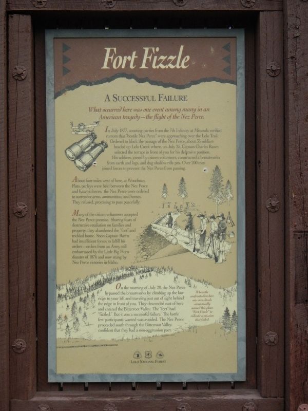
A Successful Failure
What occurred here was one event among many in an American tragedy - the flight of the Nez Perce.
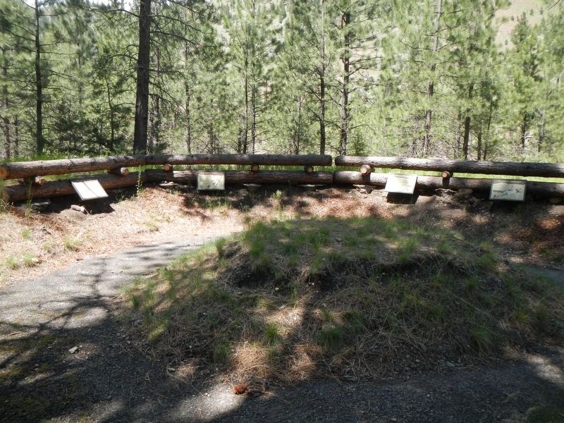
In July 1877, scouting parties from the 7th Infantry at Missoula verified rumors that “hostile Nez Perce” were approaching over the Lolo Trail. Ordered to block the passage of the Nez Perce, about 35 soldiers headed up Lolo Creek where, on July 25, Captain Charles Rawn selected the terrace in front of you for his defensive position. His soldiers, joined by citizen volunteers, constructed a breastworks from earth and logs, and dug shallow rifle pits. Over 200 men joined forces to prevent the Nez Perce from passing.
About four miles west of here, at Woodman Flats, parleys were held between the Nez Perce and Rawn’s forces; the Nez Perce were ordered to surrender arms, ammunition, and horses. They refused, promising to pass peacefully.
Many of the citizen volunteers accepted the Nez Perce promise. Sharing fears of destructive retaliation on families and property, they abandoned the “fort” and trickled home. Soon Captain Rawn had insufficient forces to fulfill his orders - orders from an Army still embarrassed by the Little Big Horn disaster of 1876 and now stung by Nez Perce victories in Idaho.
On the morning of July 28, the Nez Perce bypassed the breastworks by climbing up the low ridge to your left and traveling just out of sight behind the ridge in front of you. They descended east of here and entered the Bitterroot Valley. The “fort” had “fizzled.” But it was a successful failure. The battle few participants wanted was avoided. The Nez Perce proceeded south through the Bitterroot Valley, confident that they had a non-aggression pact.
When the confrontation here was over, locals sarcastically named this place "Fort Fizzle" to ridicule a mission that failed.
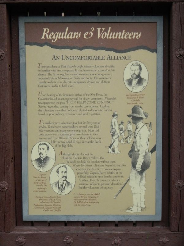
An Uncomfortable Alliance
The events here at Fort Fizzle brought citizen volunteers shoulder to shoulder with Army regulars. It was, however, an uncomfortable alliance. The Army regulars viewed volunteers as a disorganized, undependable mob looking for thrills and booty. The volunteers thought soldiers were illiterate immigrants, drunks and shiftless Easterners unable to hold a job.
Upon hearing of the imminent arrival of the Nez Perce, the Governor issued an emergency call for citizen volunteers. Missoula’s newspaper ran the plea, “HELP! HELP! COME RUNNING!” Scores responded, coming from nearby communities. Leading the volunteers were their “officers,” elected in democratic
Photographed By Barry Swackhamer, May 10, 2018
3. Regulars & Volunteers panel
Captions: (bottom left ovals, upper left and lower right) Captain Charles Rawn, a veteran of the Civil War, was the 7th Infantry's senior captain; E.A. Kenney, was the elected captain for one company of volunteers from Missoula. He held the first brief parley with the Nez Perce; Many area landmarks bear the names of Fort Fizzle volunteers: McCormick, Buckhouse Rankin, Stephens, Hammond, Higgins, Bancroft, Catlin and Chaffin.; (upper right) Territorial Governor Benjamin F. Potts visited the breastworks twice.
The soldiers were volunteers too, but for five years of service. Some were career soldiers, several were Civil War veterans, and many were immigrants. Most had been laborers or tradesmen prior to enlistment; their ages ranged from 18 to 49. Some of these soldiers were killed or wounded 12 days later at the Battle of the Big Hole.
Although skeptical about the volunteers, Captain Rawn realized that he could not hold his position without them. When the citizen volunteers began leaving after accepting the Nez Perce promise to pass peacefully, Captain Rawn bristled at the militia’s refusal to submit to his authority. Another officer threatened to shoot a volunteer officer to prevent “desertion.” But the volunteers left anyway.
Erected by U.S. Forest Service.
Topics and series. This historical marker is listed in this topic list: Wars, Non-US. In addition, it is included in the The Nez Perce Trail series list. A significant historical date for this entry is June 28, 1877.
Location. 46° 44.772′ N, 114° 10.356′ W. Marker is near Lolo, Montana, in Missoula County. Marker can be reached from U.S. 12, on the left when traveling west. Touch for map. Marker is at or near this postal address: 13442 US Highway 12, Lolo MT 59847, United States of America. Touch for directions.
Other nearby markers. At least 8 other markers are within 4 miles of this marker, measured as the crow flies. Lewis and Clark on Lolo Creek (a few steps from this marker); Outwitted and Outflanked (within shouting distance of this marker); Pauses and Parleys (within shouting distance of this marker); Taking Cover… (within shouting distance of this marker); The "Soldiers' Corral" (within shouting distance of this marker); The Nez Perce Sikum (approx. 2.6 miles away); A Crossroads of Culture (approx. 4 miles away); Following Formation (approx. 4 miles away). Touch for a list and map of all markers in Lolo.
More about this marker. The marker is located at the Fort Fizzle Historic Site.
Also see . . . Fort Fizzle -- Wikipedia. The Nez Perce were familiar with this region, having been frequent visitors while en route to the plains to hunt buffalo. Their leader Looking Glass persuaded the other Nez Perce leaders that they would be safe from the U.S. Army in Montana and that he could lead them to a safe refuge among his friends, the Crow Indians. (Submitted on September 10, 2018, by Barry Swackhamer of Brentwood, California.)
Credits. This page was last revised on September 10, 2018. It was originally submitted on September 10, 2018, by Barry Swackhamer of Brentwood, California. This page has been viewed 327 times since then and 26 times this year. Photos: 1, 2, 3, 4, 5, 6. submitted on September 10, 2018, by Barry Swackhamer of Brentwood, California.
