Near Kooskia in Idaho County, Idaho — The American West (Mountains)
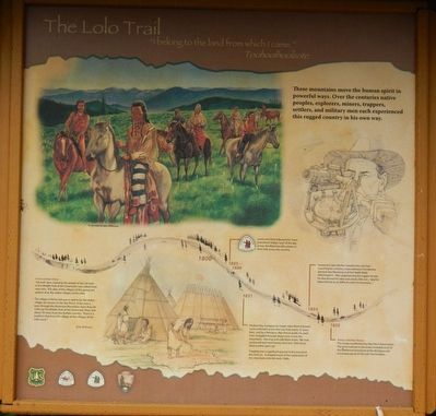
The Lolo Trail
"I belong to the land from which I came." Toohoolhoolzote
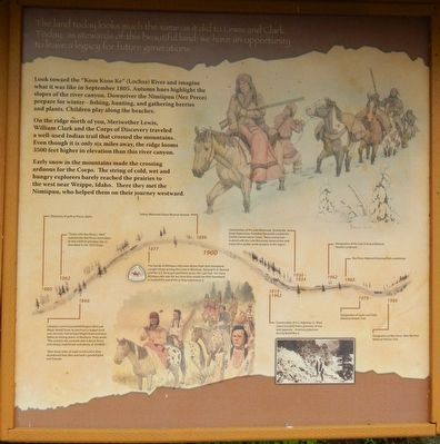
The land today looks much the same as it did to Lewis and Clark. Today, as stewards of this beautiful land, we have an opportunity to leave a legacy for future generations.
These mountains move the human spirit in powerful ways. Over the centuries native peoples, explorers, miners, trappers, settlers, and military men each experienced this rugged country in his own way. Look toward the “Koos Koos Ke” (Lochsa) River and imagine what it was like in September 1805. Autumn hues highlight the slopes of the river canyon. Downriver the Nimiipuu (Nez Perce) prepare for winter - fishing, hunting, and gathering berries and plants. Children play along the beaches.
On the ridge north of you, Meriwether Lewis, William Clark and the Corps of Discovery traveled a well-used Indian trail that crossed the mountains. Even though it is only six miles away, the ridge looms 3500 feet higher in elevation than this river canyon.
Early snow in the mountains made the crossing arduous for the Corps. The string of cold, wet and hungry explorers barely reached the prairies to the west near Weippe, Idaho. There they met the Nimiipuu, who helped them on their journey westward.
(The timeline across the bottom is present left to right by increasing dates:)
From earliest times -
“Sal-wah’-poo, meaning the people of the Sal-wah, as the Middle Fork of the Clearwater was called, lived near here. The sites of the villages of this group are spoken of as the oldest villages of the tribe.
The village of Ne’hu-kat-poo is said to be the oldest village site known to the Nez Perce. It lies near a pass through the Bitterroot Mountains more than 60 miles up the Middle Fork of the Clearwater River and about 70 miles from the ‘buffalo country.’ There is a tradition that from this village all the villages of the tribe came.” Billy Williams
1808-1806 Lewis and Clark followed the "most prominent Indian road" of the day across the Bitterroot Mountains in their trek across the country.
1831 Hudson Bay Company fur trader John Work followed Lewis and Clark across the Lolo Trail nearly 25 years later. Led by a Nimiipuu (Nez Perce) guide, his pack train struggled through deep snow across the mountains. Starving and cold, Work wrote, "We now continued and more horses were lost. One horse died, another gave up."
Trapping was a significant pursuit in the area from this time on. It shaped much of the exploration of the mountains into the early 1960s.
1854 Lieutenant John Mullan traveled the Lolo Trail searching for a military route between Fort Benton (present day Montana) and Fort Walla Walla (Washington). After experiencing the rugged terrain he abandoned the idea and stated, (We are) “glad to leave behind us so difficult a bed of mountains...."
1855 Treaty with Nez Perces - This treaty established the Nez Perce Reservation. The land outlined in the treaty included most of the traditional homeland of the Nimiipuu and encompassed all of the Lolo Trail in Idaho.
1860 Discovery of gold at Pierce, Idaho.
1863 "Treaty with Nez Perces, 1863" reduced the Nez Perce reservation to one tenth its previous size, as described in the 1855 treaty.
1866 Congress commissioned Wellington Bird and Major Sewell Truax to construct a wagon road over the Lolo Trail to haul freight from Lewiston, Idaho, to mining towns in Montana. They wrote, "The country was covered with a dense forest with heavy underbrush and plenty of windfalls."
After three miles of road construction, they abandoned that idea and built a graded pack trail instead.
1877 Five bands of Nimiipuu who were driven from their homeland sought refuge among the Crow in Montana. General O.O. Howard and the U.S. Army pursued them across the Lolo Trail. For many Nimiipuu this was the last time they would see their homeland. It marked the end of life as they had known it.
1898 Selway-Bitterroot Forest Reserve formed.
1919-1962 Construction of U.S. Highway 12. Work crews included Italian prisoners of war and Japanese-American internees during World War II.
1930-1934 Construction of the Lolo Motorway. During the Great Depression, President Roosevelt created the Civilian Conservation Corps. These young men assisted with the Lolo Motorway construction and many other public works projects in the regions.
1962 Designation of the Lolo Trail as a National Historic Landmark
1965 Nez Perce National Historical Park established
1978 Designation of Lewis and Clark National Historic Trail
1986 Designation of Nez Perce (Nee Me Poo) (sic) National Historic Trail
Erected by U.S. Forest Service, Clearwater National Forest.
Topics and series. This historical marker is listed in these topic lists: Natural Features • Roads & Vehicles. In addition, it is included in the Lewis & Clark Expedition, and the The Nez Perce Trail series lists.
Location. 46° 20.299′ N, 115° 19.695′ W. Marker is near Kooskia, Idaho, in Idaho County. Marker can be reached from U.S. 12 at milepost 121, on the right when traveling west. Touch for map. Marker is in this post office area: Kooskia ID 83539, United States of America. Touch for directions.
Other nearby markers. At least 4 other markers are within 13 miles of this marker, measured as the crow flies. Selway - Bitterroot Wilderness (approx. 3 miles away); "to our inexpressable joy" (approx. 3 miles away); Green Swoard Camp (approx. 8.9 miles away); Smoking Place (approx. 12.9 miles away).
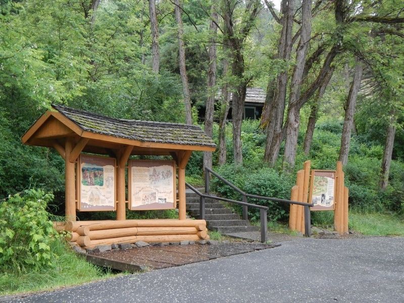
More about this marker. This marker is located in the Lochas Historic Ranger Station parking lot.
Credits. This page was last revised on September 18, 2018. It was originally submitted on September 12, 2018, by Barry Swackhamer of Brentwood, California. This page has been viewed 254 times since then and 27 times this year. Photos: 1, 2, 3. submitted on September 12, 2018, by Barry Swackhamer of Brentwood, California.


