Gambles Hill in Richmond, Virginia — The American South (Mid-Atlantic)
Hurricane Agnes
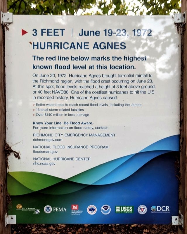
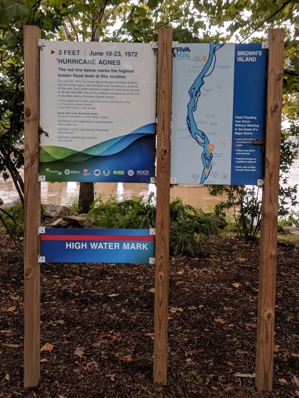
3 Feet | June 19-23, 1972
On June 20, 1972, Hurricane Agnes brought torrential rainfall to the Richmond region, with the flood crest occurring on June 23. Al this spot, flood levels reached a height of 3 feel above ground, or 40 feet NAVD88.One of the costliest hurricanes to hit the U.S in recorded history, Hurricane Agnes caused:
> Entire watersheds to reach record flood levels, including the James
> 13 local storm-related fatalities
> Over $140 million in local damage
Topics. This historical marker is listed in this topic list: Disasters. A significant historical date for this entry is June 20, 1972.
Location. 37° 32.066′ N, 77° 26.744′ W. Marker is in Richmond, Virginia. It is in Gambles Hill. Marker is at the intersection of Tredegar Street and Brown's Island Way, on the left when traveling west on Tredegar Street. Touch for map. Marker is at or near this postal address: 470 TredegarSt, Richmond VA 23219, United States of America. Touch for directions.
Other nearby markers. At least 8 other markers are within walking distance of this marker. What’s That? (within shouting distance of this marker); Gateway to the Civil War (within shouting distance of this marker); Southern Firepower (within shouting distance of this marker); Overshot Waterwheel (within shouting distance of this marker); Joseph Reid Anderson (about 300 feet away, measured in a direct line); Historic Tredegar (about 300 feet away); Haxall Headgates (about 300 feet away); Early Industrial Patterns (about 300 feet away). Touch for a list and map of all markers in Richmond.
Credits. This page was last revised on February 1, 2023. It was originally submitted on September 30, 2018, by Bernard Fisher of Richmond, Virginia. This page has been viewed 241 times since then and 24 times this year. Photos: 1, 2, 3, 4. submitted on September 30, 2018, by Bernard Fisher of Richmond, Virginia.


