Tintagel in Cornwall, England, United Kingdom — Northwestern Europe (the British Isles)
A changing coastline
A Changing coastline
Arvor ow chanjya
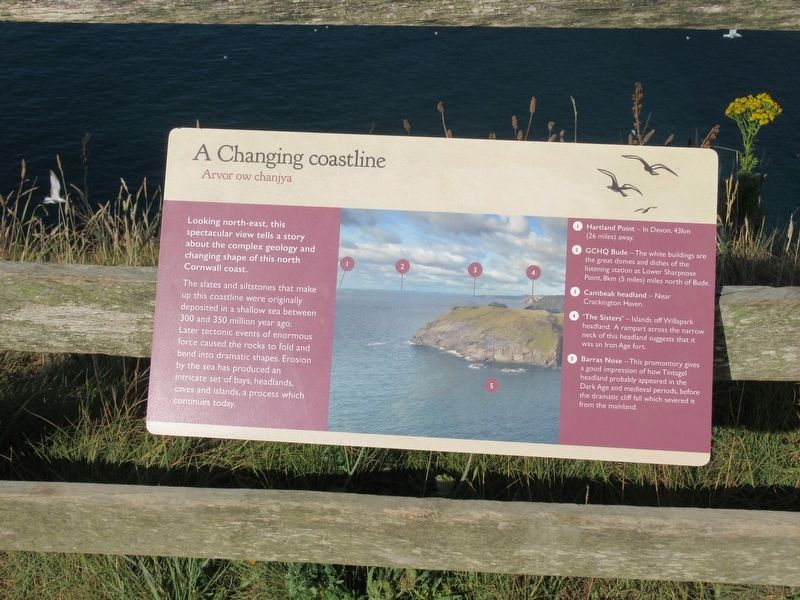
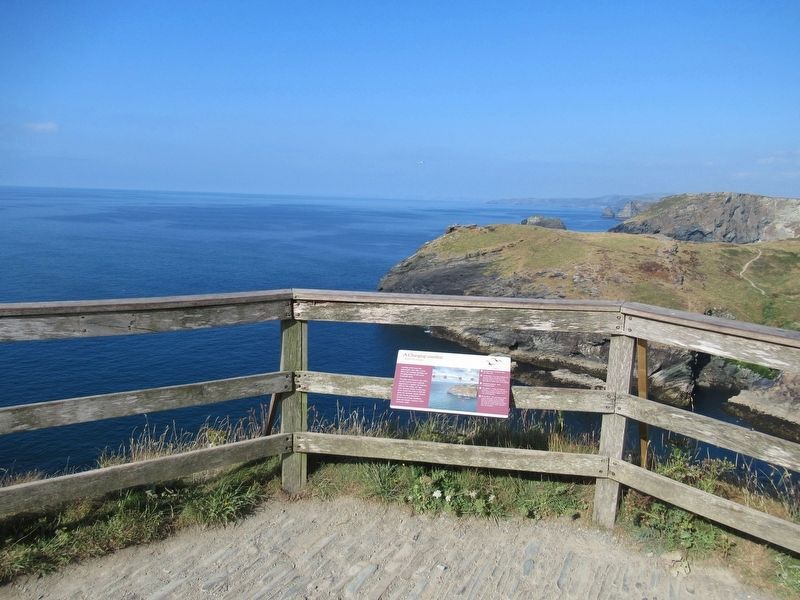
Looking north-east, this spectacular view tells a story about the complex geology and changing shape of this north Cornwall coast.
The slates and siltstones that make up this coastline were originally deposited in a shallow sea between 300 and 350 million year ago. Later tectonic events of enormous force caused the rocks to fold and bend into dramatic shapes. Erosion by the sea has produced an intricate set of bays, headlands caves and islands, a process which continues today.
1 Hartland Point - In Devon, 43km (26 miles) away.
2 GCHQ Bude -The white buildings are the great domes and dishes of the listening station at Lower Sharpnose Point, 8km (5 miles) miles north of Bude.
3 Cambeak headland - Near Crackington Haven.
4 ‘The Sisters’ - Islands off Willapark headland. A rampart across the narrow neck of this headland suggests that it was an Iron Age fort.
5 Barras Nose - This promontory gives a good impression of how Tintagel headland probably appeared in the Dark Age and medieval periods, before the dramatic cliff fall which severed it from the mainland. 50.669145, -4.760481
Topics. This historical marker is listed in these topic lists: Environment • Forts and Castles.
Location. 50° 40.149′ N, 4° 45.629′ W. Marker is in Tintagel, England, in Cornwall. Marker can be reached from Castle Road, 0.6 kilometers west of Atlantic Road, on the right when traveling west. Located at Tintagel Castle. Touch for map. Marker is in this post office area: Tintagel, England PL34 0HE, United Kingdom. Touch for directions.
Other nearby markers. At least 8 other markers are within walking distance of this marker. Tintagel village (here, next to this marker); A romantic retreat (within shouting distance of this marker); The Priest’s tale (within shouting distance of this marker); The Trader’s tale (within shouting distance of this marker); Excavations and discoveries (about 90 meters away, measured in a direct line); Well (about 90 meters away); A complicated ruin (about 120 meters away); Prince Dafydd’s tale (about 120 meters away). Touch for a list and map of all markers in Tintagel.
Also see . . .
1. English Heritage - Tintagel Castle. (Submitted on October 2, 2018, by Michael Herrick of Southbury, Connecticut.)
2. Tintagel Castle on Wikipedia. (Submitted on October 2, 2018, by Michael Herrick of Southbury, Connecticut.)
Credits. This page was last revised on January 27, 2022. It was originally submitted on October 2, 2018, by Michael Herrick of Southbury, Connecticut. This page has been viewed 162 times since then and 41 times this year. Photos: 1, 2. submitted on October 2, 2018, by Michael Herrick of Southbury, Connecticut.

