Near Dillon in Beaverhead County, Montana — The American West (Mountains)
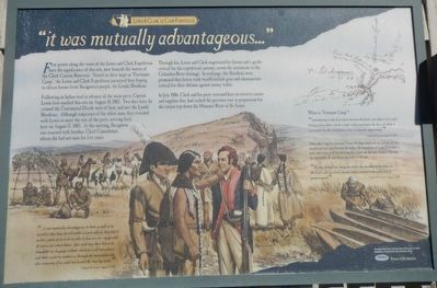
"it was mutually advantageous..."
Lewis and Clark at Camp Fortunate
Following an Indian trail in advance of the main party, Captain Lewis first reached this site on August 10, 1805. Two days later, he crossed the Continental Divide west of here, and met the Lemhi Shoshoni. Although suspicious of the white men, they returned with Lewis to meet the rest of the party, arriving back here on August 17, 1805. At the meeting, Sacajawea was reunited with brother, Chief Camehwait, whom she had not seen for five years.
Through her, Lewis and Clark negotiated for horses and a guide - critical for the expedition's journey across the mountains to the Columbia River drainage. In exchange, the Shoshoni were promised that future trade would include guns and ammunition - critical for their defense against enemy tribes.
In July 1806, Clark and his party returned here to retrieve canoes and supplies they had cached the previous year in preparation for the return trip down the Missouri River to St. Louis.
"...it was mutually advantageous to them as well as to ourselves that they should render us such aids as they had in their power to furnish in order to haisten our voyage and of course our return home. that such were their horses to transport our baggage without which we could not subsist and that a pilot to conduct us through the mountains was also necessary if we could not decend the river by water." -- Captain M. Lewis, August 17, 1805
"immediately in the level plain between the forks and about 1/2 a mile distance from them stands a high rocky mountain, the base of which is surrounded by the level plain; it has a singular appearance." -- Captain M. Lewis, August 18, 1805
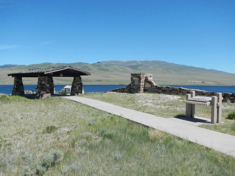
Today, this "singular mountain" forms the large island you see in front of you, marked on their map between the forks. The actual site of Camp Fortunate is now under water, half-way between this island and the dam. Loot at the map for its symbol δ just before the forks to the left.
"We now found our camp just below the junction of the forks on the Lard. side in a level smooth bottom covered with fine terf of green-swoard." Captain M. Lewis, August 17, 1805
Erected by Montana Bureau of Reclamation.
Topics and series. This historical marker is listed in these topic lists: Exploration • Native Americans. In addition, it is included in the Lewis & Clark Expedition series list. A significant historical date for this entry is August 17, 1805.
Location. 44° 59.455′ N, 112° 52.224′ W. Marker is near Dillon, Montana, in Beaverhead County. Marker is on State Highway 324 near Interstate 15, on the left when traveling east. Touch for map. Marker is in this post office area: Dillon MT 59725, United States of America. Touch for directions.
Other nearby markers. At least 8 other markers are within 14 miles of this marker, measured as the crow flies. Fortunate Camp (a few steps from this marker); The Lewis and Clark Expedition (a few steps from this marker); Sacajawea (approx. 0.9 miles away); The Montana-Utah Road (approx. 10.3 miles away); Bannack (approx. 11.1 miles away); Old Trail to the Gold Diggin's (approx. 11.1 miles away); Southern Gateway Marker (approx. 11˝ miles away); Nez Perce Camp (approx. 13.3 miles away). Touch for a list and map of all markers in Dillon.
More about this marker. This marker is located at the Camp Fortunate overlook located at the northwest edge of Clark Canyon Reservoir.
Credits. This page was last revised on October 6, 2018. It was originally submitted on October 6, 2018, by Barry Swackhamer of Brentwood, California. This page has been viewed 463 times since then and 24 times this year. Photos: 1, 2. submitted on October 6, 2018, by Barry Swackhamer of Brentwood, California.

