Fort Pierre in Stanley County, South Dakota — The American Midwest (Upper Plains)
The Verendrye Site
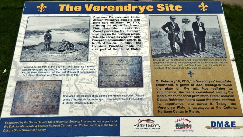
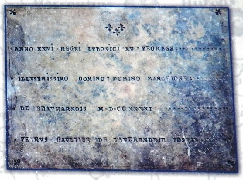
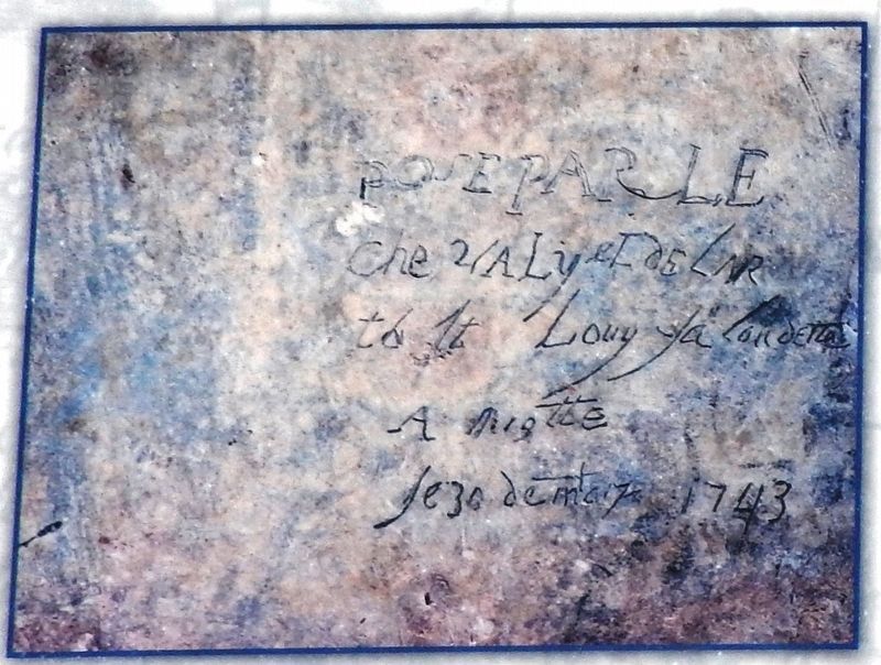
Explorers Francois and Louis-Joseph Verendrye buried a lead plate here on March 30, 1743, claiming the region for France. The plate documents the Verendryes as the first European explorers on the northern plains. This site serves as proof of early European colonization efforts in North America. In 1803, the Louisiana Purchase made the area part of the United States.
On February 16, 1913, the Verendryes' lead plate resurfaced. A group of local teenagers found the plate on the hill. Not realizing its significance, the teens considered selling the lead plate to the local print shop. State Historian Doane Robinson heard about the plate, realized its importance, and saved it. Today, the Verendrye Plate is displayed at the Cultural Heritage Center in Pierre.
Photos courtesy of the South Dakota Historical Society.
Erected by The South Dakota State Historical Society; a Preserve America grant and the Dakota, Minnesota and Eastern Railroad Corporation.
Topics. This historical marker is listed in these topic lists: Colonial Era • Exploration. A significant historical date for this entry is March 30, 1743.
Location. 44° 21.316′ N, 100° 22.699′ W. Marker is in Fort Pierre, South Dakota, in Stanley County. Marker is on Verendrye Drive (2nd Street), 0.4 miles north of West 2nd Avenue. Marker is located at the Verendrye National Historic Site, on the hilltop overlooking Fort Pierre and the Missouri River. Touch for map. Marker is in this post office area: Fort Pierre SD 57532, United States of America. Touch for directions.
Other nearby markers. At least 8 other markers are within walking distance of this marker. Translation of the Verendrye Plate (here, next to this marker); Verendrye Explorers (a few steps from this marker); Verendrye Tablet Site (within shouting distance of this marker); a different marker also named Verendrye Site (within shouting distance of this marker); Fort Pierre (approx. 0.2 miles away); Lewis and Clark / Fort Pierre, South Dakota (approx. 0.2 miles away); a different marker also named Fort Pierre (approx. 0.2 miles away); Casey Tibbs (approx. 0.2 miles away). Touch for a list and map of all markers in Fort Pierre.
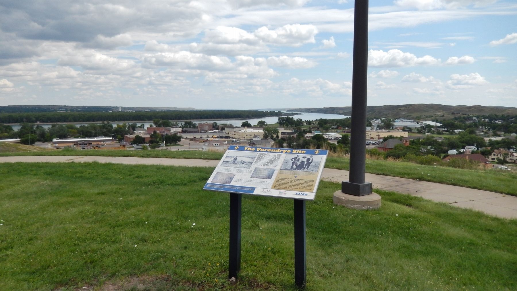
More about this marker. Marker is a large composite plaque, mounted horizontally, on waist-high posts.
Regarding The Verendrye Site. National Historic Landmark (1991)
Related markers. Click here for a list of markers that are related to this marker. The Verendrye National Historic Site
Also see . . .
1. Verendrye Plate. The American Survetor website entry:
On a warm winter day, 109 years after Lewis & Clark’s visit to this vantage point, young children played on the same hill. Stones brought in by the glaciers were scarce on the west side of the river, so when found they were carried away by the early pioneers for useful purposes. Hattie Foster, Ethel Parish, and George O’Reilly were among those on the hill that day, February 16, 1913. Hattie noticed something resembling a piece of metal sticking out of the soil. With her friend’s assistance, she dug out an unusual object... (Submitted on October 13, 2018, by Cosmos Mariner of Cape Canaveral, Florida.)
2. Discovering The Verendrye Plate. South Dakota Magazine website entry:
Ethel Parish and two friends found the plate while playing on a sunny February day on a hill over Fort Pierre. Their discovery caused historians to rethink their accounts of white man’s arrival in this region. The plate captured the imaginations of South Dakotans then, and it has remained one of the state’s most treasured museum pieces ever since. Ethel never saw friends George and Hattie after she left Fort Pierre as a 14-year-old. When the South Dakota State Legislature appropriated $700 to purchase the Verendrye plate from the finders, no one knew where she’d gone. The money was awarded to the others — George received
$500, Hattie just $200.
Ethel also lost credit for the find. Although townspeople knew there was a third teenager on the hill, the name was not always remembered accurately and other Fort Pierre youngsters occasionally were listed with George and Hattie. (Submitted on October 13, 2018, by Cosmos Mariner of Cape Canaveral, Florida.)
3. Verendrye Site. National Park Service website entry (Submitted on November 13, 2021, by Larry Gertner of New York, New York.)
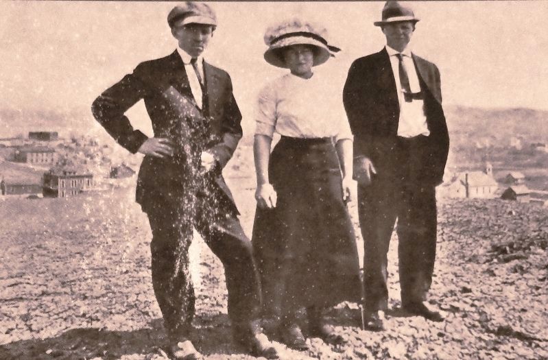
4. Marker detail: George O'Reilly, Harriet Foster and Leslie Stroup
George O'Reilly (right) and Harriet Foster (center) were among the group that discovered the Verendrye plate. Others credited with the find are Leslie Stroup (left) and Ethel Parish (not pictured). Other members of the group finding the plate are unknown.
Credits. This page was last revised on May 29, 2023. It was originally submitted on October 11, 2018, by Cosmos Mariner of Cape Canaveral, Florida. This page has been viewed 337 times since then and 50 times this year. Photos: 1, 2, 3, 4, 5. submitted on October 13, 2018, by Cosmos Mariner of Cape Canaveral, Florida. • Andrew Ruppenstein was the editor who published this page.
