St. Charles in St. Charles County, Missouri — The American Midwest (Upper Plains)
History of 426 South Main Street

Photographed By Devry Becker Jones (CC0), October 7, 2018
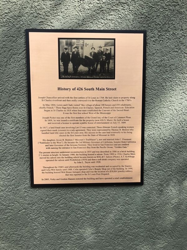
1. History of 426 South Main Street Marker
In May 1804, Lewis and Clark visited "this village of about 100 houses and 450 inhabitants, chiefly French." Three flags have flown over St Charles, Spanish, French and American. Education began in St Charles in 1818 when four nuns established the Convent of the Sacred Heart. It was the first free school West of the Mississippi.
Joseph Pichet was one of the members of the Grand Jury of the Court of Common Pleas. In 1808, he issued a certificate for the property (now 246 S. Main). He built a house and received a license to operate a public house of entertainment on July 15, 1809.
In 1818, a land fraud case involving Lot 15 was contested. Three illiterate French speaking women signed their mark (crosses) to a sale agreement. They were represented by Thomas H. Benton who handled land title cases in the St Louis area. His success in the case lead eventually to his being elected the first Senator from the State of Missouri in 1820.
His daughter, Jessie B. Benton ("Missouri's Trailblazer"), met and married John C. Freemont ("Pathfinder to the West"). He became the 3rd Military Governor of California, Senator from California and later Governor of the Arizona Territory. They lived in San Francisco and are credited with naming the entrance to San Francisco Bay from the Pacific Ocean, "Golden Gate."
The present structure underwent reconstruction in 1855 and was described in 1886 as a brick building 2 ˝ stories in height. In January 1900, the building housed a saloon. From 1908 to 1916, Charles Merx moved his saloon into the building which became known as M.K.&T. Saloon (Photo). A.T. Kohlhepp operated the saloon until Prohibition (1919) and then a soft drink company was operated by John L. Tayon until 1928.
Throughout the 1940's and afterwards the building was residential and occupied by the Stanley and Celia Witt family until 1988. Celia operated Celia's Beauty Shop out of the building. In 1990, the building housed Witt House Antiques shop and was the location of a $30,000 jewelry robbery that was reported in the St Louis Post-Dispatch.
In 2005, Vicky and Gordon Hansen restored the building and have operated a retail establishment.
Topics. This historical marker is listed in these topic lists: Government & Politics • Industry & Commerce • Settlements & Settlers • Women. A significant historical month for this entry is January 1900.
Location. 38° 46.673′ N, 90° 28.979′ W. Marker is in St. Charles, Missouri

Photographed By Devry Becker Jones (CC0), October 7, 2018
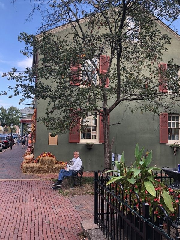
2. History of 426 South Main Street Marker
Other nearby markers. At least 8 other markers are within walking distance of this marker. The Mother-in-Law House (a few steps from this marker); St. Charles Borromeo Log Church (about 300 feet away, measured in a direct line); Glenday / Zeisler Home (about 300 feet away); Home of Dr. Jeremiah Millington (about 400 feet away); Saint Charles (about 400 feet away); First Methodist Church (about 500 feet away); Stone Building / Brick Building (about 500 feet away); Collier Cottage (about 500 feet away). Touch for a list and map of all markers in St. Charles.
Regarding History of 426 South Main Street. Freemont should be spelled Fremont.
Credits. This page was last revised on January 24, 2024. It was originally submitted on October 13, 2018, by Devry Becker Jones of Washington, District of Columbia. This page has been viewed 244 times since then and 48 times this year. Last updated on January 24, 2024, by Carl Gordon Moore Jr. of North East, Maryland. Photos: 1, 2. submitted on October 13, 2018, by Devry Becker Jones of Washington, District of Columbia. • J. Makali Bruton was the editor who published this page.