Near Lickdale in Lebanon County, Pennsylvania — The American Northeast (Mid-Atlantic)
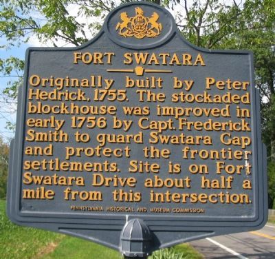
Fort Swatara
Erected 1999 by Pennsylvania Historical and Museum Commission.
Topics and series. This historical marker is listed in this topic list: War, French and Indian. In addition, it is included in the Pennsylvania Historical and Museum Commission series list. A significant historical year for this entry is 1755.
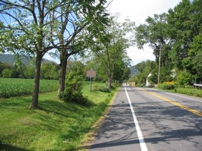
Location. 40° 27.874′ N, 76° 30.862′ W. Marker is near Lickdale, Pennsylvania, in Lebanon County. Marker is at the intersection of State Highway 72 and Bohns Lane, on the right when traveling south on State Highway 72. Touch for map. Marker is in this post office area: Jonestown PA 17038, United States of America. Touch for directions.
Other nearby markers. At least 8 other markers are within 4 miles of this marker, measured as the crow flies. Swatara Gap (approx. 0.9 miles away); Union Forge (approx. 0.9 miles away); Union Canal (approx. 1.4 miles away); Transportation Corps Unit Training Center (approx. 2.4 miles away); Sattazahn Lutheran Church (approx. 2.7 miles away); OH-6A Cayuse (approx. 3˝ miles away); AH-1F Bell (approx. 3˝ miles away); UH-1 Iroquois (approx. 3˝ miles away). Touch for a list and map of all markers in Lickdale.
Related marker. Click here for another marker that is related to this marker. To better understand the relationship to the other Blue Mountain Forts, study the marker shown.
Also see . . . Fort Swatara or Smith's Fort. From a report on the location of frontier forts, drafted in 1896. (Submitted on October 15, 2008, by Craig Swain of Leesburg, Virginia.)
Credits. This page was last revised on June 16, 2016. It was originally submitted on October 15, 2008, by Craig Swain of Leesburg, Virginia. This page has been viewed 3,073 times since then and 62 times this year. Photos: 1, 2. submitted on October 15, 2008, by Craig Swain of Leesburg, Virginia.

