Ninety Six in Greenwood County, South Carolina — The American South (South Atlantic)
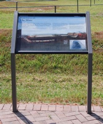
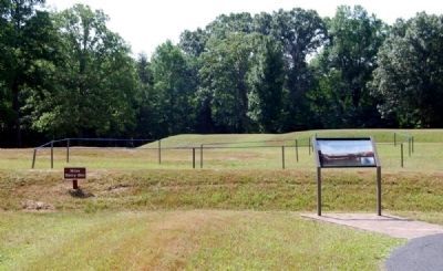
The Mine
Begun June 9, 1781
"We shall be in the ditch of the enemies works by tomorrow night or early morning; and the powder is wanting to blow up the works. I beg you will send the powder the moment this reaches you."
General Nathanael Greene to General Andrew Pickens, June 11, 1781
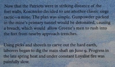
Now that the Patriots were in striking distance of the fort walls, Kosciuszko decided to use another classic siege tactic -- a mine. The plan was simple. Gunpowder packed in the mine's primary tunnel would be detonated, causing a breach, which would allow Greene's men to rush into the fort from nearby approach trenches.
Using picks and shovels to carve out the hard earth, laborers began to dig the main shaft on June 9. Progress in the late spring heat and under constant Loyalist fire was painfully slow.
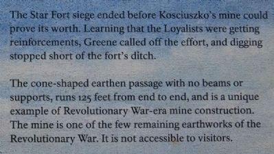
The Star Fort siege ended before Kosciuszko's mine could prove its worth. Learning that the Loyalists were getting reinforcements, Greene called off the effort, and digging stopped short of the fort's ditch.
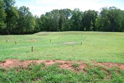
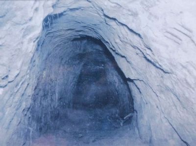
The cone-shaped earthen passage with no beams or supports, ran 125 feet from end to end, and is a unique example of Revolutionary War-era mine construction. The mine is one of the few remaining earthworks of the Revolutionary War. It is not accessible to visitors.
Erected 2009 by National Park Service.
Topics. This historical marker is listed in these topic lists: Colonial Era • Forts and Castles • Man-Made Features • War, US Revolutionary. A significant historical date for this entry is June 11, 1781.
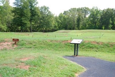
Location. 34° 8.778′ N, 82° 1.143′ W. Marker is in Ninety Six, South Carolina, in Greenwood County. Marker can be reached from South Cambridge Street. Marker is on the grounds of Ninety Six Historic Park battlefield. Touch for map. Marker is in this post office area: Ninety Six SC 29666, United States of America. Touch for directions.
Other nearby markers. At least 8 other markers are within walking distance of this marker. The Attack (within shouting distance of this marker); The Rifle Tower (within shouting distance of this marker); The Forlorn Hope (within shouting distance of this marker); Second Approach Trench (within shouting distance of this marker); The Star Fort (within shouting distance of this marker); Covered Way (within shouting distance of this marker); Second Parallel (within shouting distance of this marker); The Well (about 300 feet away, measured in a direct line). Touch for a list and map of all markers in Ninety Six.
More about this marker. The current marker is shown in Photo 1.
Also see . . .
1. Ninety Six National Historic Site (U.S. National Park Service). Here settlers struggled against the harsh backcountry to survive, Cherokee Indians hunted and fought to keep their land, two towns and a trading post were formed and abandoned to the elements, and two Revolutionary War battles that claimed over 100 lives took place here. (Submitted on September 8, 2008, by Brian Scott of Anderson, South Carolina.)
2. Nathanael Greene. Nathanael Greene (August 7, 1742 – June 19, 1786) was a major general of the Continental Army in the American Revolutionary War. (Submitted on July 12, 2010, by Brian Scott of Anderson, South Carolina.)
3. Tadeusz Kościuszko. Andrzej Tadeusz Bonawentura Kościuszko (February 4, 1746 – October 15, 1817) was a Polish-Lithuanian general and military leader during the Kościuszko Uprising. He is a national hero in Poland, Lithuania, the United States and Belarus. (Submitted on July 12, 2010, by Brian Scott of Anderson, South Carolina.)
4. Andrew Pickens. Andrew Pickens (September 13, 1739 – August 11, 1817) was a militia leader in the American Revolution and a member of the United States House of Representatives from South Carolina. (Submitted on July 12, 2010, by Brian Scott of Anderson, South Carolina.)
Photographed By Brian Scott, September 5, 2008
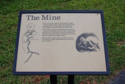
5. Original The Mine Marker
From the third parallel, Kosciuszko began constructing a mine. American sappers dug a perpendicular shaft about six feet deep, then began a tunnel toward the Star Fort.
Kosciuszko planned to extend the tunnel to a chamber beneath the fort wall. Gunpowder packed in the chamber would be exploded to blow an opening in the fort parapet and allow Patriot troops to charge inside.
Kosciuszko's mine was not used, however, because the siege ended before the tunnel was finished.
Credits. This page was last revised on November 2, 2018. It was originally submitted on September 8, 2008, by Brian Scott of Anderson, South Carolina. This page has been viewed 913 times since then and 16 times this year. Last updated on October 30, 2018, by Bruce Guthrie of Silver Spring, Maryland. Photos: 1, 2, 3, 4. submitted on July 12, 2010, by Brian Scott of Anderson, South Carolina. 5, 6. submitted on September 8, 2008, by Brian Scott of Anderson, South Carolina. 7. submitted on July 12, 2010, by Brian Scott of Anderson, South Carolina. 8. submitted on September 8, 2008, by Brian Scott of Anderson, South Carolina. 9. submitted on July 12, 2010, by Brian Scott of Anderson, South Carolina. • Andrew Ruppenstein was the editor who published this page.
