Ninety Six in Greenwood County, South Carolina — The American South (South Atlantic)
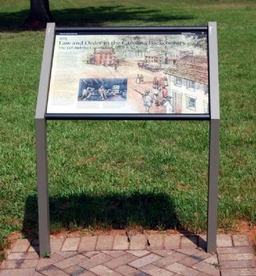
Law and Order in the Carolina Backcountry
1773
— The Jail and the Courthouse —
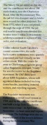
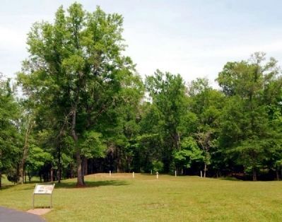
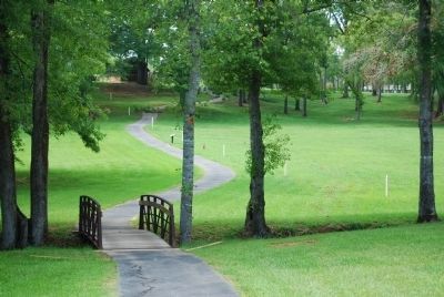
The Ninety Six jail stood on this site and the courthouse was about 100 yards from it, near the Charleston Road. After the Revolutionary War, the jail fell into disrepair and its bricks were reused for other purposes. But from 1772, when it was completed, through the siege of 1781, the jail and nearby courthouse elevated this frontier town's status from a remote wilderness outpost to a place of law, order, and civilization.
Unlike colonial South Carolina's coastal communities, the early backcountry settlements were sparsely populated and had virtually no law enforcement. with the courts far away in Charleston, a vigilante group called Regulators emerged. Ninety Six was the center for the Regulator movement. By 1767 there were about 4,000 Regulators, whose self-appointed duties including tracking down bandits, punishing immoral women, and expelling vagrants.
The Regulator movement was replaced by a circuit court system in 1769, and by the time the courthouse was built a judge from Charleston came twice a year -- in April and November -- to hear cases and impose sentences. The buildings were also an important part of the town's defenses during the Revolutionary War.
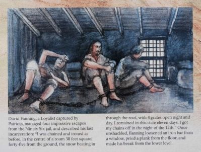
David Fanning, a Loyalists captured by Patriots, manage four impressive escapes from the Ninety Six jail, and described his last incarceration: "I was chained and ironed as before, in the centre of a room, 30 feet square; forty-five from the ground, the snow beating in through the roof, with 4 grates open night and day. I remained in this state eleven days. I got my chains off in the night for the 12th." Once unshackled, Fanning loosened an iron bar from a window, pried a plank from the floor, and made his break from the lower level.
Erected 2009 by National Park Service.
Topics. This historical marker is listed in these topic lists: Colonial Era • Settlements & Settlers • War, US Revolutionary. A significant historical year for this entry is 1772.
Location. 34° 8.669′ N, 82° 1.241′ W. Marker is in Ninety Six, South Carolina, in Greenwood County. Marker can be reached from South Cambridge Street (State Highway 248). Touch for map. Marker is in this post office area: Ninety Six SC 29666, United States of America. Touch for directions.
Other nearby markers. At least 8 other markers are within walking distance of this marker. The American Revolution Comes to the South (a few steps from this marker); Spring Branch (within shouting distance of this marker); Why Did the British Burn Ninety Six? (within shouting distance of this marker); Woman and Child (about 300 feet away, measured in a direct line); Gouedy Trail and Charleston Road (about 300 feet away); Ninety Six (about 400 feet away); Sharpshooter (about 700 feet away); "Light Horse Harry" Lee Takes the Stockade Fort (about 700 feet away). Touch for a list and map of all markers in Ninety Six.
More about this marker. Photo 1 shows the current version of the marker.
Also see . . .
1. Ninety Six National Historic Site (U.S. National Park Service). Here settlers struggled against the harsh backcountry to survive, Cherokee Indians hunted and fought to keep their land, two towns and a trading post were formed and abandoned to the elements, and two Revolutionary War battles that claimed over 100 lives took place here. (Submitted on September 9, 2008, by Brian Scott of Anderson, South Carolina.)
2. War of the Regulation. The War of the Regulation (or the Regulator Movement) was a North Carolina uprising, lasting from approximately 1764 to 1771, where citizens took up arms against corrupt colonial officials. (Submitted on July 28, 2010, by Brian Scott of Anderson, South Carolina.)
Photographed By Brian Scott, September 5, 2008
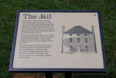
4. Original The Jail Marker
The South Carolina provincial assembly passed a law in 1769 "for establishing Courts, building Gaols, and appointing sheriffs" in the colony. This act created seven judicial districts with a courthouse and jail for the westernmost district located at Ninety Six.
The Ninety Six jail was a two-story building with brick walls 16 inches thick, and including a third floor lookout room and a dungeon below ground.
In peacetime, the jail served as a district prison for horse thieves, counterfeiters, robbers, and murderers awaiting trial. The British, in 1780, fortified the jail to protect the western flank of the town.
Photographed By Brian Scott, September 5, 2008
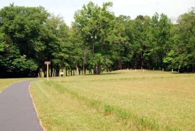
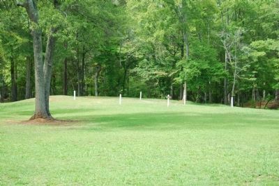
7. Outline of the Ninety Six Jail
Nothing of the structure survived. Following the British evacuation, the settlement was burned and abandoned. It wasn't until after the Revolution that the settlement was reestablished. From 1785-1852, the town was known as Cambridge, named so for a nearby college. The name was changed back to Ninety Six in 1852.
Credits. This page was last revised on November 2, 2018. It was originally submitted on September 9, 2008, by Brian Scott of Anderson, South Carolina. This page has been viewed 1,081 times since then and 16 times this year. Last updated on October 30, 2018, by Bruce Guthrie of Silver Spring, Maryland. Photos: 1, 2, 3. submitted on July 28, 2010, by Brian Scott of Anderson, South Carolina. 4. submitted on September 9, 2008, by Brian Scott of Anderson, South Carolina. 5, 6. submitted on July 28, 2010, by Brian Scott of Anderson, South Carolina. 7, 8. submitted on September 9, 2008, by Brian Scott of Anderson, South Carolina. • Andrew Ruppenstein was the editor who published this page.
