Anastasia in St. Augustine in St. Johns County, Florida — The American South (South Atlantic)
Coquina - Foundation of St. Augustine
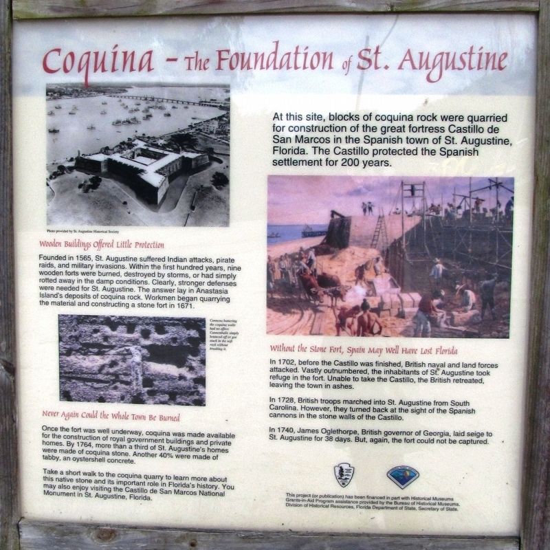
Wooden Buildings Offered Little Protection
Founded in 1565, St. Augustine suffered Indian attacks, pirate raids, and military invasions. Within the first hundred years, nine wooden forts were burned, destroyed by storms, or had simply rotted away in the damp conditions. Clearly, stronger defenses were needed for St. Augustine. The answer lay in Anastasia Island's deposits of coquina rock. Workmen began quarrying the material and constructing a stone fort in 1671.
Never Again Could the Whole Town be Burned
Once the fort was well underway, coquina was made available for the construction of royal government buildings and private homes. By 1764, more than a third of St. Augustine's homes were made of coquina stone. Another 40% were made of tabby, an oystershell concrete.
Take a short walk to the coquina quarry to learn more about this native stone and its important role in Florida's history. You may also enjoy visiting the Castillo de San Marcos National Monument in St. Augustine, Florida.
At this site, blocks of coquina rock were quarried for construction of the great fortress Castillo de San Marcos in the Spanish town of St. Augustine, Florida. The Castillo protected the Spanish settlement for 200 years.
Without the Stone Fort, Spain May Well Have Lost Florida
In 1702, before the Castillo was finished, British naval and land forces attacked. Vastly outnumbered, the inhabitants of St. Augustine took refuge in the fort. Unable to take the Castillo, the British retreated, leaving the town in ashes.
In 1728, British troops marched into St. Augustine from South Carolina. However, they turned back at the sight of the Spanish cannons in the stone walls of the Castillo.
In 1740, James Oglethorpe, British governor of Georgia, laid siege to St. Augustine for 38 days. But, again, the fort could not be captured.
Erected by Bureau of Historical Museums, Division of Historical Resources, Florida Department of State, Secretary of State.
Topics. This historical marker is listed in these topic lists: Architecture • Colonial Era • Forts and Castles • Natural Resources.
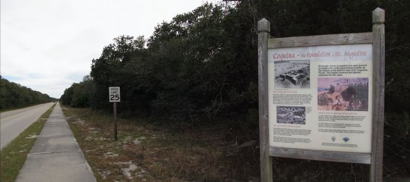
Location. 29° 52.799′ N, 81° 17.122′ W. Marker is in St. Augustine, Florida, in St. Johns County. It is in Anastasia. Marker is on Anastasia Park Road
, 0.1 miles east of Anastasia Boulevard (State Road A1A), on the right when traveling east. Marker is located in a pull-out on the south side of the road, just inside the Anastasia State Park entrance. Touch for map. Marker is at or near this postal address: 300 Anastasia Park Road, Saint Augustine FL 32080, United States of America. Touch for directions.
Other nearby markers. At least 8 other markers are within walking distance of this marker. Old Spanish Quarries (a few steps from this marker); Spanish Mining of the Quarry (within shouting distance of this marker); St. Augustine Alligator Farm (approx. ¼ mile away); a different marker also named St. Augustine Alligator Farm (approx. ¼ mile away); William Bartram Trail (approx. 0.4 miles away); The St. Augustine Amphitheatre (approx. 0.4 miles away); 1888 Outdoor Kitchens (approx. 0.4 miles away); 1872 South Privy (approx. 0.4 miles away). Touch for a list and map of all markers in St. Augustine.
More about this marker. Marker is a large composite plaque, mounted vertically in a heavy-duty wooden frame.
Related markers. Click here for a list of markers that are related to this marker. Castillo de San Marcos Coquina Construction
Also see . . . Coquina - The Rock that Saved St Augustine. Spanish began construction on the Castillo de San Marcos in 1672. The coquina stone was quarried in the area of present-day Anastasia State Park on Anastasia Island. Military engineers and stonemasons were brought from Spain. Convicts and additional soldiers were brought from Cuba. Oyster shells were burned into lime and mixed with sand and water to make mortar. Workers cut stones and used pulley systems to raise the blocks into place as Castillo was constructed. Slowly, the walls rose. Since no one had ever built a fort or any large building out of coquina, they had no idea how strong it would be. At least it would not burn, and the termites wouldn’t eat it. But how well would seashells last under cannon fire? No one knew, so they built the walls an average of 12 feet thick. (Submitted on November 10, 2018, by Cosmos Mariner of Cape Canaveral, Florida.)
Credits. This page was last revised on September 26, 2022. It was originally submitted on November 10, 2018, by Cosmos Mariner of Cape Canaveral, Florida. This page has been viewed 723 times since then and 74 times this year. Last updated on December 14, 2018, by Cosmos Mariner of Cape Canaveral, Florida. Photos: 1, 2. submitted on November 10, 2018, by Cosmos Mariner of Cape Canaveral, Florida. • Andrew Ruppenstein was the editor who published this page.

