Crown Point in Essex County, New York — The American Northeast (Mid-Atlantic)
Eastern Terminus
North Country National Scenic Trail
The North Country National Scenic Trail
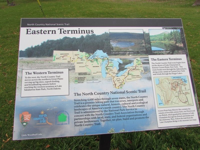
Stretching 4,600 miles through seven states, the North Country Trail is a premier hiking path that traverses, interprets and celebrates the unique natural, historic, cultural and ecological landscapes of America’s north country. The North Country Trail is administered by the National Park Service in concert with the North Country Trail Association through partnerships with local, state, and federal organizations and private landowners. Together, we plan, build and promote the North Country Trail.
The Western Terminus
To the west, the North Country Trail moves across the northern Great Plains serving up big skies, superb birding, and breathtaking sunsets before reaching the western terminus at Lake Sakakawea State Park, North Dakota.
The Eastern Terminus
The North Country Trail route begins here on the shores of Lake Champlain in Historic Crown Point, New York. The route heads west through the Adirondacks, along scenic canals in Central New York, and winds through the Finger Lakes.
Crown Point State Historic Site contains the remains of two 18th century forts, one French and one British, which guarded the entrance to Lake Champlain through the French and Indian and Revolutionary Wars. Follow the trail from the Lake Champlain Bridge to the museum (see map).
Topics. This historical marker is listed in these topic lists: Natural Features • Notable Places.
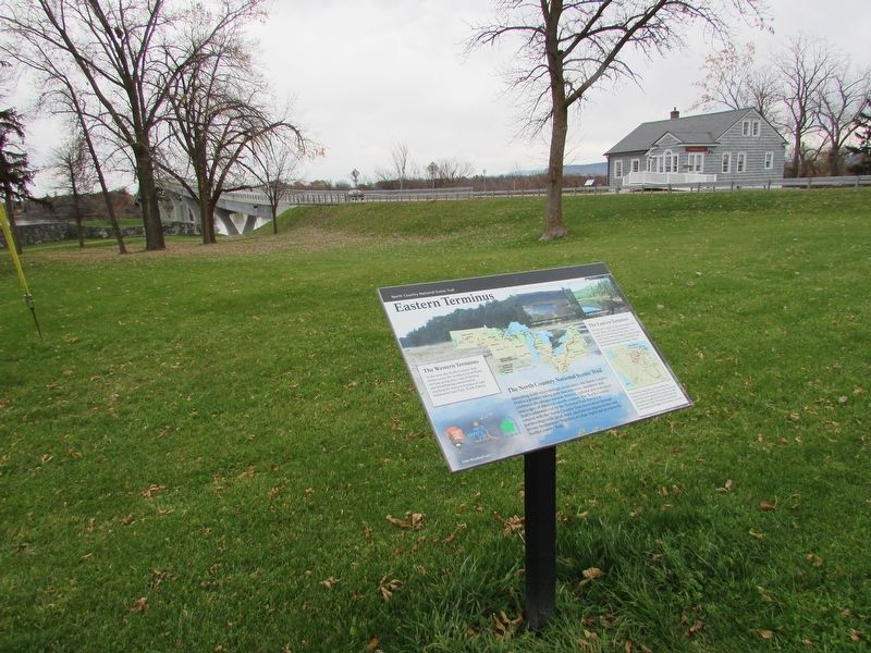
Location. 44° 1.759′ N, 73° 25.581′ W. Marker is in Crown Point, New York, in Essex County. Marker is on Bridge Road (County Route 185), on the left when traveling east. Marker is in Crown Point State Historic Site, along the Fort St. Frédéric walking trail. Touch for map. Marker is in this post office area: Crown Point NY 12928, United States of America. Touch for directions.
Other nearby markers. At least 8 other markers are within walking distance of this marker. Welcome To The Lake Champlain Bridge Heritage Area (within shouting distance of this marker); Selecting a Bridge Location (within shouting distance of this marker); Crown Point (about 300 feet away, measured in a direct line); The French at Crown Point (about 300 feet away); Crown Point: Military Focus (about 400 feet away); Gen. Henry Knox Trail (about 400 feet away); The White Flag (about 400 feet away); Fort St. Frédéric (about 500 feet away). Touch for a list and map of all markers in Crown Point.
More about this marker. The top of the marker contains a map of the North Country Trail from North Dakota to New York State. Pictures of some sites along the trail, including Labrador Pond Unique Area and Peaked Mountain Pond.
Also see . . . North Country National Scenic Trail. National Park Service. (Submitted on November 13, 2018, by Bill Coughlin of Woodland Park, New Jersey.)
Credits. This page was last revised on November 13, 2018. It was originally submitted on November 13, 2018, by Bill Coughlin of Woodland Park, New Jersey. This page has been viewed 230 times since then and 19 times this year. Photos: 1, 2. submitted on November 13, 2018, by Bill Coughlin of Woodland Park, New Jersey.

