St. John's Episcopal Church
St. Johnís Episcopal Church
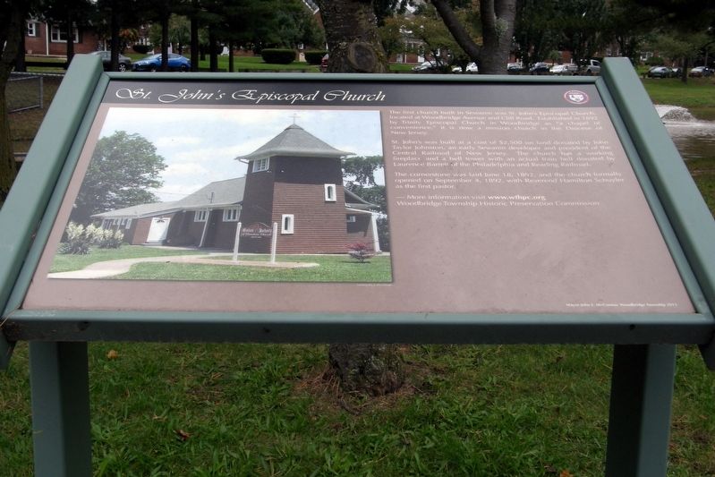
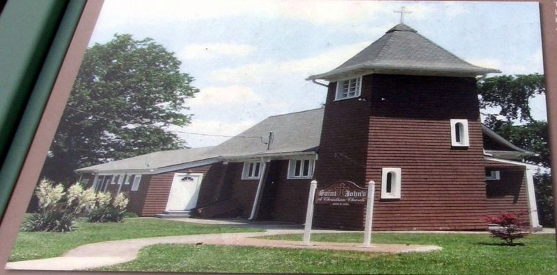
The first church built in Sewaren was St. Johnís Episcopal Church, located at Woodbridge Avenue and Cliff Road. Established in 1892 by Trinity Episcopal Church in Woodbridge as “a chapel of convenience”, it is now a mission church in the Diocese of New Jersey.
St. Johnís was built at a cost of $2,500 on land donated by John Taylor Johnston, an early Sewaren developer and president of the Central Railroad of New Jersey. The church has a working fireplace and a bell tower with an actual bell donated by Lawrence Barrett of the Philadelphia and Reading Railroad.
The cornerstone was laid June 18, 1892, and the church formally opened on September 4, 1892, with Reverend Hamilton Schuyler as the first pastor.
More information visit www.wthpc.org
Woodbridge Township Historic Preservation Commission
Mayor John E. McCormac Woodbridge Township 2013
Erected 2013 by Woodbridge Township Historic Preservation Commission.
Topics. This historical marker is listed in this topic list: Churches & Religion. A significant historical date for this entry is June 18, 1892.
Location. 40° 33.326′ N, 74° 17.282′ W. Marker is in Woodbridge, New Jersey, in Middlesex County. Marker is at the intersection
Other nearby markers. At least 8 other markers are within walking distance of this marker. Isaac Inslee Estates (a few steps from this marker); Embassy Theatre (within shouting distance of this marker); Henry Inman (within shouting distance of this marker); The Womanís Club of Fords (about 300 feet away, measured in a direct line); Salamander Works (about 500 feet away); Star Eagle Section (about 500 feet away); Historic Green Street (about 500 feet away); The Clay-and-Brick Industry (about 600 feet away). Touch for a list and map of all markers in Woodbridge.
Credits. This page was last revised on November 22, 2018. It was originally submitted on November 21, 2018, by Larry Gertner of New York, New York. This page has been viewed 156 times since then and 16 times this year. Photos: 1, 2, 3. submitted on November 21, 2018, by Larry Gertner of New York, New York. • Andrew Ruppenstein was the editor who published this page.


