Tallahassee in Leon County, Florida — The American South (South Atlantic)
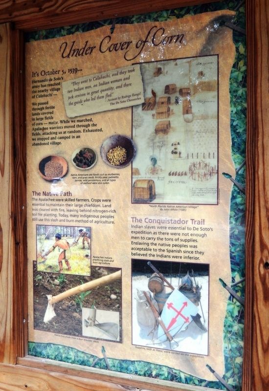
Under Cover of Corn
Florida De Soto Trail
— October 5, 1539 —
Hernando de Soto’s army has reached the nearby village of Calahuchi -
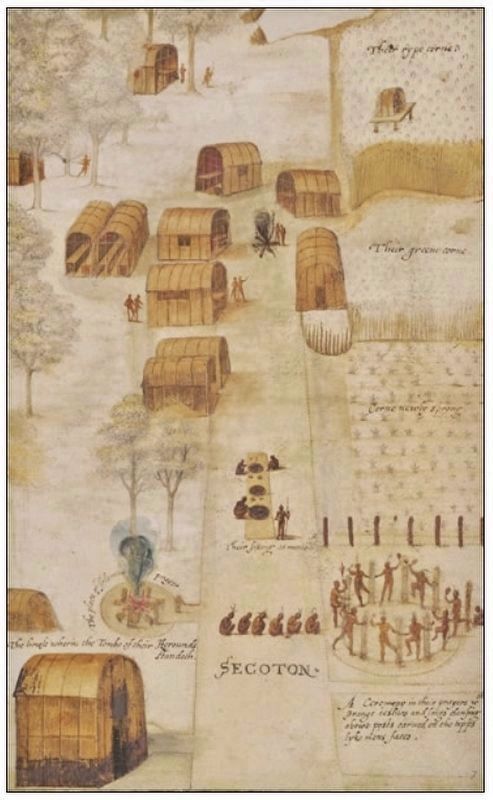
We passed through fertile lands covered in large fields of corn - maize. While we marched, Apalachee warriors moved through the fields, attacking us at random. Exhausted, we stopped and camped in an abandoned village.
”They went to Calahuchi, and they took two Indian men, an Indian woman and jerk venison in great quantity, and there the guide who led them fled.”
- Account by Rodrigo Rangel
The De Soto Chronicles
The Native Path
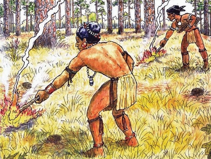
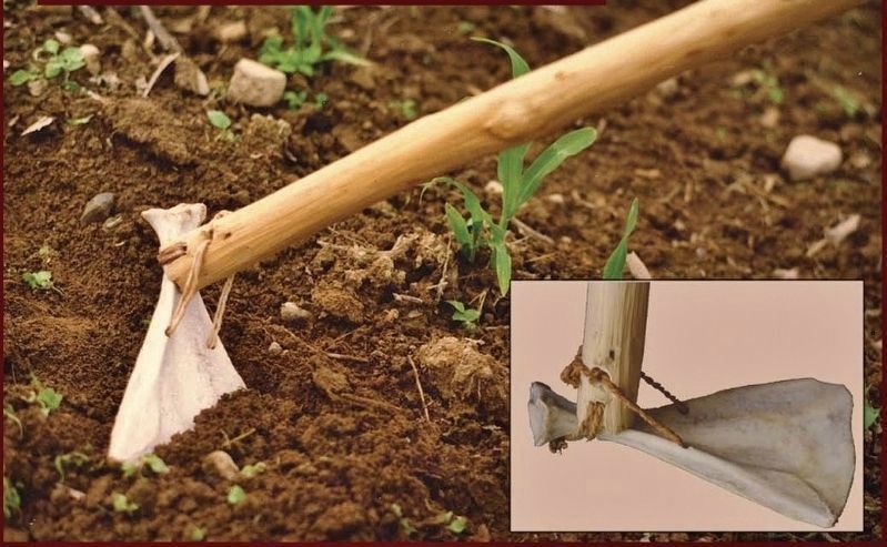
The Apalachee were skilled farmers. Crops were essential to maintain their large chiefdom. Land was cleared with fire, leaving behind nitrogen-rich soil for planting. Today, many indigenous peoples still use this slash and burn method of agriculture.
The Conquistador Trail
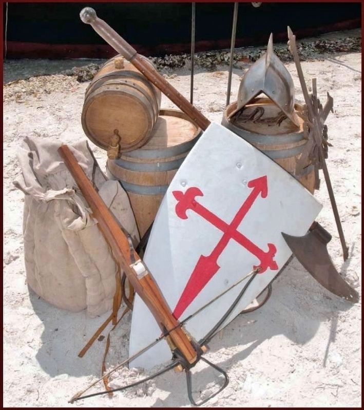
Indian slaves were essential to De Soto’s expedition as there were not enough men to carry the tons of supplies. Enslaving the native peoples was acceptable to the Spanish since they believed the Indians were inferior.
Erected by Florida De Soto Trail, Florida Department of Transportation, the Florida Park Service, and the National Park Service. (Marker Number 28.)
Topics. This historical marker is listed in these topic lists: Colonial Era • Exploration • Native Americans • Notable Events. A significant historical date for this entry is October 5, 1539.
Location. 30° 26.393′ N, 84° 11.531′ W. Marker is in Tallahassee, Florida, in Leon County. Marker can be reached from Heritage Park Boulevard east of Parkview Drive when traveling east. Marker is located within Tallahassee's Lafayette Heritage Trail Park, inside the park loop near the main parking lot. Touch for map. Marker is at or near this postal address: 4900 Heritage Park Boulevard, Tallahassee FL 32311, United States of America. Touch for directions.
Other nearby markers. At least 8 other markers are within 4 miles of this marker, measured as the crow flies. Tallahassee National Cemetery (approx. 1.1 miles away); Tallahassee National Cemetery Carillon (approx. 1.1 miles away); The "Luraville Locomotive" (approx. 1.9 miles away); a different marker also named The Luraville Locomotive (approx. 1.9 miles away); Munree (Fleischmann) Cemetery of Welaunee Plantation (approx. 2.4 miles away); Hickory Hill Cemetery of Welaunee Plantation (approx. 3.1 miles away); The Mission Of San Pedro y San Pablo de Patale
(approx. 3.1 miles away); Layfayette Land Grant (approx. 3.8 miles away). Touch for a list and map of all markers in Tallahassee.
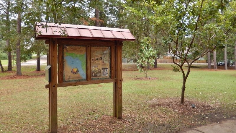
More about this marker. Marker is a large, composite plaque mounted vertically within a heavy-duty wooden kiosk.
Regarding Under Cover of Corn. Hernando de Soto landed at Tampa Bay in 1539 and made his way north in search of gold and riches. A controversial figure in American history, Spanish Conquistador Hernando de Soto is regarded as a hero and brave explorer by some — and an overzealous madman by others. The De Soto Trail shows him as a product of Medieval Europe, a brutal society forged over 780 years of warfare. It also tells the story of the Native American peoples of 16th-century Florida, a highly advanced collection of chiefdoms struggling against each other to gain dominance over their regions.
Related markers. Click here for a list of markers that are related to this marker. Florida De Soto Trail
Also see . . .
1. De Soto’s Expedition to North America. In 1536, de Soto obtained a royal commission to conquer and settle the region known as La Florida (now the southeastern
United States), which had been the site of earlier explorations by Juan Ponce de León and others. De Soto set out from Spain in April 1538, set with 10 ships and 700 men. After a stop in Cuba, the expedition landed at Tampa Bay in May 1539. They moved inland and eventually set up camp for the winter at a small Indian village near present-day Tallahassee. (Submitted on November 17, 2018, by Cosmos Mariner of Cape Canaveral, Florida.)
2. Apalachee Indians. The Apalachee Indians were great farmers and fearless warriors. They numbered perhaps 50,000 and grew miles of fields of corn in the rolling foothills around today's Tallahassee, corn which they stored in large community houses and exported to Cuba. They also hunted a ton of white-tail deer whose hides they stacked to the sky. (Submitted on January 10, 2021, by Cosmos Mariner of Cape Canaveral, Florida.)

Photographed By Cosmos Mariner, November 14, 2018
6. Florida De Soto Trail Map (panel to the left of marker in kiosk)
1539-1540
Credits. This page was last revised on January 10, 2021. It was originally submitted on November 16, 2018, by Cosmos Mariner of Cape Canaveral, Florida. This page has been viewed 550 times since then and 35 times this year. Last updated on November 21, 2018, by Cosmos Mariner of Cape Canaveral, Florida. Photos: 1, 2, 3. submitted on November 17, 2018, by Cosmos Mariner of Cape Canaveral, Florida. 4, 5. submitted on December 28, 2018, by Cosmos Mariner of Cape Canaveral, Florida. 6, 7. submitted on November 17, 2018, by Cosmos Mariner of Cape Canaveral, Florida. 8. submitted on December 28, 2018, by Cosmos Mariner of Cape Canaveral, Florida. • Bernard Fisher was the editor who published this page.
