Grand Rapids in Itasca County, Minnesota — The American Midwest (Upper Plains)
Minnesota Territory 1849-1858 / Itasca County Takes Shape
(marker side 1)
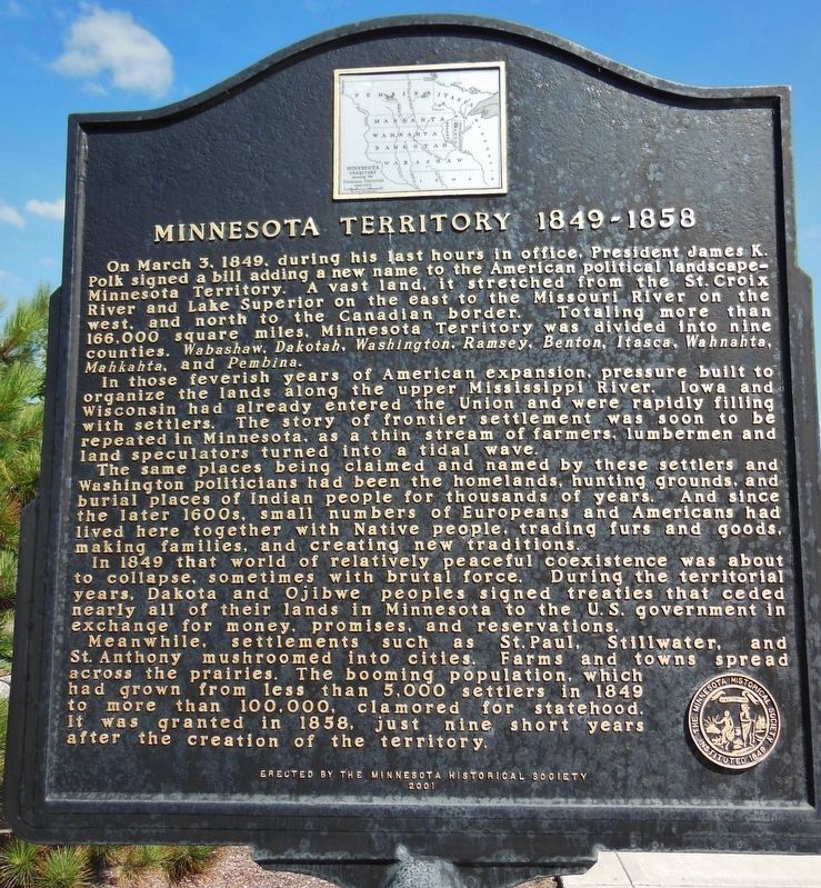
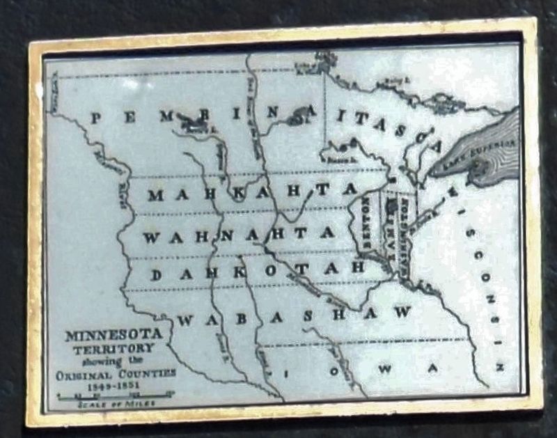
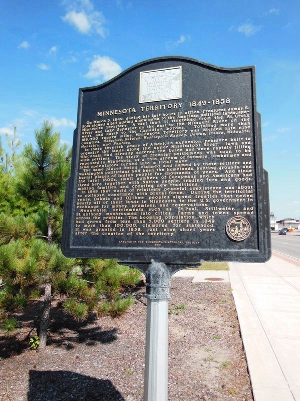
On March 3, 1849, during his last hours in office. President James K. Polk signed a bill adding a new name to the American political landscape — Minnesota Territory. A vast land, it stretched from the St. Croix River and Lake Superior on the east to the Missouri River on the west, and north to the Canadian border. Totaling more than 166,000 square miles, Minnesota Territory was divided into nine counties: Wabashaw, Dakotah, Washington, Ramsey, Benton, Itasca, Wahnahta, Mahkahta, and Pembina.
In those feverish years of American expansion, pressure built to organize the lands along the upper Mississippi River. Iowa and Wisconsin had already entered the Union and were rapidly filling with settlers. The story of frontier settlement was soon to be repeated in Minnesota, as a thin stream of farmers, lumbermen and land speculators turned into a tidal wave.
The same places being claimed and named by these settlers and Washington politicians had been the homelands, hunting grounds, and burial places of Indian people for thousands of years. And since the later 1600s, small numbers of Europeans and Americans had lived here together with Native people, trading furs and goods, making families, and creating new traditions.
In 1849 that world of relatively peaceful coexistence was about to collapse, sometimes with brutal force. During the territorial years, Dakota and Ojibwe people signed treaties that ceded nearly all of their lands in Minnesota to the U.S. government in exchange for money, promises, and reservations.
Meanwhile settlements such as St. Paul, Stillwater, and St. Anthony mushroomed into cities. Farms and towns spread across the prairies. The booming population, which had grown from less than 5,000 settlers in 1849 to more than 100,000, clamored for statehood. It was granted in 1858, just nine short years after the creation of the territory.
(marker side 2)
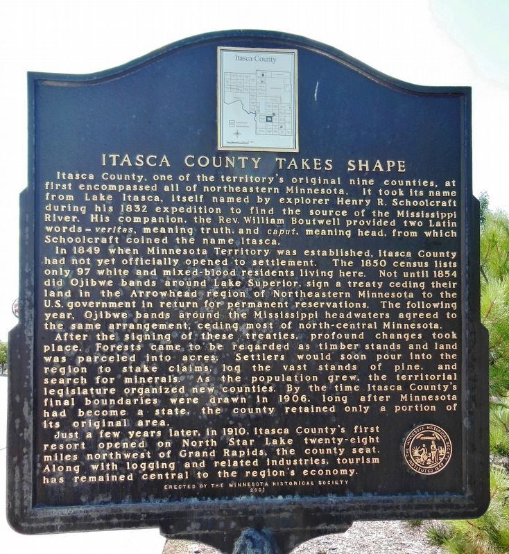
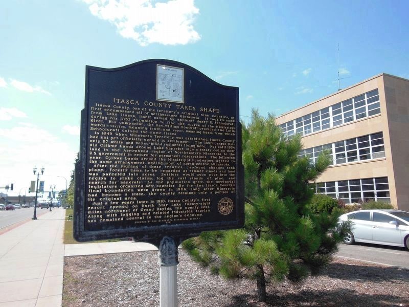
Itasca County, one of the territory's original nine counties, at first encompassed all of northeastern Minnesota. It took its name from Lake Itasca, itself named by explorer Henry R. Schoolcraft during his 1832 expedition to find the source of the Mississippi River. His companion, the Rev. William Boutwell provided two Latin words — veritas, meaning truth, and caput, meaning head, from which School craft coined the name Itasca.
In 1849 when Minnesota Territory was established, Itasca County had not yet officially opened to settlement. The 1850 census lists only 97 white and mixed-blood residents living here. Not until 1854 did Ojibwe bands around Lake Superior, sign a treaty ceding their land in the Arrowhead region of Northeastern Minnesota to the U.S. government in return for permanent reservations. The following year, Ojibwe bands around the Mississippi headwaters agreed to the same arrangement, ceding most of north-central Minnesota.
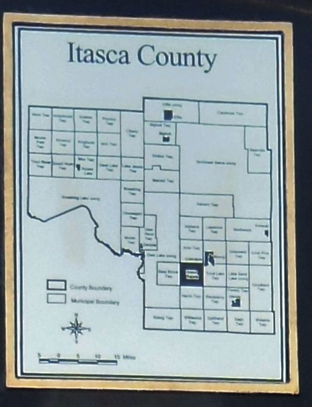
After the signing of these treaties, profound changes took place. Forests came to be regarded as timber stands and land was parceled into acres. Settlers would soon pour into the region to stake claims, log the vast stands of pine, and search for minerals. As the population grew, the territorial legislature organized new counties. By the time Itasca County's final boundaries were drawn in 1906, long after Minnesota had become a state, the county retained only a portion of its original area.
Just a few years later, in 1910, Itasca County's first resort opened on North Star Lake twenty-eight miles northwest of Grand Rapids, the county seat. Along with logging and related industries, tourism has remained central to the region's economy.
Erected 2001 by Minnesota Historical Society.
Topics and series. This historical marker is listed in these topic lists: Exploration • Industry & Commerce • Native Americans • Settlements & Settlers. In addition, it is included in the Minnesota Historical Society series list. A significant historical date for this entry is March 3, 1849.
Location. 47° 14.164′ N, 93° 31.515′ W. Marker is in Grand Rapids, Minnesota, in Itasca County. Marker is at the intersection of Northeast 4th Street (U.S. 2) and Northeast 2nd Avenue, on the right when traveling west on Northeast 4th Street. Marker is located beside the sidewalk, on the north side of the street, adjacent to the Itasca County Courthouse parking lot. Touch for map. Marker is at or near this postal address: 123 Northeast 4th Street, Grand Rapids MN 55744, United States of America. Touch for directions.
More about this marker. This is a two-sided marker: side (1) "Minnesota Territory 1849-1858," and side (2) "Itasca County Takes Shape."
Also see . . . Itasca County. Itasca County was originally named for Lake Itasca (no longer in the county). It was found to be the true source of the Mississippi River. (Submitted on November 23, 2018, by Cosmos Mariner of Cape Canaveral, Florida.)
Credits. This page was last revised on January 8, 2021. It was originally submitted on November 22, 2018, by Cosmos Mariner of Cape Canaveral, Florida. This page has been viewed 309 times since then and 31 times this year. Photos: 1. submitted on November 22, 2018, by Cosmos Mariner of Cape Canaveral, Florida. 2, 3, 4, 5, 6. submitted on November 23, 2018, by Cosmos Mariner of Cape Canaveral, Florida. • Bill Pfingsten was the editor who published this page.
