St. Augustine in St. Johns County, Florida — The American South (South Atlantic)
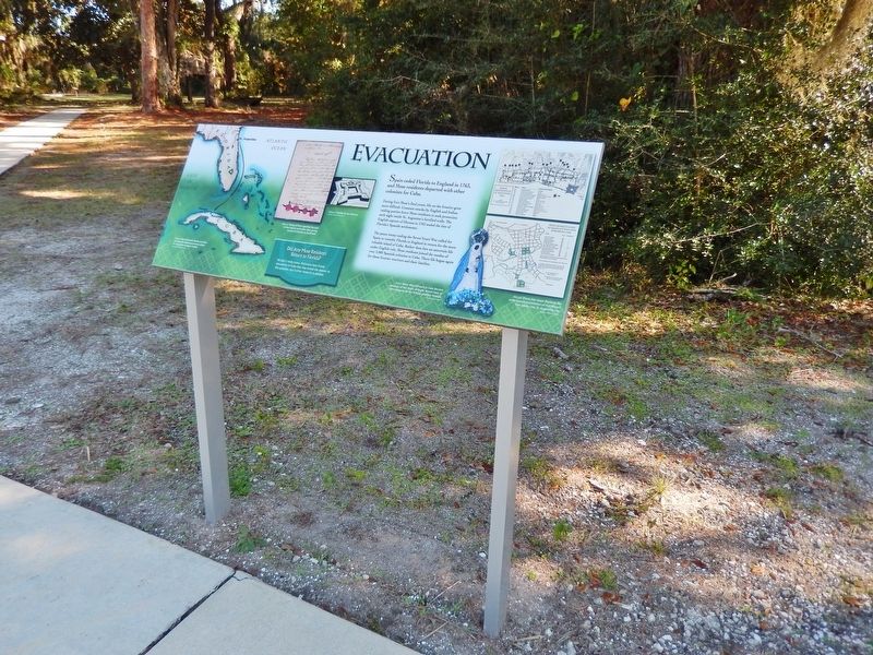
Evacuation
Fort Mose Historic State Park
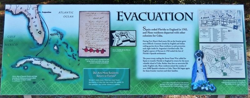
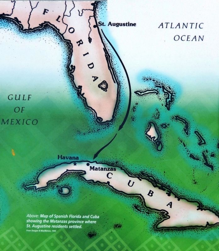
Spain ceded Florida to England in 1763, and Mose residents departed with other colonists for Cuba.
During Fort Mose's final years, life on the frontier grew more difficult. Constant attacks by English and Indian raiding parties drove Mose residents to seek protection each night inside St. Augustine's fortified walls. The English capture of Havana in 1762 sealed the fate of Florida's Spanish settlements.
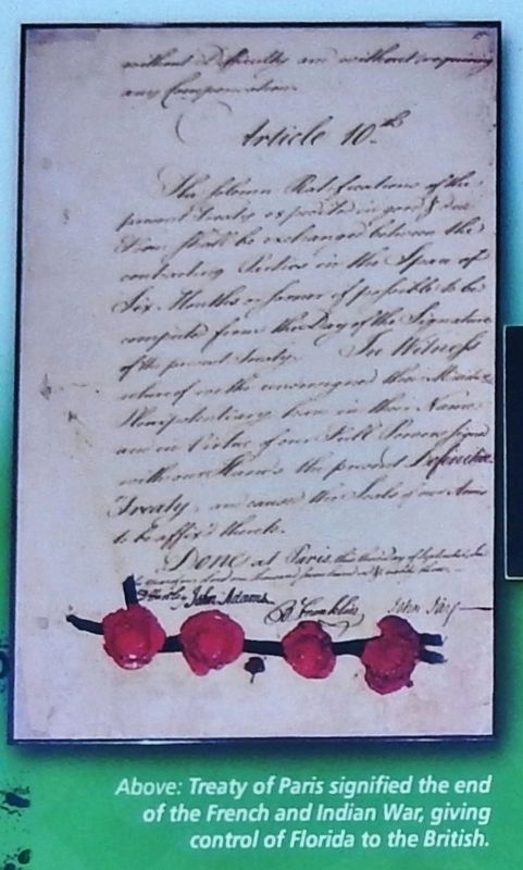
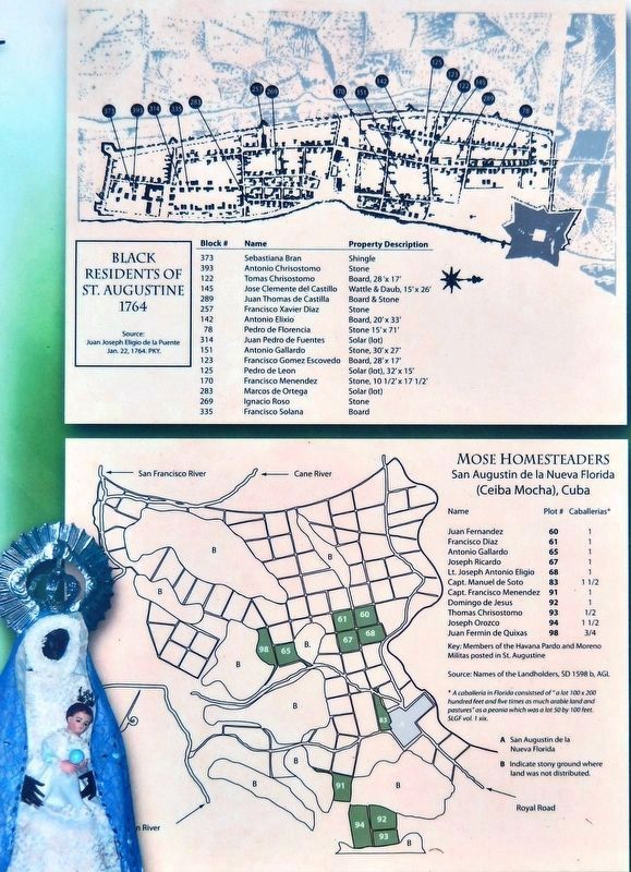
The peace treaty ending the Seven Years' War called for Spain to transfer Florida to England in return for the more valuable island of Cuba. Rather than face an uncertain life under English rule, Mose residents joined the exodus of over 3,000 Spanish colonists to Cuba. There life began again for these frontier warriors and their families.
Did Any Mose Residents Return to Florida?
We don't really know. Historians have found documents in Cuba that may reveal the answer to this question, but further research is needed.
Erected by Fort Mose Historic State Park.
Topics. This historical marker is listed in these topic lists: African Americans • Colonial Era • Forts and Castles • Settlements & Settlers. A significant historical year for this entry is 1763.
Location. 29° 55.743′ N, 81° 19.507′ W. Marker is in St. Augustine, Florida, in St. Johns County. Marker is on Fort Mose Trail, 0.2 miles east of North Ponce De Leon Boulevard (U.S. 1), on the right when traveling north. Marker is located in Fort Mose Historic State Park, beside the sidewalk leading from the parking lot to the visitor center. Touch for map. Marker is at or near this postal address: 15 Fort Mose Trail, Saint Augustine FL 32084, United States of America. Touch for directions.
Other nearby markers. At least 8 other markers are within walking distance of this marker. Fort Mose II (a few steps from this marker); Bloody Mose (a few steps from this marker); Fort Mose Site (a few steps from this marker); El Pueblo de Gracia Real de Santa Teresa de Mose (a few steps from this marker); Fort Mose I (within shouting distance of this marker); Escape & Flight (within shouting distance of this marker); British Enslavement (within shouting distance of this marker); Middle Passage (within shouting distance of this marker). Touch for a list and map of all markers in St. Augustine.
Related markers. Click here for a list of markers that are related to this marker. Fort Mose Historic State Park
Also see . . .
1. Fort Mose Historic State Park. Florida State Parks website entry (Submitted on December 3, 2018.)
2. Francisco Menéndez. Wikipedia entry:
Together with most of the Spanish colonists from St. Augustine and the Fort Mosé community, Francisco Menéndez was evacuated by the Spanish crown to Cuba. There he established a similar community called St. Augustine of the New Florida. (Submitted on December 2, 2018, by Cosmos Mariner of Cape Canaveral, Florida.)
Credits. This page was last revised on September 24, 2022. It was originally submitted on December 1, 2018, by Cosmos Mariner of Cape Canaveral, Florida. This page has been viewed 278 times since then and 14 times this year. Photos: 1. submitted on December 1, 2018, by Cosmos Mariner of Cape Canaveral, Florida. 2, 3, 4, 5. submitted on December 2, 2018, by Cosmos Mariner of Cape Canaveral, Florida. • Bernard Fisher was the editor who published this page.
