Financial District in Manhattan in New York County, New York — The American Northeast (Mid-Atlantic)
Stone Street Historic District and Colonial New York Street Plan
Exploring Downtown
Inscription.
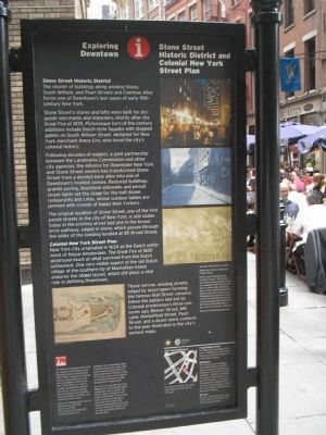
Stone Street Historic District
The cluster of buildings along winding Stone, South William, and Pearl Streets and Coenties Alley forms one of Downtown’s last oases of early 19th-century New York.
Stone Street’s stores and lofts were built for dry-goods merchants and importers, shortly after the Great Fire of 1835. Picturesque turn-of-the-century additions include Dutch-style facades with stepped gables on South William Street, designed for New York merchant Amos Eno, who loved the city’s colonial history.
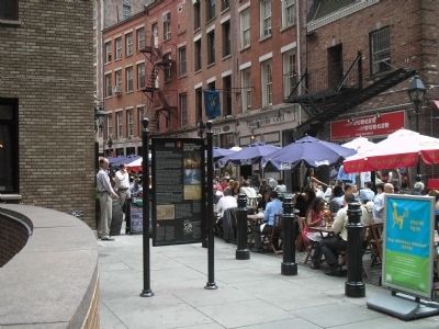
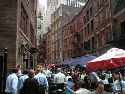
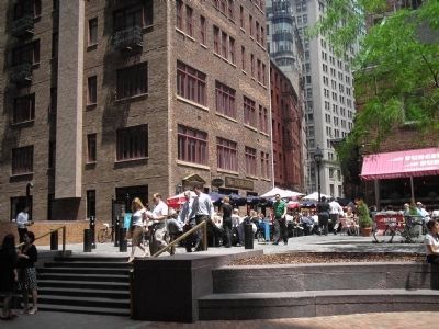
Following decades of neglect, a joint partnership between the Landmarks Commission and other city agencies, the Alliance for Downtown New York and Stone Street owners has transformed Stone Street from a derelict back alley into one of Downtown’s liveliest scenes. Restored buildings, granite paving, bluestone sidewalks and period streetlights set the stage for the half dozen restaurants and cafes, whose outdoor tables are jammed with crowds of happy New Yorkers.
The original location of Stone Street, one of the first paved streets in the city of New York, is still visible today in the existing street bed and in the brown brick pathway, edged in stone, which passes through the lobby of the building located at 85 Broad Street.
Colonial New York Street Plan
New York City originated in 1624 as the Dutch settlement of Nieuw Amsterdam. The Great Fire of 1835 destroyed much of what survived from the Dutch settlement. One very visible aspect of the old Dutch village at the southern tip of Manhattan Island endures: the street layout, which still plays a vital role in defining Downtown.
Those narrow, winding streets, edged by skyscrapers forming the famous Wall Street canyons, follow the pattern laid out by Colonial predecessors three centuries ago, Beaver Street, Mill Lane, Marketfield Street, Pearl Street, and a dozen more, conform to the plan illustrated in the city’s earliest maps.
Erected by The Alliance for Downtown New York, Inc.
Topics. This historical marker is listed in these topic lists: Colonial Era • Roads & Vehicles. A significant historical year for this entry is 1835.
Location. Marker has been reported permanently removed. It was located near 40° 42.252′ N, 74° 0.641′ W. Marker was in Manhattan, New York, in New York County. It was in the Financial District. Marker was at the intersection of Stone Street and Coenties Alley, on the right when traveling west on Stone Street. Touch for map. Marker was in this post office area: New York NY 10004, United States of America.
We have been informed that this sign or monument is no longer there and will not be replaced. This page is an archival view of what was.
Other nearby markers. At least 8 other markers are within walking distance of this location. Stone Street Historic District (here, next to this marker); Dutch Hoog Straat (a few steps from this marker); First Printing Press in the Colony of New York (within shouting distance of this marker); 57 Stone Street (within shouting distance of this marker); 13 South William Street (within shouting distance of this marker); The Archaeology of the Stadt Huys Block (within shouting distance of this marker); Fraunces Tavern Block Historic District (about 300 feet away, measured in a direct line); 75 Broad Street (about 300 feet away). Touch for a list and map of all markers in Manhattan.
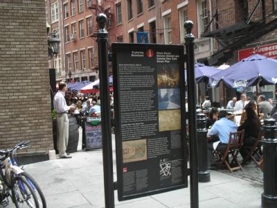
More about this marker. Several pictures appear on the marker including a photograph of Stone Street, circa 2003, a Historical photograph of Stone Street, and a 1664 illustration of Duke Street plan. Also present is a picture of lower New York engulfed in flames, with a caption of “The Great Fire of December 16 and 17, 1835 leveled over twenty Downtown blocks in the area bounded by Wall Street, Broad Street, Coenties Slip, and the East River. It took nineteen hundred firefighters, some from as far away as Philadelphia, to bring the fire under control, but not before the city had sustained property losses upwards of $40 million, bankrupting most of New York’s fire insurance companies.”
Related markers. Click here for a list of markers that are related to this marker. Take a tour of the markers in lower Manhattan erected by the Alliance for Downtown New York, Inc.
Credits. This page was last revised on January 31, 2023. It was originally submitted on June 26, 2009, by Bill Coughlin of Woodland Park, New Jersey. This page has been viewed 2,682 times since then and 26 times this year. Last updated on December 23, 2018, by Larry Gertner of New York, New York. Photos: 1, 2, 3, 4, 5. submitted on June 26, 2009, by Bill Coughlin of Woodland Park, New Jersey. • Bill Pfingsten was the editor who published this page.
