Culpeper in Culpeper County, Virginia — The American South (Mid-Atlantic)
Mountain Run Watershed
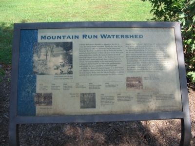
In 1954, the Town of Culpeper engaged in its most important planning project to date - the preservation and control of its water supply. Public Law 566 allowed localities to partner with the U.S. Soil and Conservation Service (SCS) to protect property from floods and water damage and to create municipal water supplies and watershed protection programs.
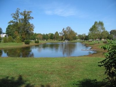
With help from the SCS, the Culpeper National Bank, and the Second National Bank, the Town of Culpeper decided to use the new Federal law to improve its water supply. A new entity was also formed, the Culpeper Soil Conservation District would be the basis of Culpeper's move toward a better use of Mountain Run. Soon the small stream channel was cleared and three lakes were built. Of the later, two were for food control while the third served as a water supply for the town. Today, Yowell Meadow Park is an example of the Town of Culpeper's achievements in water control. Once a continual flood hazard, Yowell Meadow Park is a safe and green environment for visitors from everywhere to enjoy.
Topics. This historical marker is listed in this topic list: Natural Features. A significant historical year for this entry is 1954.
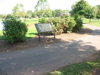
Location. 38° 28.449′ N, 78° 0.037′ W. Marker is in Culpeper, Virginia, in Culpeper County. Marker can be reached from North Blue Ridge Avenue, on the right when traveling south. Located along the Yowell Meadow Park loop trail. Touch for map. Marker is in this post office area: Culpeper VA 22701, United States of America. Touch for directions.
Other nearby markers. At least 8 other markers are within walking distance of this marker. The Revolutionary War (about 500 feet away, measured in a direct line); Major Gabriel Long (about 500 feet away); The Civil War (about 500 feet away); Yowell Meadow Park (about 600 feet away); Historic Antioch Baptist Church (approx. 0.2 miles away); Vietnam War Memorial (approx. 0.2 miles away); The Blair Property and Sugar Bottom (approx. 0.2 miles away); Confederate Memorial (approx. 0.2 miles away). Touch for a list and map of all markers in Culpeper.
More about this marker. On the left is a photo of Yowell's Bottom after five days of rain in late September, 1975. At the bottom of the marker are photos of Mountain Run Lake and Mountain Run Spring.
At the bottom of the marker is a timeline of events:
1923 - Severe flooding of Mountain Run Watershed.
1938 - Severe flooding of Mountain Run Watershed.
1939 - Severe flooding of Mountain Run Watershed.
1954 - Public Law 566 passed by Congress.
1958 - SCS & Town of Culpeper create Mountain Run Watershed Work Plan.
1961 - First Phase Mountain Run Watershed complete.
1966 - After a period of growth in Culpeper, the wast water plan was supplemented to provide 100 year level flood protection and 1,000 additional acres of water storage.
1982 - Special project conducted in Mountain Run West area which included the implementation of agricultural developments.
1987 - Recommendations made that a comprehensive management plan be developed by the Rapidan-Rappahannock Planning District Commission and the Town of Culpeper.
1988 - Recommendations made for vegetative drain buffers, [illegible] application of arresting erosion, sedimentary controls, and an [illegible] water quality monitoring program.
Credits. This page was last revised on June 16, 2016. It was originally submitted on October 21, 2008, by Craig Swain of Leesburg, Virginia. This page has been viewed 1,432 times since then and 38 times this year. Photos: 1, 2, 3. submitted on October 21, 2008, by Craig Swain of Leesburg, Virginia.


