Near Williamsburg in James City County, Virginia — The American South (Mid-Atlantic)
Statehouse Foundations
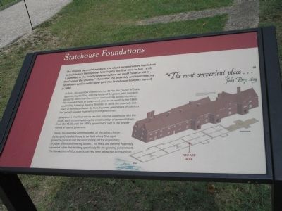
In 1643, the assembly divided into two bodies, the Council of State, appointed by the King, and the House of Burgesses, with members elected by voters from Jamestown and counties across the colony. This bicameral form of government grew to its zenith by the 1660s and 1670s. Following Bacon’s Rebellion in 1676, the assembly lost much of its independence. By then, however, generations of colonists had gained valuable experience in self-government.
Jamestown’s church served as the first informal statehouse into the 1630s, easily accommodating the small number of representatives. From the 1630s until the 1660s, government met in the private homes of several governors.
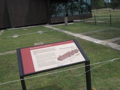
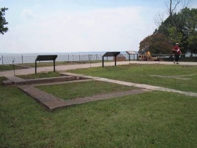
Finally, the assembly commissioned “at the public charge … [to support] a public house to be built where [the royal governor-general] and the council may sitt for dispatching of public affairs and hearing causes.” In 1665, the General Assemble convened in the first building specifically for the growing government. The foundations of that statehouse rest here below the Archaearium.
"The most convenient place … " – John Pory, 1619
Erected by Colonial National Historic Park.
Topics. This historical marker is listed in these topic lists: Colonial Era • Notable Buildings. A significant historical month for this entry is July 1619.
Location. 37° 12.629′ N, 76° 46.835′ W. Marker is near Williamsburg, Virginia, in James City County. Marker can be reached from Colonial Parkway, on the right when traveling west. Marker is in the "Old Towne" section of the Historic Jamestown unit of Colonial National Historic Park. Touch for map. Marker is in this post office area: Williamsburg VA 23185, United States of America. Touch for directions.
Other nearby markers. At least 8 other markers are within walking distance of this marker. The Statehouse (here, next to this marker); The English Inns of Court (here, next to this marker); These Foundations (a few steps from this marker); The Archaearium (a few steps from this marker); In Memory of Early Settlers (within shouting distance of this marker); Sealing of the Magna Carta (about 300 feet away, measured in a direct line); The Site of the First Landing (about 300 feet away); Robert Hunt (about 500 feet away). Touch for a list and map of all markers in Williamsburg.
More about this marker. The right side of the marker contains a diagram of the foundations with the location of the marker indicated. Above this is a picture of what the statehouse looked like.
Also see . . .
1. Historic Jamestowne. Colonial National Historic Park from National Park Service website. (Submitted on March 15, 2009, by Bill Coughlin of Woodland Park, New Jersey.)
2. Historic Jamestowne. Historic Jamestowne is the site of the first permanent English settlement in America. The site is jointly administered by APVA Preservation Virginia and the National Park Service. (Submitted on March 15, 2009, by Bill Coughlin of Woodland Park, New Jersey.)
Credits. This page was last revised on January 10, 2019. It was originally submitted on March 15, 2009, by Bill Coughlin of Woodland Park, New Jersey. This page has been viewed 680 times since then and 19 times this year. Last updated on January 10, 2019, by Bruce Guthrie of Silver Spring, Maryland. Photos: 1, 2, 3, 4. submitted on March 15, 2009, by Bill Coughlin of Woodland Park, New Jersey. • Andrew Ruppenstein was the editor who published this page.


