Dover in Kent, England, United Kingdom — Northwestern Europe (the British Isles)
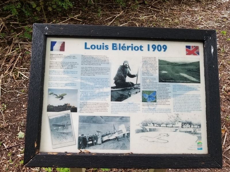
Louis Blériot 1909
(b.July 1, Cambrai, France 1872; d.August 2, 1936), graduated from École Centrale Paris with a degree in engineering.
At 30 he taught himself to fly in an aircraft of his own design, his skills as a pilot and designer improving by trial and error. In 1907 he made his first short flight at Bagatelle, France in the ‘Bleriot V’ and in 1908 had his first real success in 1908 with the ‘Bleriot VIII’.
Blériot became famous for being the first to fly an aircraft across the English Channel. On July 25, 1909, in his Model XI 25 horsepower monoplane, he flew from Les Barraques, France to Dover. This 27 mile flight, that took approximately 37 minutes, and ended with a crash landing in Northfall meadow, won him the much sought after London Daily Mail prize of £1000.
In the 1914-1918 War his company produced the famous S.P.A.D. fighter aircraft flown by all the Allied Nations. His skill and ingenuity contributed to the advance of aviation technology in his time, and popularised aviation as a sport. He remained active in the aviation industry until his death on August 2, 1936.
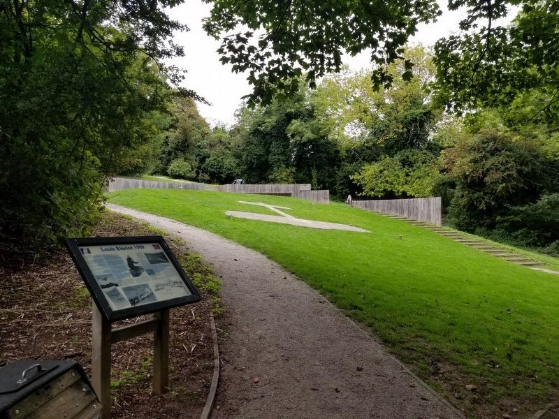
The Aero Club of the United Kingdom (now the Royal Aero Club) commemorated Blériot's achievement with a monument placed at the site of his landing in North Fall Meadow, just behind Dover Castle. The monument, a stone silhouette of Bleriot's aeroplane constructed of granite blocks, was presented to the club by one of its members - Mr. A. Duckham.
To commemorate the 100th anniversary of Bleriot's flight this memorial has now been re-presented. Access has been improved by creating a series of chalk 'vapour trail' paths to and from the memorial. A new oak retaining wall frames the memorial and new oak seating provides visitors with a new vantage point from which to appreciate the memorial and views of Dover castle.
Dover District Council has transformed the memorial's setting, to put Bleriot's momentous achievement back on the map and on the tourist trail. Encroaching scrub has been cleared from around the memorial itself and a newly created area of chalk grassland will be re-established. Restoration of this habitat (found only on the North and South Downs) is also being tested on another site nearby.
Chalk grassland can be incredibly rich in plant and insect life, supporting up to 40 species per square metre.These include the Pyramidal Orchid (Anacamptis pyramidalis) and the Adonis Blue butterfly (Polyommatus bellargus).
Topics. This historical marker is listed in this topic list: Air & Space. A significant historical date for this entry is July 1, 1872.
Location. 51° 7.863′ N, 1° 19.542′ E. Marker is in Dover, England, in Kent.
Marker can be reached from Upper Road. Marker is in a wooded area less than 0.1 mile northeast of Dover Castle and is accessible via a path through the woods from Upper Road. Touch for map. Marker is in this post office area: Dover, England CT16 1HP, United Kingdom. Touch for directions.
Other nearby markers. At least 8 other markers are within walking distance of this marker. Blériot’s 1909 Landing Site (a few steps from this marker); Arthur’s Hall (approx. 0.3 kilometers away); Buildings of Dover Castle (approx. 0.3 kilometers away); Medieval Dover (approx. 0.4 kilometers away); Dover’s early history (approx. 0.4 kilometers away); Dover’s defences (approx. 0.4 kilometers away); Command, Control and Communication (approx. half a kilometer away); Saluting Platform (approx. half a kilometer away). Touch for a list and map of all markers in Dover.
Also see . . . Louis Blériot on Wikipedia. (Submitted on January 13, 2019, by Michael Herrick of Southbury, Connecticut.)
Credits. This page was last revised on January 27, 2022. It was originally submitted on January 13, 2019, by Michael Herrick of Southbury, Connecticut. This page has been viewed 214 times since then and 14 times this year. Photos: 1, 2. submitted on January 13, 2019, by Michael Herrick of Southbury, Connecticut.

