Civic Center in Manhattan in New York County, New York — The American Northeast (Mid-Atlantic)
Foley Square c. 1800
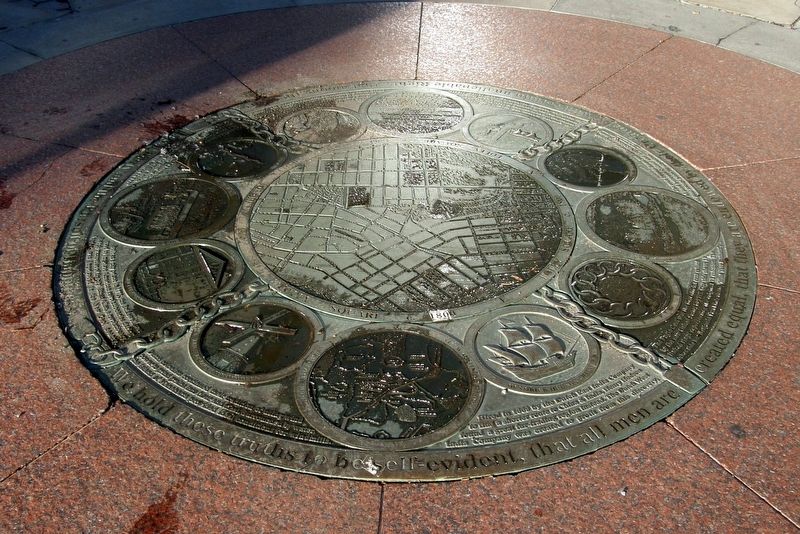
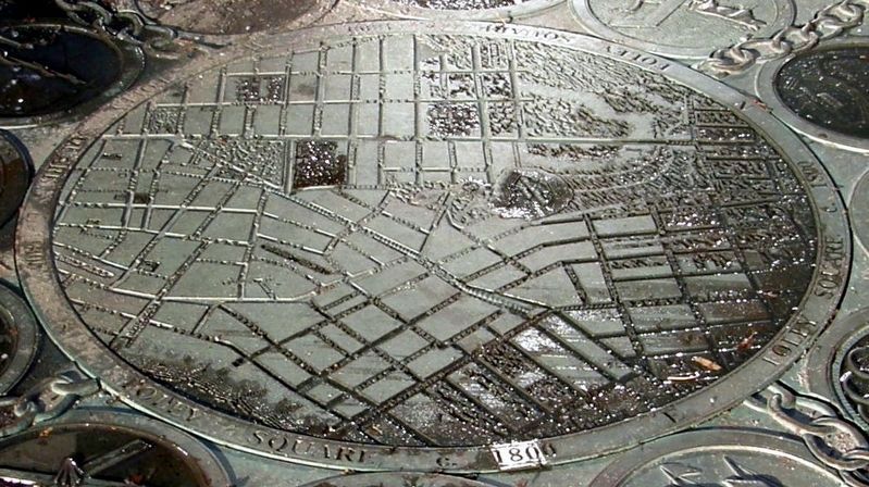
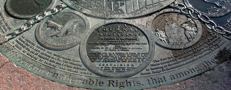
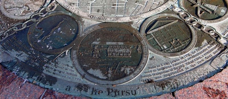
Foley Square c. 1800 consists of a central medallion surrounded by four segments of three medallions.
Central medallion: Map of Foley Square c. 1800
Around the perimeter: We hold these truths to be self-evident, that all men are created equal, that they are endowed by their Creator with certain Unalienable Rights, that among these are Life, Liberty and the Pursuit of Happiness.
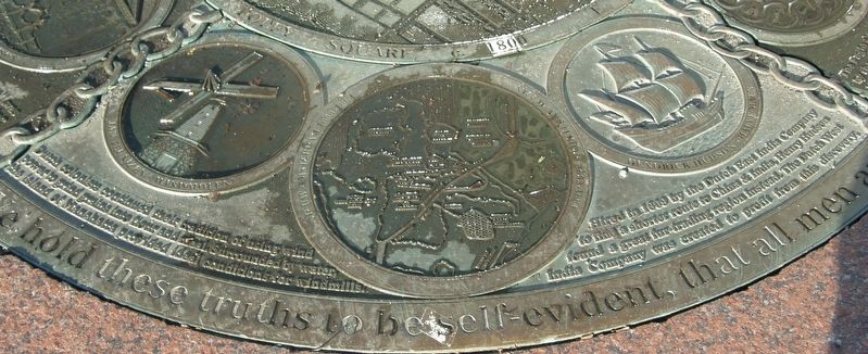
Segment One
Medallion One: Jan Teunizen – Windmolen
Dutch colonists continued their tradition of using wind power to grind grains into flour and meal. Surrounded by water, the island of Manhattan provided ideal conditions for windmills.
Medallion Two: Nieuw Amsterdam 1653-1664
Medallion Three: Hendrick Hudson – Halve Maen
Hired in 1609 by the Dutch East India Company to find a shorter route to China & India, Henry Hudson found a great fur-trading region instead. The Dutch West India Company was created to profit from this discovery.
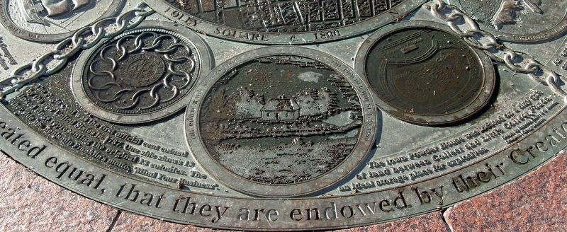
Segment Two:
Medallion One: The Fugio Cent was the first official cent coined by the new United States in 1787. One side shows 13 linked rings representing the original 13 colonies. The other side has Benjamin Franklin’s motto, “Mind Your Business”.
Medallion Two: The Powder House 1728-1789
Medallion Three: The town Powder House was located on a tiny spit of land between Collect and Little Collect Ponds, an Ideal storage place for explosives.
Segment Three:
Medallion One: Hangings at the Powder House gibbet
An unsolved robbery and unexplained fires caused fears of a slave uprising in 1741. The resulting conspiracy trial put 32 enslaved men and 3 white colonists to death by hanging or burning, and exiled others. Medallion Two: The Panic of 1741 - The Great New York Conspiracy
Medallion Three: Burning at the stake
The Powder House gibbet was the site of the “Slave Conspiracy” executions by hanging. Executions by burning at the stake occurred further east on Magazine Street. Judge D. Horsmanden described the events in his journal.
Segment Four:
Medallion One: George III, Pitt & Liberty - Liberty Pole 1766
The first Liberty Pole was erected in 1766 on the Town Common to celebrate the repeal of the Stamp Act. More poles were erected to protest British dominion until the new nation was created in 1776.
Medallion Two: The American Revolutionary War 1775-1783 – The mustering of troops on The Commons
Medallion Three: Bridewell Prison
Built as a city prison in 1775, the Bridewell was used to imprison American revolutionaries during British occupation of the city. Ethan Allen, a revolutionary leader, was imprisoned in the New Gaol nearby.
Topics. This historical marker is listed in these topic lists: African Americans • Colonial Era • Government & Politics • Settlements & Settlers. A significant historical year for this entry is 1800.
Location. 40° 42.88′ N, 74° 0.179′ W. Marker is in Manhattan, New York, in New York County. It is in Civic Center. Marker can be reached from Lafayette Street near Duane Street, on the left when traveling south. Touch for map. Marker is in this post office area: New York NY 10007, United States of America. Touch for directions.
Other nearby markers. At least 8 other markers are within walking distance of this marker. Thomas Paine Park (a few steps from this marker); Triumph of the Human Spirit (within shouting distance of this marker); Foley Square c. 1880 (within shouting distance of this marker); Judge Walter R. Mansfield Memorial (within shouting distance of this marker); Foley Square c. 1730 (within shouting distance of this marker); Abraham De Peyster (within shouting distance of this marker); New York County Court House (within shouting distance of this marker); African Burial Ground (about 300 feet away, measured in a direct line). Touch for a list and map of all markers in Manhattan.
More about this marker. The marker is set into the pavement.
Credits. This page was last revised on January 31, 2023. It was originally submitted on January 14, 2019, by Larry Gertner of New York, New York. This page has been viewed 259 times since then and 27 times this year. Photos: 1, 2, 3, 4, 5, 6. submitted on January 14, 2019, by Larry Gertner of New York, New York. • Bill Pfingsten was the editor who published this page.
