NoMa/Sursum Corda in Northwest Washington in Washington, District of Columbia — The American Northeast (Mid-Atlantic)
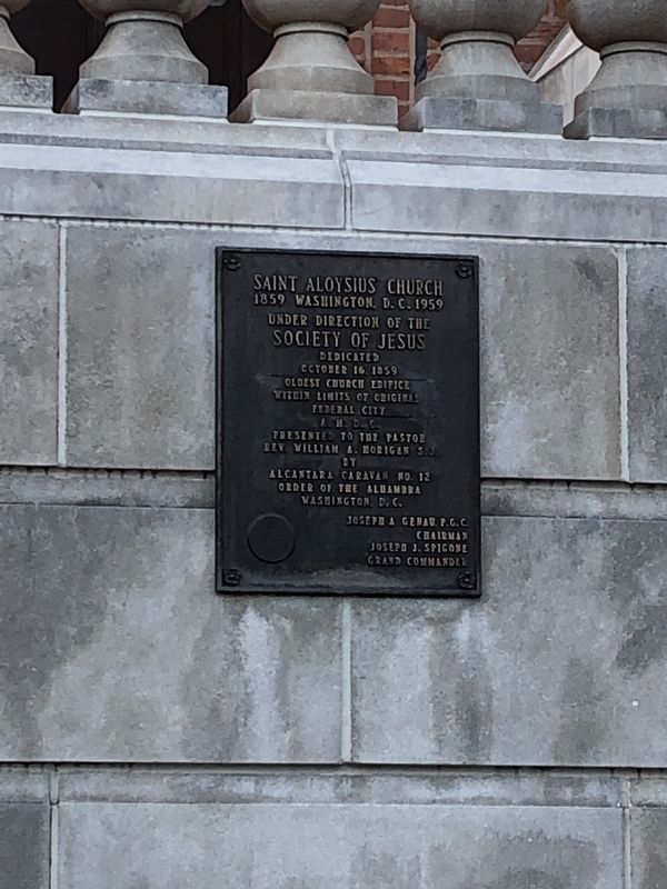
Saint Aloysius Church
1859 Washington, D.C. 1959
Under direction of the
Society of Jesus
Dedicated
October 16, 1859
Oldest church edifice
within limits of original
Federal City
A. M. D. C.
presented to the pastor
Rev. William A. Morgan S.J.
by
Alcantara Caravan No. 12
Order of the Alhambra
Washington, D.C.
Joseph A. Genau, P. G. C.
Chairman
Joseph J. Spigone
Grand Commander
Erected 1959 by Alcantara Caravan No. 12, Order of the Alhambra, Washington, D.C.
Topics. This historical marker is listed in this topic list: Churches & Religion. A significant historical date for this entry is October 16, 1859.
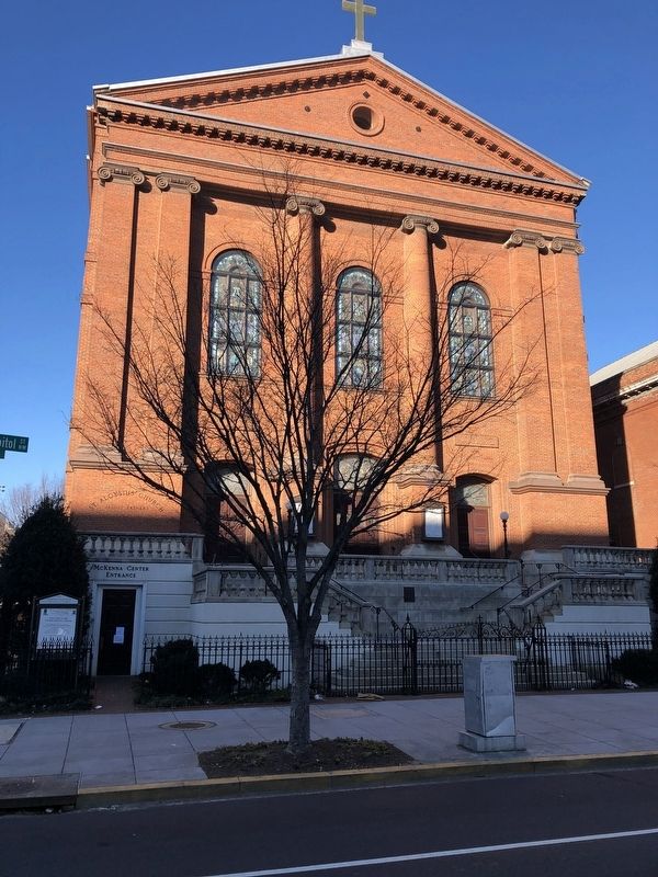
Location. 38° 54.094′ N, 77° 0.56′ W. Marker is in Northwest Washington in Washington, District of Columbia. It is in NoMa/Sursum Corda. Marker is on North Capitol Street Northwest south of K Street Northwest, on the right when traveling south. Touch for map. Marker is at or near this postal address: 19 Eye Street Northwest, Washington DC 20002, United States of America. Touch for directions.
Other nearby markers. At least 8 other markers are within walking distance of this marker. Gonzaga College High School (a few steps from this marker); Victims of Communism Memorial (approx. ¼ mile away); a different marker also named Victims of Communism Memorial (approx. ¼ mile away); Famine-Genocide in Ukraine (approx. 0.3 miles away); Second Baptist Church (approx. 0.3 miles away); Workers Memorial Day (approx. 0.3 miles away); Votes for Women (approx. 0.3 miles away); U.S. Reservation 196 (approx. 0.4 miles away). Touch for a list and map of all markers in Northwest Washington.
More about this marker. The northern border of the historic City of Washington is at what is now known as Florida Avenue (known as Boundary Street prior to 1890). North Capitol Street was originally designed to divide the Northeast and Northwest quadrants of DC, leading directly north from the U.S. Capitol Building.
In 1871, the boundaries of the City of Washington were dissolved along with Georgetown's and Washington County's. Since then, the District of Columbia has had one unified territorial government. Since the church was built in 1859, it was built within the City of Washington when it existed.
Also see . . . St. Aloysius Church (Washington, D.C.). Wikipedia article about the church (Submitted on January 21, 2019, by Devry Becker Jones of Washington, District of Columbia.)
Credits. This page was last revised on January 30, 2023. It was originally submitted on January 21, 2019, by Devry Becker Jones of Washington, District of Columbia. This page has been viewed 150 times since then and 19 times this year. Last updated on January 23, 2019, by Devry Becker Jones of Washington, District of Columbia. Photos: 1, 2. submitted on January 21, 2019, by Devry Becker Jones of Washington, District of Columbia. • Andrew Ruppenstein was the editor who published this page.

