Old Town West in Alexandria, Virginia — The American South (Mid-Atlantic)
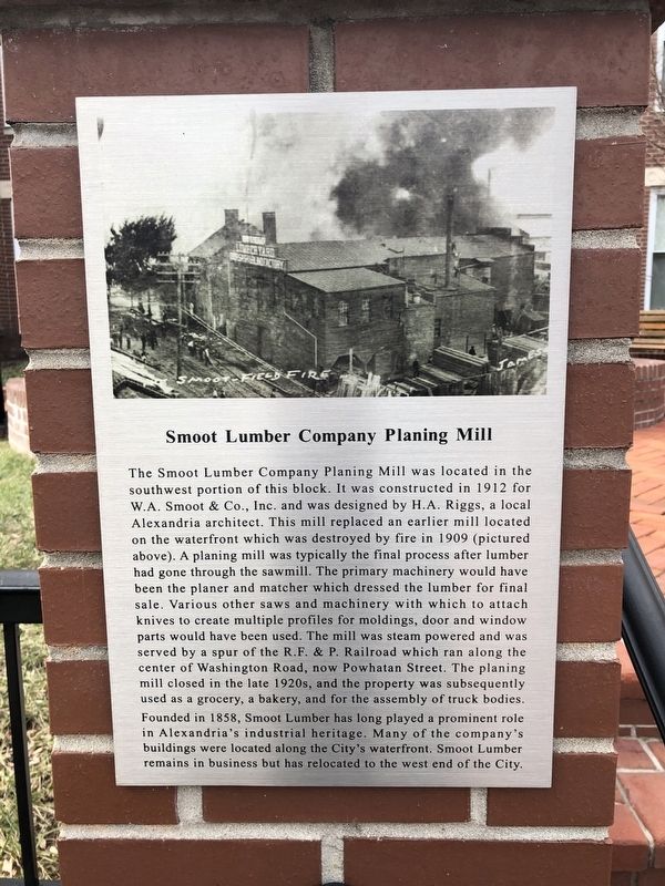
Smoot Lumber Company Planing Mill

Photographed By Devry Becker Jones (CC0), January 26, 2019
1. Smoot Lumber Company Planing Mill Marker
The Smoot Lumber Company Planing Mill was located in the southwest portion of this block. It was constructed in 1912 with W.A. Smoot & Co., Inc. and was designed by H.A. Riggs, a local Alexandria architect. This mill replaced an earlier mill located on the waterfront which was destroyed by fire in 1909 (pictured above). A planing mill was typically the final process after lumber had gone through the sawmill. The primary machinery would have been the planer and matcher which dressed the lumber for final sale. Various other saws and machinery with which to attach knives to create multiple profiles for moldings, door and window parts would have been used. The mill was steam powered and was served by a spur of the R.F. & P. Railroad which ran along the center of Washington Road, now Powhatan Street. The planing mill closed in the late 1920s, and the property was subsequently used as a grocery, a bakery, and for the assembly of truck bodies.
Founded in 1858, Smoot Lumber has long played a prominent role in Alexandria's industrial heritage. Many of the company's buildings were located along the City's waterfront. Smoot Lumber remains in business but has relocated to the west end of the City.
Topics. This historical marker is listed in this topic list: Industry & Commerce. A significant historical year for this entry is 1912.
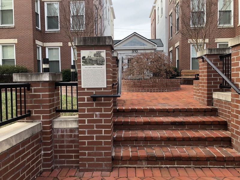
Location. 38° 48.878′ N, 77° 2.736′ W. Marker is in Alexandria, Virginia. It is in Old Town West. Marker is on Powhatan Street west of North Washington Street (Virginia Route 400), on the right when traveling south. The marker stands in the Old Town West neighborhood of Alexandria. Touch for map. Marker is at or near this postal address: 910 Powhatan Street, Alexandria VA 22314, United States of America. Touch for directions.
Other nearby markers. At least 8 other markers are within walking distance of this marker. James Bland Homes (about 500 feet away, measured in a direct line); The Hump: Open Lots For Blocks (about 500 feet away); Alexandria Canal Turning Basin (about 700 feet away); The Tale of Spa Spring (approx. 0.2 miles away); Remnants of Lock #4 of the Alexandria Canal (approx. 0.2 miles away); Saint Joseph's Church (approx. 0.2 miles away); The Student-Athletes of Parker-Gray High School (approx. 0.2 miles away); The Memorial Pool (approx. 0.2 miles away). Touch for a list and map of all markers in Alexandria.

Photographed By Devry Becker Jones (CC0), January 26, 2019
2. Smoot Lumber Company Planing Mill Marker
Credits. This page was last revised on January 28, 2023. It was originally submitted on January 27, 2019, by Devry Becker Jones of Washington, District of Columbia. This page has been viewed 722 times since then and 84 times this year. Photos: 1, 2. submitted on January 27, 2019, by Devry Becker Jones of Washington, District of Columbia. • Bill Pfingsten was the editor who published this page.