Tribeca in Manhattan in New York County, New York — The American Northeast (Mid-Atlantic)
Finn Square
.1 acre
.1 acre
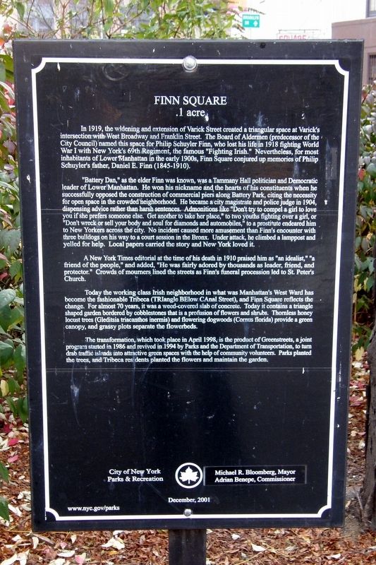
In 1919, the widening and extension of Varick Street created a triangular space at Varickís intersection with West Broadway and Franklin Street. The Board of Aldermen (predecessor of the City Council) named the space for Philip Schuyler Finn, who lost his life in 1918 fighting World War I with New Yorkís 69th Regiment, the famous “Fighting Irish.” Nevertheless, for most inhabitants of Lower Manhattan in the early 1900s, Finn Square conjured up memories of Philip Schuylerís father, Daniel E. Finn (1845-1910).
“Battery Dan” as the older Finn was known, was a Tammany Hall Politician and Democratic leader of Lower Manhattan. He won his nickname and the hearts of his constituents when he successfully opposed the construction of commercial piers along Battery Park, citing the necessity for open space in the crowded neighborhood. He became a city magistrate and police judge in 1904, dispensing advice rather than harsh sentence. Admonitions like “Donít try to compel a girl to love you if she loves someone else. Get another to take her place,” to two youths fighting over a girl, or “Donít wreck or sell your body and soul for diamonds and automobiles,” to a prostitute endeared him to New Yorkers across the city. No incident caused more amusement than Finnís encounter with three bulldogs on his way to a court session in the Bronx. Under attack, he climbed a lamppost and yelled for help. Local papers carried the story and New York loved it.
A New York Times editorial at the time of his death in 1910 praised him as “an idealist,” “a friend of the people,” and added, “He was fairly adored by thousands as leader, friend, a protector.” Crowds of mourners lined the streets as Finnís funeral procession ked to St. Peterís Church.
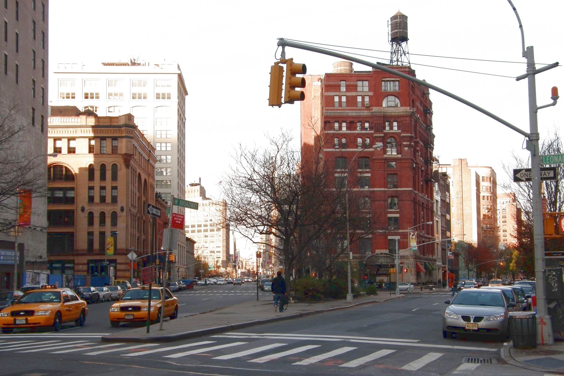
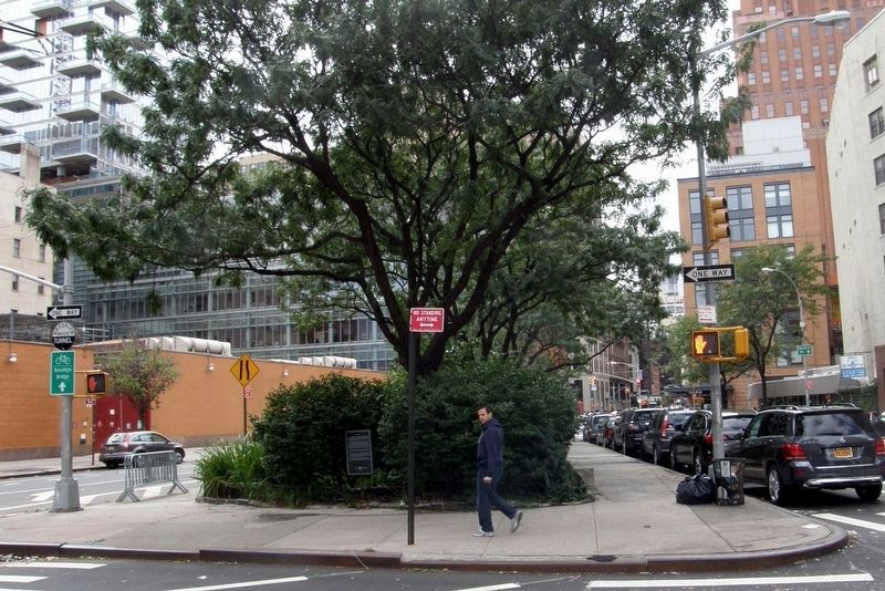
Today the working class Irish neighborhood in what was Manhattanís West Ward has become the fashionable Tribeca (TRiangle BElow CAnal Street), and Finn Square reflects the change. For almost 70 years, it was a weed-cover slab of concrete. Today it contains a triangle shaped garden bordered by cobblestones that is a profusion of flowers and shrubs. Thornless honey locust trees (Gleditsia triacanthos inermis) and flowering dogwoods (Cornus florida) provide a green canopy, and grassy plots separate the flowerbeds.
The transformation, which took place in April 1998, is the product of Greenstreets, a joint program started in 1986 and revived in 1994 by Parks and the Department of Transportation, to turn drab traffic islands into attractive green spaces with the help of community volunteers. Parks planted the trees, and Tribeca residents planted the flowers
and maintain the garden
City of New York Parks and Recreation
Michael R. Bloomberg, Mayor
Adrian Benepe, Commissioner
December, 2001
www.nyc.gov/parks
Erected 2001 by City of New York Parks and Recreation.
Topics. This historical marker is listed in these topic lists: Government & Politics • Parks & Recreational Areas. A significant historical month for this entry is April 1998.
Location. 40° 43.133′ N, 74° 0.406′ W. Marker is in Manhattan, New York, in New York County. It is in Tribeca. Marker is on Franklin Street near Varick Street, on the right when traveling east. Touch for map. Marker is in this post office area: New York NY 10013, United States of America. Touch for directions.
Other nearby markers. At least 8 other markers are within walking distance of this marker. Barnett Newman Triangle (about 500 feet away, measured in a direct line); Headquarters (about 600 feet away); New York Mercantile Exchange (about 700 feet away); Terrarium (about 800 feet away); 85 Leonard Street (about 800 feet away); 55 White Street (approx. 0.2 miles away); Duane Park (approx. 0.2 miles away); a different marker also named Duane Park (approx. 0.2 miles away). Touch for a list and map of all markers in Manhattan.
Regarding Finn Square. The text incorrectly refers to New York's 69th Regiment as the "Fighting Irish" rather than the "Fighting 69th".
Also see . . .
Finn Square, Tribeca subsection. "Forgotten NY" entry. (Submitted on April 9, 2020, by Larry Gertner of New York, New York.)
Credits. This page was last revised on January 31, 2023. It was originally submitted on February 1, 2019, by Larry Gertner of New York, New York. This page has been viewed 242 times since then and 22 times this year. Photos: 1, 2. submitted on February 1, 2019, by Larry Gertner of New York, New York. 3. submitted on November 21, 2020, by Larry Gertner of New York, New York. 4. submitted on February 1, 2019, by Larry Gertner of New York, New York. • Andrew Ruppenstein was the editor who published this page.


