Near Forks in Clallam County, Washington — The American West (Northwest)
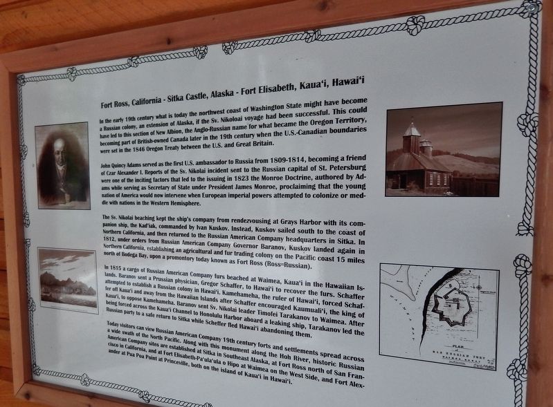
Fort Ross, California - Sitka Castle, Alaska - Fort Elisabeth, Kaua’i, Hawai’i
John Quincy Adams served as the first U.S. ambassador to Russia from 1809-1814, becoming a friend of Czar Alexander I. Reports of the Sv. Nikolai incident sent to the Russian capital of St. Petersburg were one of the inciting factors that led to the issuing in 1823 of the Monroe Doctrine, authored by Adams while serving as Secretary of State under President James Monroe, proclaiming that the young nation of America would now intervene when European imperial powers attempted to colonize or meddle with nations in the Western hemisphere.
The Sv. Nikolai beaching kept the ship’s company from rendezvousing at Grays Harbor with its companion ship, the Kad’iak, commanded by Ivan Kuskov. Instead, Kuskov sailed south to the coast of Northern California, and then returned to the Russian American Company headquarters in Sitka. In 1812, under orders from Russian American Company Governor Baranov, Kuskov landed again in Northern California, establishing an agricultural and fur trading colony on the Pacific coast 15 miles north of Bodega Bay, upon a promontory today known as Fort Ross (Ross=Russian).
In 1815, a cargo of Russian American Company furs beached a Waimea, Kaua’i in the Hawaiian Islands. Baranov sent a Prussian physician, Gregor Schaffer, to Hawai’i to recover the furs. Schaffer attempted to establish a Russian colony in Hawai’i. Kamehameha, the ruler of Hawai’i, forced Schaffer off Kaua’i and away from the Hawaiian Islands after Schaffer encouraged Kaumuali’i, the king of Kaua’i, to oppose Kamehameha. Baranov sent Sv. Nikolai leader Timofei Tarakanov to Waimea. After being forced across the Kaua’i Channel to Honolulu Harbor aboard a leaking ship, Tarakanov led the Russian party to a safe return to Sitka while Schaffer fled Hawai’i abandoning them.
Today visitors can view Russian American Company 19th century forts and settlements spread across a wide swath of the North Pacific. Along with this monument along the Hoh River, historic Russian American Company sites are established at Sitka in Southeast Alaska, at Fort Ross north of San Francisco in California, and at Fort Elisabeth-Pa’ula’ula o Hipo at Waimea on the West Side, and Fort Alexander at Pua Poa Point at Princeville, both on the island
of Kaua’i in Hawai’i.
Erected 2015 by Association of Washington Generals, The Peterson Family, State of Washington, State of Alaska, and American Legion Post 106.
Topics and series. This historical marker is listed in these topic lists: Colonial Era • Industry & Commerce • Notable Places • Settlements & Settlers. In addition, it is included in the Former U.S. Presidents: #05 James Monroe, and the Former U.S. Presidents: #06 John Quincy Adams series lists.
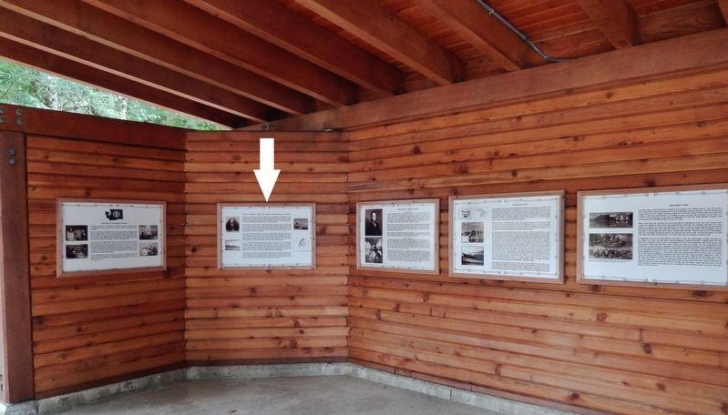
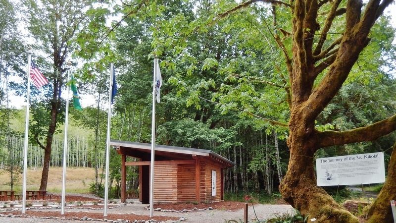
Location. 47° 49.021′ N, 124° 9.127′ W. Marker is near Forks, Washington, in Clallam County. Marker can be reached from Upper Hoh Road, 0.1 miles east of Linder Creek Lane, on the left when traveling east. Marker is located in the "Journey of the Sv. Nikolai" interpretive kiosk, on the north side of Upper Hoh Road. Touch for map. Marker is at or near this postal address: 5833 Upper Hoh Road, Forks WA 98331, United States of America. Touch for directions.
Other nearby markers. At least 7 other markers are within 9 miles of this marker, measured as the crow flies. Anna Petrovna - Timothei Tarakanov (here, next to this marker); Makah Indian Tribe (here, next to this marker); Hoh Indian Tribe (here, next to this marker); Escape to the Hoh River Leads to Captivity (here, next to this marker); Sv. Nikolai Mission (here, next to this marker); Quileute Indian Tribe (here, next to this marker); Rain Forest Monarch (approx. 8.4 miles away).
More about this marker. Marker is a framed interpretive panel mounted at eye-level on the kiosk wall. This monument commemorates the 1808 expedition of the Russian American Company sailing vessel Sv. Nikolai and its crew of 22 explorers who were stranded when their 45-foot schooner went aground on the Pacific Coast north of the Quillayute River.
Related markers. Click here for a list of markers that are related to this marker. The Journey of the Sv. Nikolai
Also see . . .
1. Fort Ross, California. Fort Ross (Russian: Форт-Росс), originally Fortress Ross (Russian: Крѣпость Россъ, tr. Krepostʹ Ross), is a former Russian establishment on the west coast of North America in what is now Sonoma County, California. It was the hub of the southernmost Russian settlements in North America from 1812 to 1842. In the early nineteenth century, Spanish and Russian expansion met along the coast of Spanish Alta California, with Russia pushing south and Spain pushing north. By that time, British and American fur trade companies had also established a coastal presence, in the Pacific Northwest. Fort Ross is now a part of Fort Ross State Historic Park, open to the public. (Submitted on February 6, 2019, by Cosmos Mariner of Cape Canaveral, Florida.)
2. Castle Hill, Sitka Alaska. Alexander Baranov, a leading figure in the Russian-American Company, arrived in the Sitka area in 1795, and sought to establish a trading post on the hill. In 1867, after the Alaska Purchase was negotiated, Russian Alaska was formally transferred to the United States in a ceremony held on Castle Hill. In 1898 the hill was transferred to the United States Department of Agriculture, which built a structure on the hill which served as its Alaska headquarters until 1932. This building was then used for a variety of commercial purposes before it was demolished in 1955. The site was then designated a territorial park. When Alaska was admitted as the 49th U.S. state in 1959, Castle Hill was the location where the first 49-star U.S. flag in Alaska was raised. (Submitted on February 6, 2019, by Cosmos Mariner of Cape Canaveral, Florida.)
3. Russian Fort Elizabeth. Russian Fort Elizabeth is a National Historic Landmark and is administered as the Russian Fort Elizabeth State Historical Park just southeast of present-day Waimea on the island of Kauaʻi in Hawaiʻi. It is located at the site of the former Fort Elizabety (Russian: Форт Елизаветы), the last remaining Russian fort on the Hawaiian islands, built in the early 19th century by the Russian-American Company as the result of an alliance with High Chief Kaumualiʻi. The star fort was employed by the Kingdom of Hawaii in the 19th century under the name Fort Hipo (Hawaiian: Paʻulaʻula o Hipo). (Submitted on February 6, 2019, by Cosmos Mariner of Cape Canaveral, Florida.)
Credits. This page was last revised on February 6, 2019. It was originally submitted on February 5, 2019, by Cosmos Mariner of Cape Canaveral, Florida. This page has been viewed 348 times since then and 18 times this year. Photos: 1, 2, 3. submitted on February 6, 2019, by Cosmos Mariner of Cape Canaveral, Florida. • Andrew Ruppenstein was the editor who published this page.


