Near Soda Springs in Nevada County, California — The American West (Pacific Coastal)
Lake Van Norden Dam
Hwy 40 Scenic Bypass

Photographed By Barry Swackhamer, April 26, 2018
1. Lake Van Norden Dam Marker
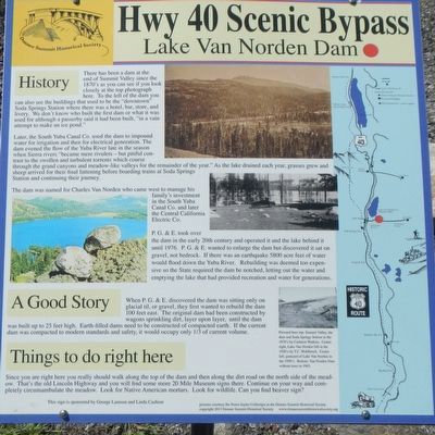
Captions: Pictured here top: Summit Valley, the dam and Soda Springs Station in the 1870's by Carlton Watkins. Center right, Lake Van Norden full in the 1920's by T.C. Wohlbruck. Center left, postcard of Lake Van Norden in the 1950's. Bottom, Van Norden Dam without trees in 1963.
History
There has been a dam at the end of Summit Valley since the 1870's as you can see if you look closely at the top photograph here. To the left of the dam you can also see the buildings that used to be the "downtown" Soda Springs where there was a hotel, bar, store, and livery. We don't know who built the first dam or what it was used for although a passerby said it had been built, "in a vain attempt to make an ice pond."
Later, the South Yuba Canal Co. used the dam to impound water for irrigation and then for electrical generation. The dam evened the flow of the Yuba River late in the season when Sierra rivers "became mere rivulets - but pitiful contrast to the swollen and turbulent torrents which course through the grand canyons and meadows-like valleys for the remainder of the year." As the lake drained each year, grasses grew and sheep arrived for their final fattening before boarding trains at Soda Springs Station and continuing their journey.
The dam was named for Charles Van Norden who came west to manage this family's investment in the South Yuba Canal Co. and later the Central California Electric Co.
P.G.&E. took over the dam in the early 20th century and operated it and the lake behind it until 1976. P.G.&E. wanted to enlarge the dam but discovered it sat on gravel, not bedrock. If there was an earthquake 5800 acre feet of water would flow down the Yuba River. Rebuilding was deemed too expensive so the State required the dam be notched, letting out the water and emptying the lake that had provided recreation and water for generations.
A Good Story
When P.G.&E. discovered the dam was sitting only on glacial till, or gravel, they first wanted to rebuild the dam 100 feet east. The original dam had been constructed by wagons sprinkling dirt, layer upon layer, until the dam was built up to 25 feet high. Earth-filled dams need to be constructed of compacted earth. It the current dam was compacted to modern standards and safety, it would occupy only 1/3 of current volume.
Things to do right here
Since you are right here you really should walk along the top of the dam and then along the dirt road on the north side of the meadow. That's the old Lincoln Highway and you will find some more 20 Mile Museum signs there. Continue on you way and completely circumambulate the meadow. Look for Native American mortars. Look for wildlife. Can you find beaver sign?
Erected by Donner Summit Historical Society.
Topics and series. This historical marker is listed in these topic lists: Industry & Commerce • Waterways & Vessels. In addition, it is included in the Donner Summit Historical Society series list.
Location. 39° 19.274′ N, 120° 22.641′ W. Marker is near Soda Springs, California, in Nevada County. Marker is at the intersection of Van Norden Lake Road and Soda Springs Road, on the right when traveling east on Van Norden Lake Road. Touch for map. Marker is in this post office area: Soda Springs CA 95728, United States of America. Touch for directions.
Other nearby markers. At least 8 other markers are within walking distance of this marker. Soda Springs Hotel (approx. 0.2 miles away); Summit Valley Native American Mortars (approx. 0.3 miles away); Soda Springs Store (approx. 0.4 miles away); Central Sierra Snow Lab (approx. half a mile away); Truckee Trail - Leaving Summit Valley (approx. 0.6 miles away); Emigrant Wagon Route (approx. 0.6 miles away); Donner Summit Lodge (approx. 0.7 miles away); Dutch Flat Donner Lake Wagon Road (approx. 0.9 miles away). Touch for a list and map of all markers in Soda Springs.
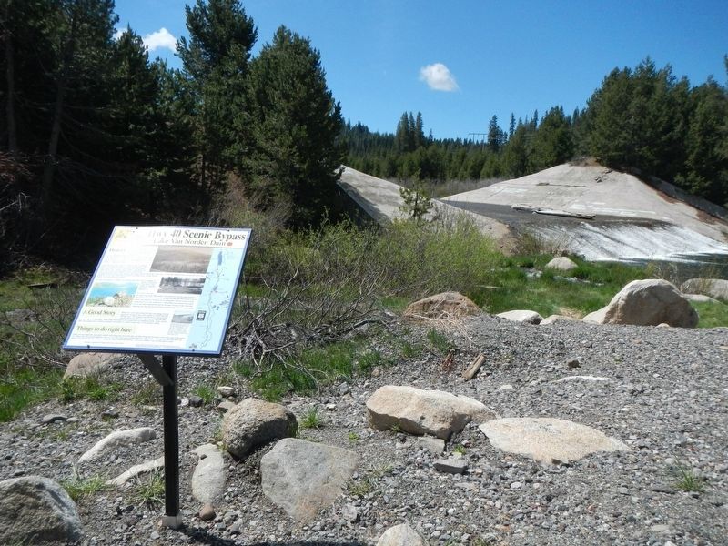
More about this marker. The marker is located in a large, gravel parking lot.
Credits. This page was last revised on August 17, 2020. It was originally submitted on February 5, 2019, by Barry Swackhamer of Brentwood, California. This page has been viewed 329 times since then and 29 times this year. Photos: 1, 2. submitted on February 5, 2019, by Barry Swackhamer of Brentwood, California.
